Castles (Burgen und Schlösser) near CFB Lahr and CFB Baden-Soellingen, Germany
Most Canadians who lived in or near Baden-Soellingen and Lahr until 1993, will be familiar with the numerous medieval castles within a short drive of the two bases. The aim of this page is to tell you a bit about them.
Canadian Forces Base Baden–Soellingen or CFB Baden–Soellingen, formerly known as RCAF Station Baden–Soellingen (Baden), was located near the farming community of Söllingen, part of the municipality of Rheinmünster in the West German state of Baden-Württemberg. It is now a commercial area called Baden Airpark, which also includes the regional airport, Flughafen Karlsruhe/Baden-Baden.
Canadian Forces Base Lahr was operated primarily as a French air force base, and later as a Canadian army base, beginning in the late 1960s. Lahr is located on the western edge of the Black Forest where the Schutter Valley merges with the Upper Rhine River Plains from the east, in western Baden-Württemberg, Germany. It is approximately 50 km north of Freiburg im Breisgau, 40 km south east of Strasbourg, France, and 95 km south west of Karlsruhe. The military base was closed in 1994 and converted to civilian use. It is now known as Flughafen.
Canadian Forces Europe (CFE) consisted of two formations in what was known as West Germany before the Berlin Wall fell in November 1990. These formations included Canadian Forces Base (CFB) Lahr with 4 Canadian Mechanized Brigade Group (4 CMBG) (1957-1993), and No. 1 Canadian Air Division (1 CAD), RCAF, at CFB Base Baden-Soellingen and CFB Base Lahr, which later became No. 1 Canadian Air Group (1 CAG). Both formations were closed in 1993 with the end of the Cold War, and the remaining staff came home in 1994.
My father served with the RCAF at 3 (F) Wing, Zweibrucken, Germany, (1959-1963), and he took our family castle hunting often throughout our time there. This generated a huge interest for me in exploring and examining these historic time capsules. I joined the Army and had the extraordinary privilege of serving with HQ CFE in Lahr from 1981 to 1983, and with 4 CMBG based at CFB Lahr, from 1989 to 1992. I have explored, photographed, painted pictures and documented castles from one end of Europe to the other, and you will find other pages describing some of them on this website, but this page is specifically dedicated to castles in Germany within an hour or two’s drive from Baden-Soellingen and Lahr. I hope you find them interesting.
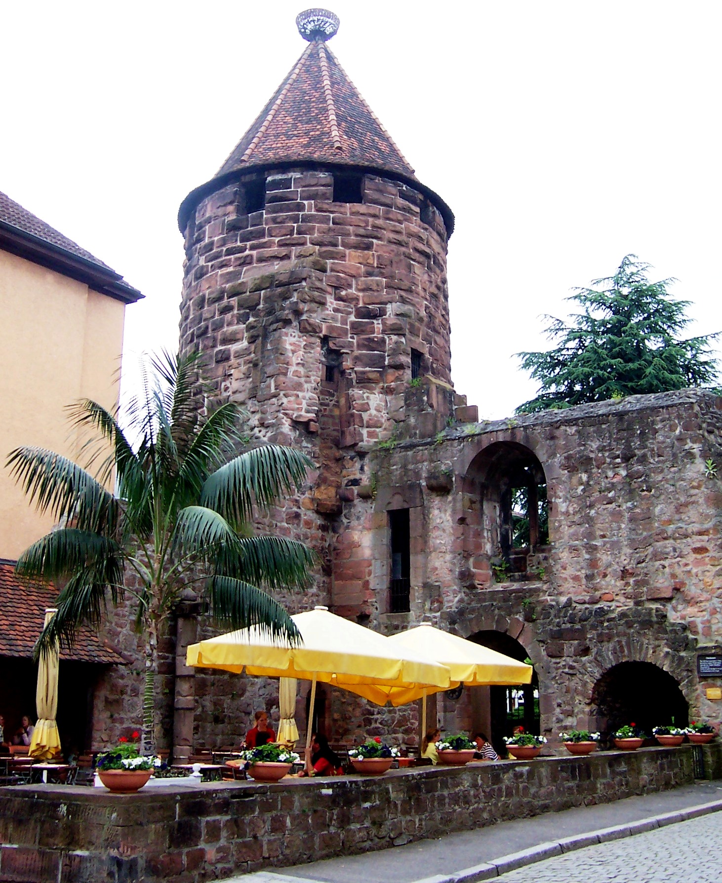
(Author Photo)
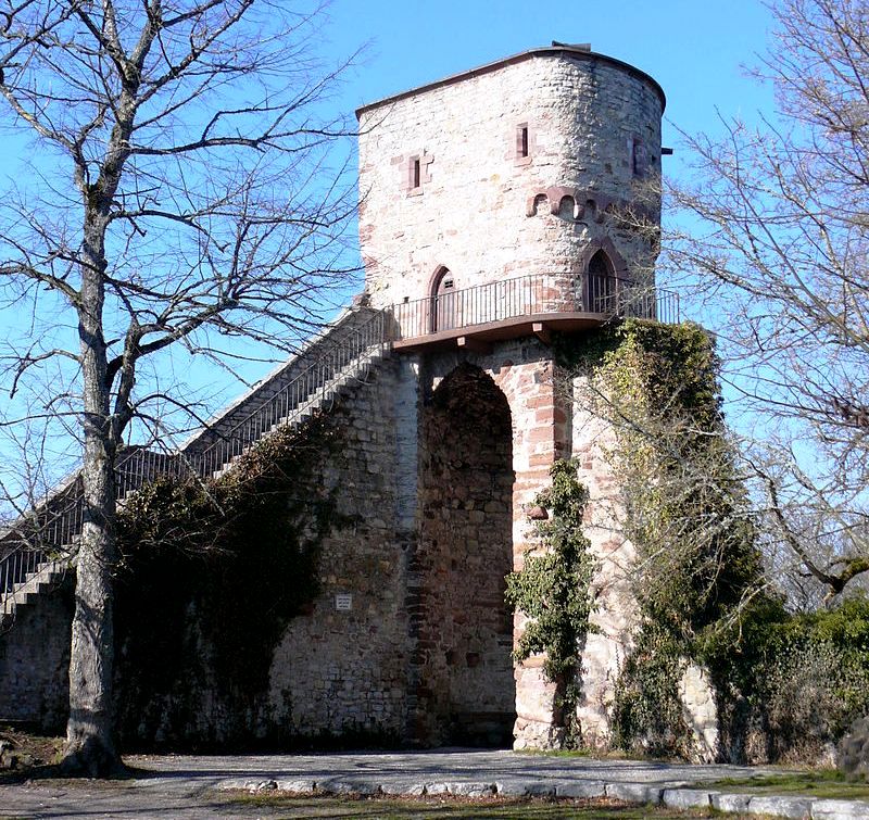
Storchenturm (stork tower), the only remaining tower of four that formed the corners of the 11th century medieval castle that Lahr was built around. The Lahr Storchenturm, also known as Lahr Castle, is the surviving remnant of a medieval moated castle and the landmark of the city of Lahr. It takes its name from the storks that regularly brooded there until the 1960s and found food in the wet meadows around the city.
Lahr developed around the Storchenturm, which was owned by the House of Geroldseck around 1220. In 1278 Lahr was granted a city charter, which was renewed in 1377. Lahr served as the foundation for municipal independence through to the end of the Old Empire (aka the Holy Roman Empire of the German Nation), which was a multi-ethnic complex of territories in Western and Central Europe that developed during the early Middle Ages and continued until its dissolution in 1806 during the Napoleonic Wars. The significant tax privileges enjoyed by Lahr allowed the city to quickly grow into a centre of trade during the eighteenth century. The original Lahr castle may have been built by the von Geroldseck lords between 1220 and 1235. In 1250 there are documents that record Walter I von Geroldseck and his son were arrested “in his castle in Lahr” by Konrad von Freiburg.
After the division of the Geroldseck house in 1277, it became the family seat of the Lower Lordship. In 1426 the Lahr line of the Geroldsecker died out, whereupon the Lahr castle went to various Nassau family members (Nassau-Saarbrücken, Nassau-Weilburg, Nassau-Usingen). The castle survived the Thirty Years’ War without damage, but was destroyed on 15 September 1677 by the French under François de Créquy. It was also damaged in an earthquake on 3 August 1728, after which it was bought by the city of Lahr in 1757. The Storchenturm functioned as a prison until 1861.
The layout of the castle (Niederungsburg) was a regular rectangular system with four round towers in the corners and thus followed the well-known late Staufer type as its pattern is also found in Sicily with the Castello Ursino in Catania and the Castello Maniace in Syracuse. From this period in German history, it only occurs in the design of the neighbouring Dautenstein Castle in Seelbach and at Neuleiningen Castle. The stork tower was the north tower of the complex and now houses a small exhibition on the history of the moated castle. Its viewing platform offers a beautiful panoramic view of the old town and the foothills. The east tower was uncovered in the 1980s and is located in the basement of the former Cafe Kopf, on Marktstrasse, but can no longer be visited. The foundations of the south tower were exposed and removed during the construction of the department store in the 1960s; the west tower was buried under a concrete foundation in 2003. In June 2011 the stork tower was closed because pieces of sandstone threatened to fall and cracks in the masonry were discovered. After an extensive renovation, during which the statics of the tower were stabilized and extensive sandstone restorations were carried out, it was reopened in September 2016. (Wikipedia)
Lahr history
The city and surrounding land with the same name remained the property of the Geroldsecks from 1220 until 1426. Their successor was the House of Moers-Saarwerden, which gave half the land to Baden as collateral for loans and in 1497 legal ownership was transferred to it. The other half was transferred to the House of Nassau-Saarbrücken in 1522. Both Baden and the House of Nassau-Saarbrücken implemented the Reformation in the areas under their control and ruled the city jointly until the Baden half also became the property of the Nassaus in 1629.
The Thirty Years’ War reduced the city’s population significantly and during the Dutch War in 1677 it was burned to the ground by French troops under the leadership of Marshall de Créquy. Later on, during the eighteenth century, the citizens of Lahr sued the House of Nassau in the “Lahr Law Suits” in 1726 and 1778. The suits were decided in favour of the citizens of Lahr and thwarted Nassau’s attempt at absolute rule.
In 1803 Lahr and the surrounding land in Baden became the seat of a court, whose areal boundaries were modified several times. During the 19th century Lahr was highly involved in the printing industry and the Burda Publishing Company, currently located in neighboring Offenburg, had its start at least partially in Lahr.
Between 1898 and 1919 and again between 1936 and 1945, the city was home to a garrison. After the Second World War, Lahr became one of the bases for the French until France left the North Atlantic Treaty Organization (NATO) in 1966. From 1967 until 1994, the Canada’s NATO forces came to Lahr. Following the closing down of the “old” Brigade Area in North-Rhine Westphalia centred around Iserlohn, Hemer, Deilinghofen as well as Werl and Soest (1970–1971), the Land Forces and their families were transferred to the Lahr area to join the existing Air Force contingent. On 6 May 1994, Werner Dietz, Mayor of Lahr/Schwarzenwald presented the Canadian Forces a plaque from “the City of Lahr/Schwarzenwald, in the Black Forest, thanking the Canadian Forces for their contribution to Peace, Security and harmonious relations between Canadian and German populations of Lahr during their presence from 1967 to 1994.” After the Canadian Forces left in 1994, a small Canadian contingent of former civilian employees remained in Lahr (approximately 200).
Lahr’s boroughs also enjoy a long history. Hugsweier, Burgheim, Dinglingen, Langenwinkel, Mietersheim and Sulz used to be ruled by the same rulers as Lahr itself and therefore shared a great deal of the city’s history. In 1803 they became part of Baden and were communities in a previous district of Lahr until they were merged and
became part of the city.
Hugsweier was first mentioned in 1341 as “Hugelswilre”, Burgheim in 1035 as “Burcheim”, Dinglingen in 961 as “Tuntelinga”, Mietersheim in 762 as “Mutherisheim” and Sulz in 1270 as “Sulz”. Langenwinkel is a village with a fairly short history. It was built starting in 1787 in the area of the Nassau forest, which was cut down to make room for the new village, on land that belonged to Dinglingen. In 1790 the first house was built and in 1797 Langenwinkel became an independent community that was also made part of Baden in 1803. After 1951 the airfield for the Canadian Forces was built in Langenwinkel’s immediate vicinity and the associated noise and traffic became a tremendous hardship for the residents of Langenwinkel. In 1965 the German Ministry of Defense decided therefore to move the village and Langenwinkel was recreated between 1968 and 1971 several kilometres southeast of the Hurster Hof.
Kippenheimweiler was first mentioned in 1427 as “Wilre” and then in 1462 as “Kippenwiler”. It was an extension of Kippenheim and like Kippenheim it became part of the Baden House of Mahlberg in 1629. In 1810 it was assigned to the Ettenheim court and only íts subsequent dissolution did it become part of the district Lahr. Kuhbach was first mentioned in 1035 as “Cuobach”. Initially it belonged to the Geroldsecks. After the family divided into two in 1278 was it made part of Hohengeroldseck (Vogtei Seelbach). Ecclesiastically, it was first part of the Burgheim parish and was later assigned to the Lahr parish. After the counter-reformation the town became Catholic again, and was only made part of Baden in 1819 when it was assigned to the district of Lahr.
Reichenbach was first mentioned as “Richenbach” in 1270. The town was divided up between the Houses of Geroldseck and Tiersberg. During the fourteenth century the part owned by the Tiersbergs came after several detours into the possession of Baden and was given to the Röder vassals as a fief. The Hohengeroldseck part eventually became the property of the Counts van der Leyen. Reichenbach was initially Protestant, but returned to Catholicism in 1658. The Baden-Röder part was then passed on to the County of Geroldseck in 1806 and with the County came into the possession of Austria in 1815. In 1819 it was returned to Baden and became part of the court of Hohengeroldseck. In 1832 was it made part of the Lahr district. (Stadt Lahr (Publisher), History of the City of Lahr)
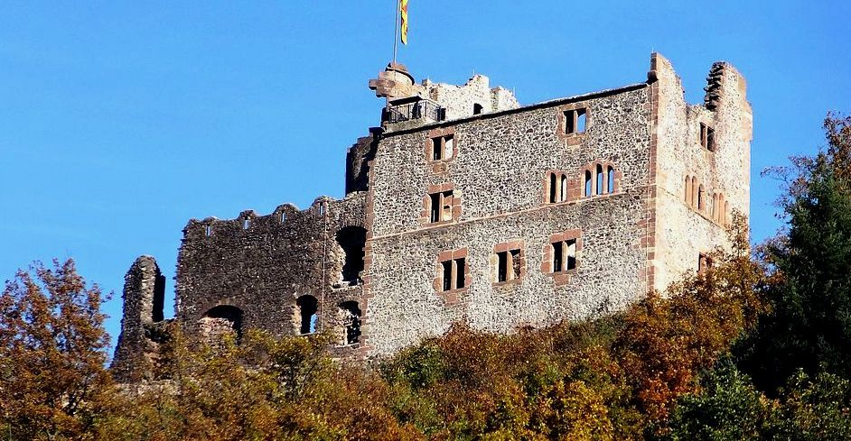
(Peter Poschadel Photo)
Burg Hohengeroldseck. The Geroldseck family originated in Alsace during the Carolingian and Ottonian periods. They were first mentioned in a witness list dating from the 1080s, and were definitely proven to reside in the Black Forest region from 1139. They were heavily involved in silver mining and other minerals.
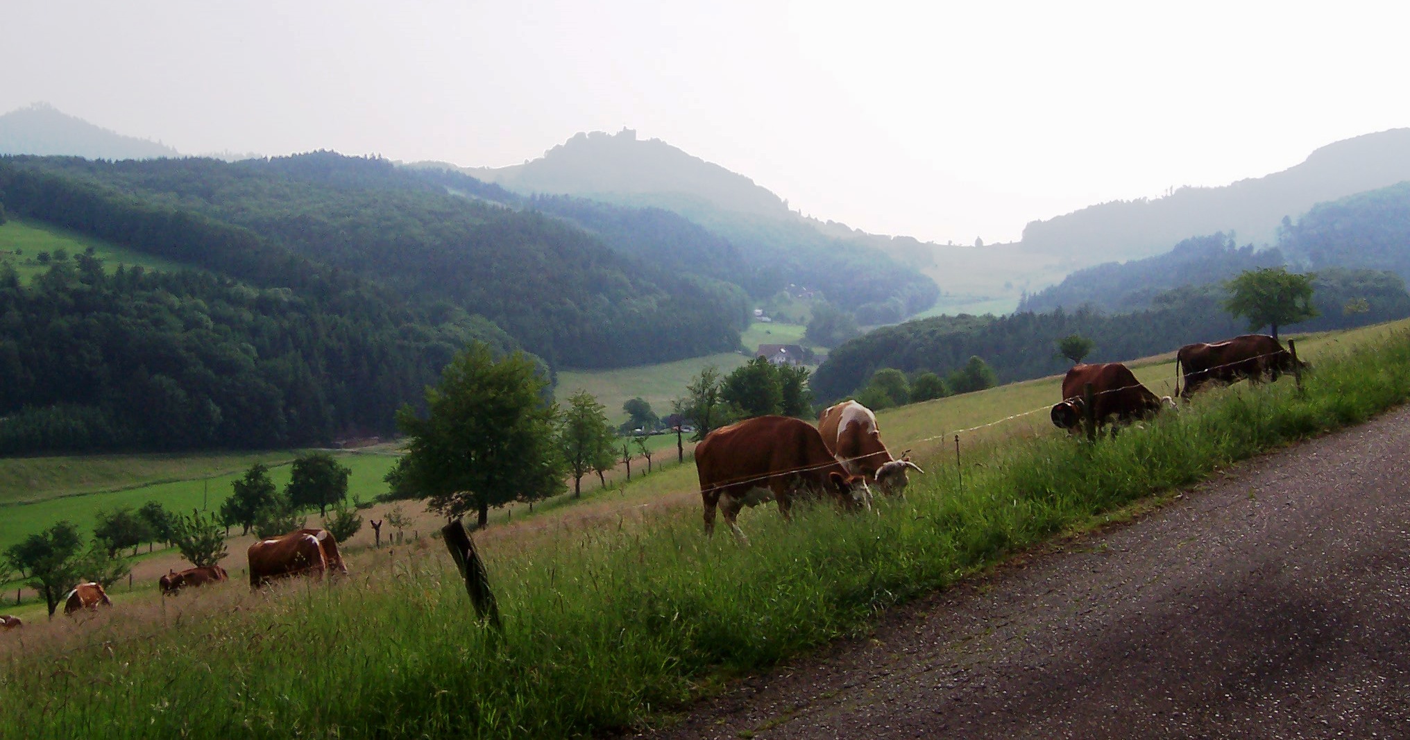
(Author Photo)
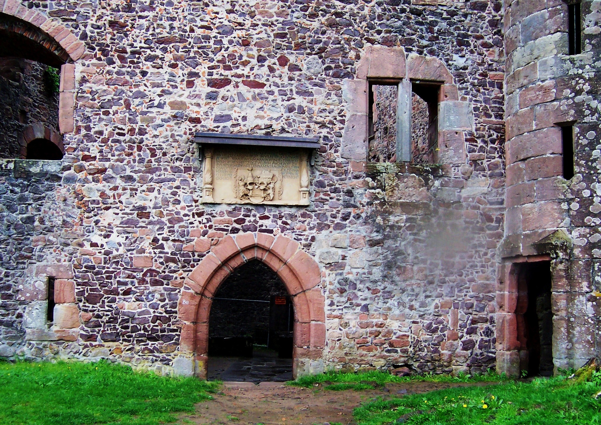
Burgruine Hohengeroldseck, Seelbach. The castle, of which the approximately 10 m high outer walls (lower castle) and the main building (upper castle) have been preserved, was built around 1260 as the family seat of the Lords of Geroldseck. After an eventful history, it was destroyed by French soldiers in 1688.
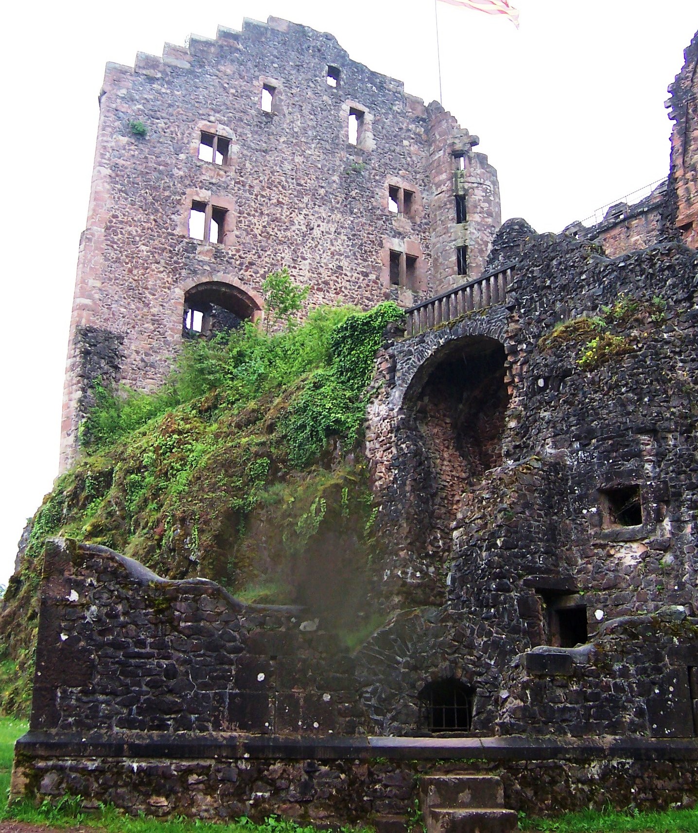
(Author Photo)
Hohengeroldseck castle ruins on Schönberg in the community of Seelbach in the Ortenau district.
(Author Photo)
Hohengeroldseck castle ruins on Schönberg in the community of Seelbach in the Ortenau district.
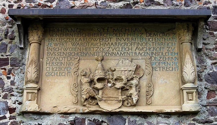
(Ralf Heidler Photo)
Hohengeroldseck castle ruins on Schönberg, coat of arms over the entrance to the main hall.
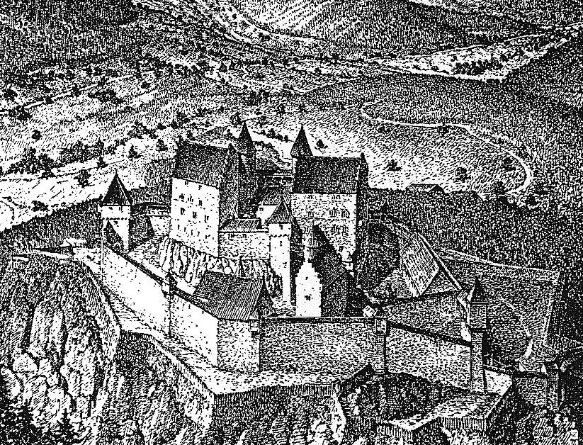
(Lahr Historical Society Photo)
Burg Hohengeroldseck as it appeared before its destruction in the 1689. The castle was built ca 1270 on the Seelbacher Schönberg mountain between Schutter and Kinzigtal in the Ortenau, not far from Offenburg and Lahr. At that time, it served as the family seat of the Lords of Geroldseck, initially under Walther I von Geroldseck. (Hohengeroldseck was a state of the Holy Roman Empire).
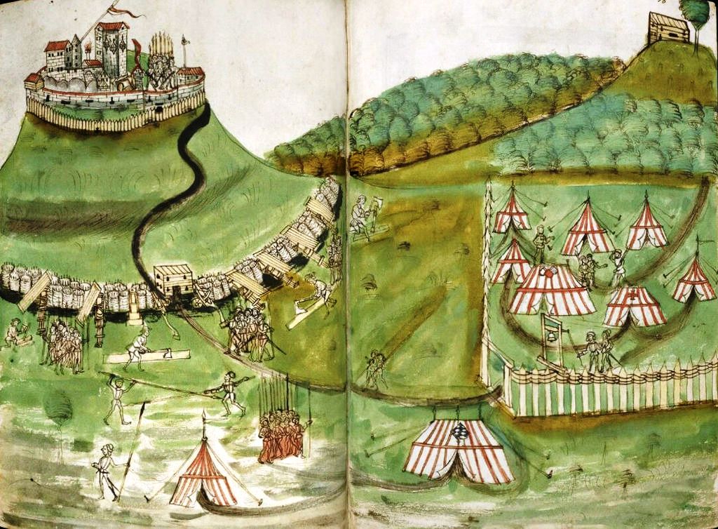
(Philipp Mönch)
Hohengeroldseck during the siege by Count Palatine Philip the Sincere (Elector Philipp von der Pfalz) in 1486. Philip’s siege was successful, and he took possession of the castle. In 1534, it passed back into the hands of the Geroldseck family, when brothers Walter and Gangolf II von Geroldseck received it as a fief. The Geroldseckers died out in 1634, and in 1635, the castle was acquired by Count Otto Adolf von Kronberg as an Austrian fief.
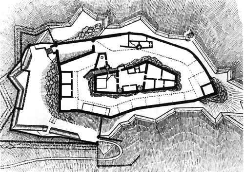
(Hugo Schneider Map)
Hohengeroldseck Schlossberg, Seelbach, Germany, ground plan. The castle was extensively destroyed by French soldiers in 1689. In 1697, plans were made to convert the ruins into a Habsburg fortress, but the idea was abandoned. From 1711 the Austrians controlled the Geroldsecker area by force. In 1891, work was begun to repair and save elements of the ruin. Additional repairs were conducted on the ruin between 1958 and 1963. The Association for the Preservation of the Ruins of the Geroldseck eV is presently engaged in preserving the ruins of the castle, as well as funding new excavations and repairs.
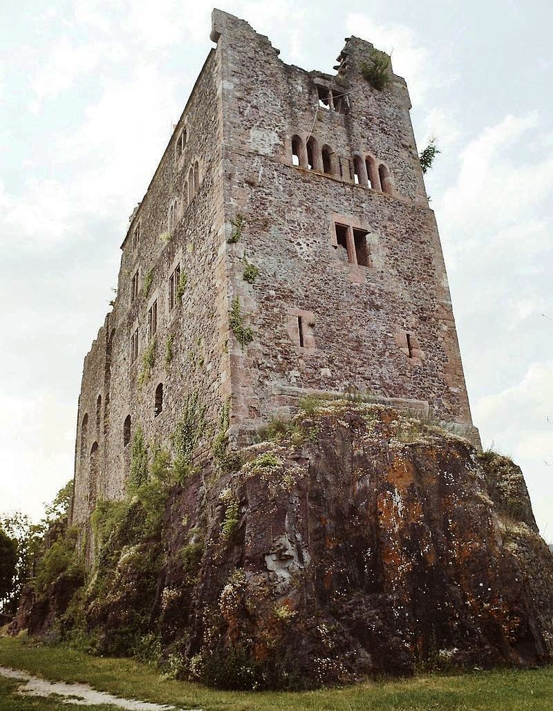
(Helmut Schönberger Photo)
Hohengeroldseck, view of the south face. Much of the building material is said to have been quarried in the ditch below the castle. Many Canadian families lived in the areas that were once controlled by the Hohengeroldseck family. Located in the Ortenau region of Swabia, the area of the state never exceeded 72 square km (45 square miles). Despite its small size, Hohengeroldseck had many neighbours. At the beginning of the nineteenth century, it was bound clockwise by the Free Imperial City of Zell to the north, the Lordship of Hausen (a possession of the Prince of Fürstenberg) to the east, the Ettenheim territory of the bishopric of Strassburg to the south as well as an enclave within the territory of Hohengeroldseck itself, an estate of a Free Imperial Knight of the autonomous Ortenau District to the southwest, territory of Nassau-Usingen to the west with portions of Baden-Durlach above and below it, and finally a tiny exclave of Further Austria to the northwest.
In addition, two small exclaves to the northwest of Hohengeroldseck shared numerous borders. The larger exclave was surrounded on three sides by three different estates of Free Imperial Knights of the Ortenau District, with an exclave of Further Austria to the north and the Free Imperial City of Gengenbach to the northeast, while the smaller exclave of Hohengeroldseck was bound to the south by the Schutterwald knightly estate (held in condominium with Austria), another exclave of Further Austria to the west, and the Free Imperial City of Offenburg to the north and east. Both exclaves were held in condominium with Austria. The Baden authorities referred to the territory as “the Provisional District of Hohengeroldseck” until 1 March 1831, when it was merged into the District of Lahr and and it then disappeared from history. (Fickler, Carl Borromeo Alois: Brief History of the houses Fürstenberg, Geroldseck und von der Leyen / Carl B. Fickler. – Karlsruhe: Macklot, 1844.- 112 S.; (dt.) – 112 S)


(Lutz H Photos)
Alt-Geroldseck Castle on the Rauhkasten mountain (to the right of the four wind turbines) and Hohengeroldseck Castle (view from the southwest). Very little remains to be seen of the ruins of Burg Alt-Geroldseck, built some time before Hohengeroldseck.
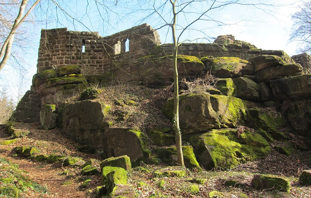
(Lutz H Photo)
Burg Lützelhardt, southwestern part of the main castle, view from the south. Ruins of this medieval castle stand on a hill opposite Hohengeroldseck, and east of Seelbach in the Ortenau district in Baden-Württemberg. The former rock castle is about 460 meters above sea level. Its name goes back to the Old High German lucilinhart (small forest), which is apparently a very rare castle name in the German-speaking area.
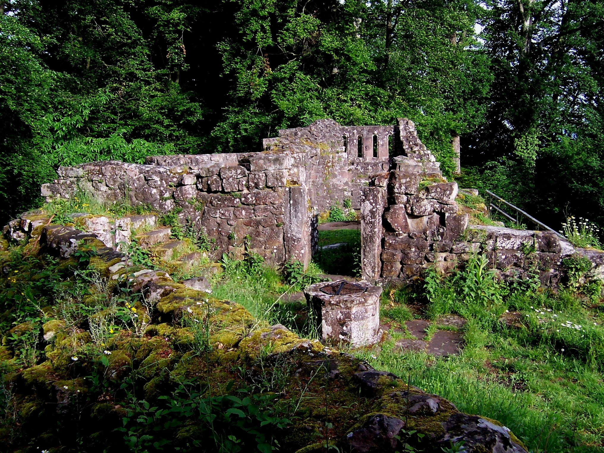
(Author Photo)
View from the keep through the cistern building to the castle courtyard (behind the door). To the right of it was the residential tower, and behind it the hall. The castle originally served to secure the pass road into the Kinzig valley. From the 11th century on, the southern Ortenau came under the influence of the Zähringer. The construction of the castle can also be traced back to this family in the early 12th century. It was probably managed by a Zähringen ministerial family. However, there are few written records. In the course of disputes between the Hohenstaufen and the bishops of Strasbourg, the castle was probably destroyed around 1245 by the neighboring Geroldseckern, who belonged to the episcopal party. After that, the security of the pass road was taken over at the newly built Hohengeroldseck Castle.
In the 12th century, Zähringer ministerials were mentioned repeatedly, bearing the name “von Lützelhardt”. A branch of this family or this community of heirs rose to imperial ministry around the middle of the 12th century.
Konrad von Lützelhardt became one of the most important officials of the Hohenstaufen imperial administration in Italy. The name Mosca-in-Cervello or Mosca-in-Cerebro (Mück-im-Hirn) has been handed down in the records. During the conquest of the Kingdom of Sicily by Henry VI, Konrad von Lützelhardt as Margrave of Molise served as an impoortant military leader. Descendants of Konrad appear in the records of the 13th century under the name de Lucinardo. They opposed the Emperor Friedrich II in the late 13th century and no further records of their history have been found.The legend of the Grüselhorn surrounds the castle, according to which a gentleman from Geroldseck was abducted to Lützelhardt, but was able to discover his whereabouts through a familiar horn call and then freed himself. Shortly
after his escape, the Lützelhardt was destroyed.
The three parts of the castle lie on three rocks of different sizes, up to 10 meters high, and were originally probably connected by a palisade. Most of the rising walls of the castle go back to excavations and reconstructions from 1926 to 1929. The remains of the main house with Romanesque palace windows and a dragon relief are particularly impressive. Inside the main castle there is a medieval cistern and a pouring stone. Numerous finds are kept in the Lahr City Museum. (Wikipedia)
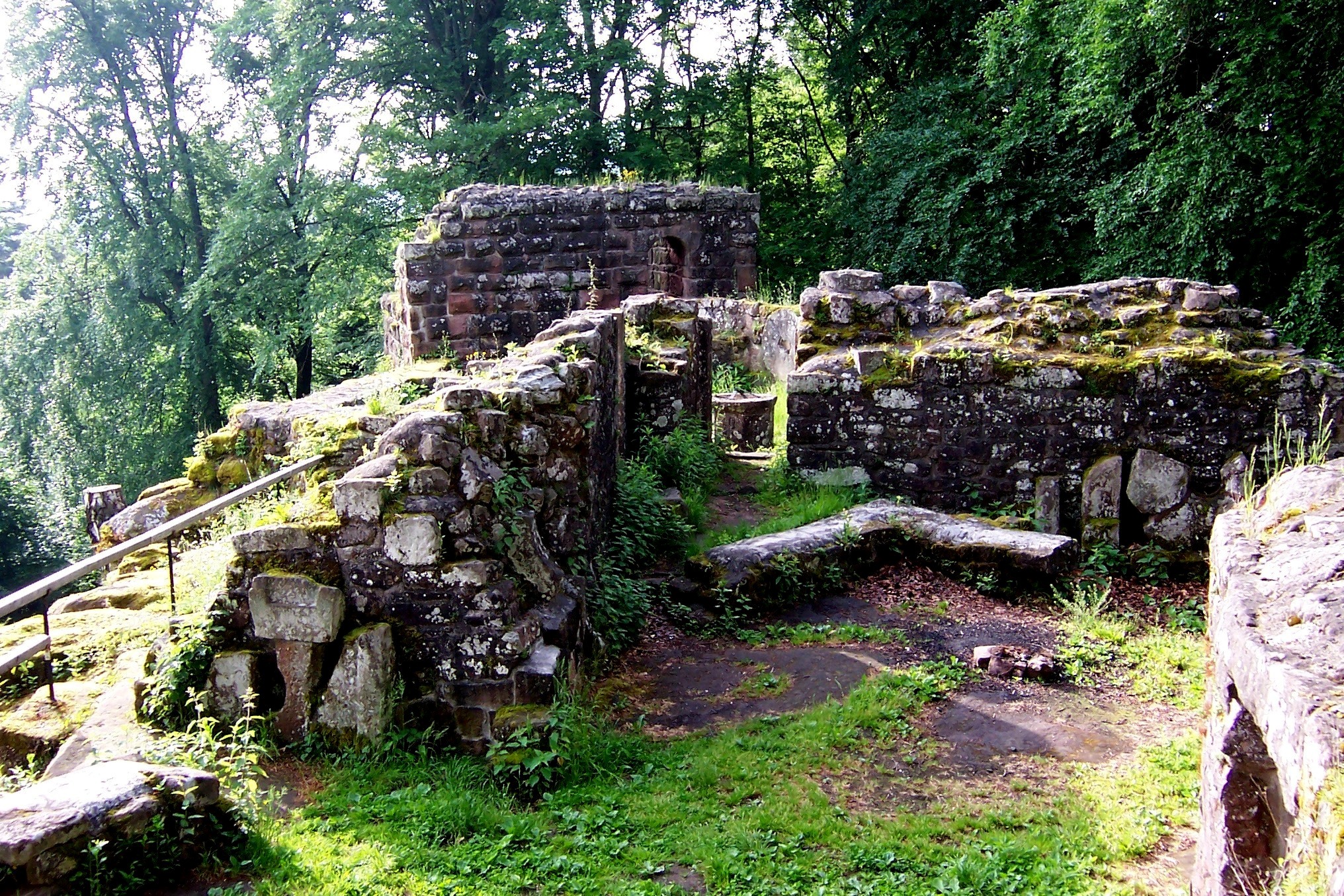
(Author Photos)
Lutzelhardt castle, remaining ruins, just above the village of Reichenbach, Germany. View of the cistern building, behind the Bergfriedrest.
Castles within an hour or two of Lahr, listed North to South.
Many Canadians have served with Allied Air Forces Central Europe (AAFCE), which was the NATO command tasked with air and air defence operations in NATOs Allied Forces Central Europe (AFCENT) area of command. AAFCE was activated on 2 April 1951 at Fontainebleau, France through General Dwight D. Eisenhower’s General Order No. 1. AAFCE consisted of two allied tactical air forces, Second Tactical Air Force, comprising British-Dutch No. 2 Group, RAF, Belgian-Dutch 69 Group, and British-Belgian No. 83 Group, RAF. Fourth Allied Tactical Air Force, comprised of the Twelfth Air Force, French 1er Air Division, and No. Canadian Air Division, RCAF. The peacetime headquarters of 4 ATAF was in Heidelberg, and as many Canadians served there, the list of castles to explore from Lahr begins here.
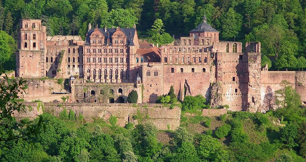
(Pumuckel42 Photo)
Heidelberg Castle (Heidelberger Schloss) is a ruin in Germany and landmark of the city of Heidelberg. Heidelberg was first mentioned in 1196 as “Heidelberch”. The castle ruins are among the most important Renaissance structures north of the Alps. The castle has only been partially rebuilt since its demolition in the 17th and 18th centuries. It is located 80 metres (260 ft) up the northern part of the Konigstuhl ,hillside, and thereby dominates the view of the old town. The earliest castle structure near this site was built before 1214 and later expanded into two castles c1294; however, in 1537, a lightning bolt destroyed the upper castle. The present structures had been expanded by 1650, before damage by later wars and fires. In 1764, another lightning bolt caused a fire which destroyed some rebuilt sections.
When Ruprecht became the King of Germany in 1401, the castle was so small that on his return from his coronation, he had to camp out in the Augustinians’ monastery, on the site of today’s University Square. What he desired was more space for his entourage and court and to impress his guests, but also additional defences to turn the castle into a fortress. After Ruprecht’s death in 1410, his land was divided between his four sons. During the reign of Louis V, Elector Palatine (1508–1544) that Martin Luther came to Heidelberg to defend one of his theses (Heidelberg Disputation) and paid a visit to the castle. He was shown around by Louis’s younger brother, Wolfgang, Count Palatine, and in a letter to his friend George Spalatin praised the castle’s beauty and its defences.
In 1618, Protestants rebelling against the Holy Roman Empire offered the crown of Bohemia to Frederick V, Elector Palatine, who accepted despite misgivings and in doing so triggered the outbreak of the Thirty Year’s War. The Thirty Years’ War was a religious war fought primarily in Central Europe between 1618 and 1648. It resulted in the deaths of over 8 million people, including 20% of the German population, making it one of the most destructive conflicts in human history.
It was during the Thirty Years War that arms were raised against the castle for the first time. This period marks the end of the castle’s construction; the centuries to follow brought with them destruction and rebuilding. After his defeat at the Battle of White Mountain on 8 November 1620, Frederick V was on the run as an outlaw and had to release his troops prematurely, leaving the Palatinate undefended against General Tilly, the supreme commander of the Imperial and Holy Roman Empire’s troops. On 26 August 1622, Tilly commenced his attack on Heidelberg, taking the town on 16 September, and the castle few days later. When the Swedes captured Heidelberg on 5 May 1633 and opened fire on the castle from the Königstuhl hill behind it, Tilly handed over the castle. The following year, the emperor’s troops tried to recapture the castle, but it was not until July 1635 that they succeeded. It remained in their possession until the Peace of Westphalia ending the Thirty Years War was signed. The new ruler, Chalres Louis (Karl Ludwig) and his family did not move into the ruined castle until 7 October 1649.
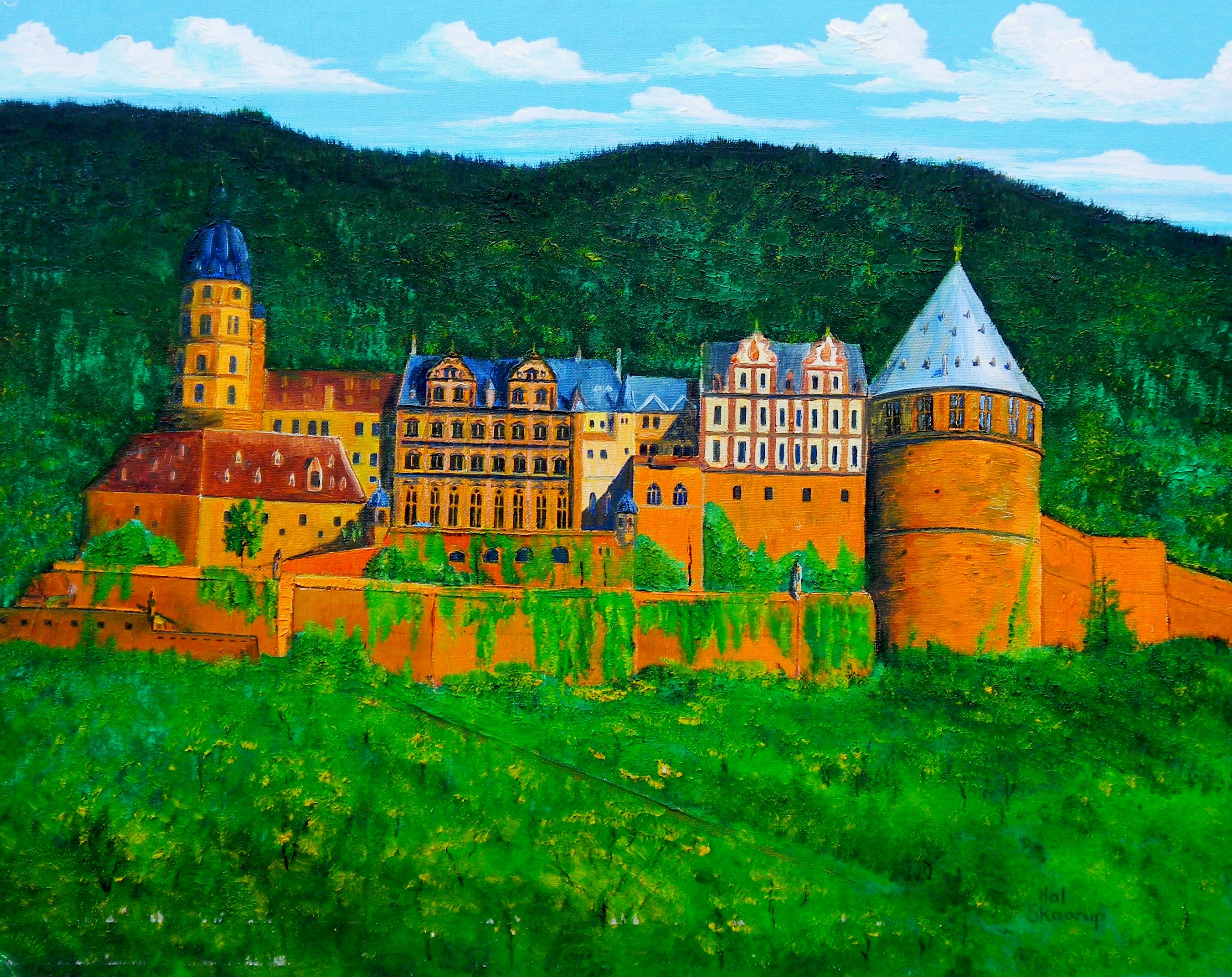
(Author’s artwork.)
Heidelberg Castle c1616.
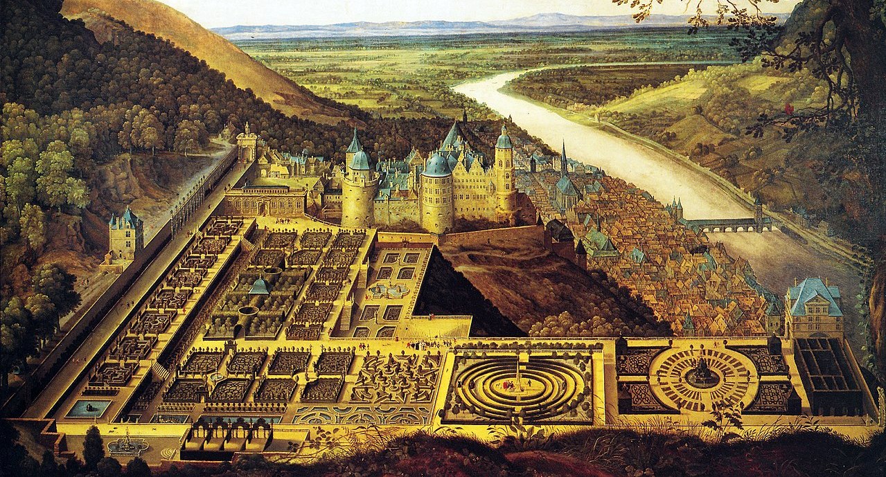
Heidelberg Castle before its destruction in 1689.
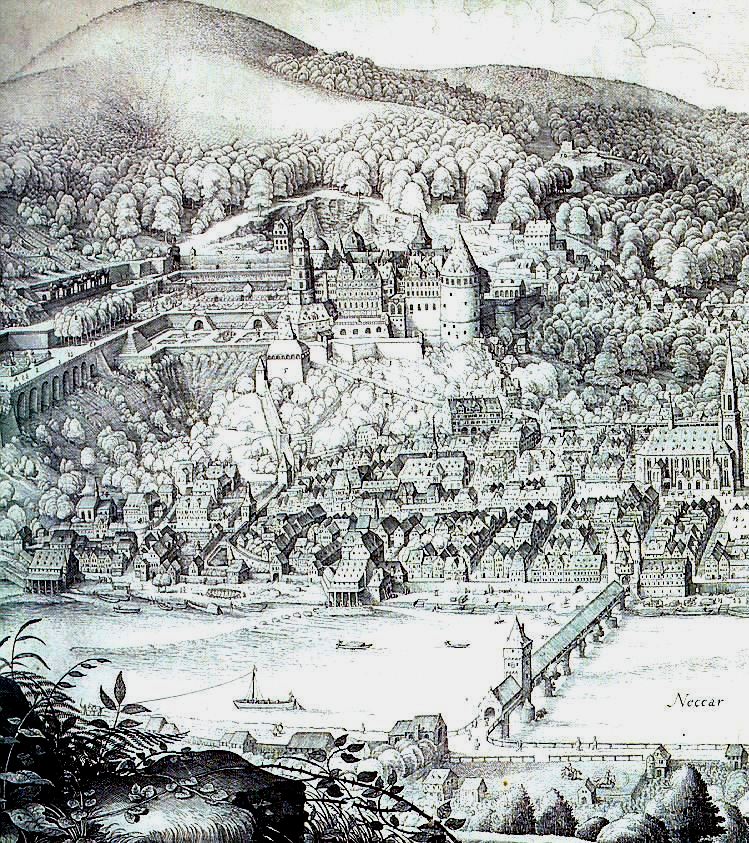
Heidelberger Schloss on the Neckar River showing the Alte Bruecke (Old Bridge), Heilgigeistkirche (Church of the Holy Ghost), from an engraving by Matthaeus Merian. After the death of Charles II, Elector Palatine, Louis XIV of France demanded the surrender of the allodial title in favour of the Duchess of Orléans, Elizabeth Charlotte, Princess Palatine, who he claimed was the rightful heir to the Simmern lands. On 29 September 1688, the French troops marched into the Palatinate of the Rhine and on 24 October moved into Heidelberg, which had been deserted by Philipp Wilhelm, the new Elector Palatine. At war against the allied European powers, France’s war council decided to destroy all fortifications and to lay waste to the Palatinate (Brûlez le Palatinat!), in order to prevent an enemy attack from this area. As the French withdrew from the castle on 2 March 1689, they set fire to it and blew the front off the Fat Tower. Portions of the town were also burned, but the mercy of a French general, René de Froulay de Tessé, who told the townspeople to set small fires in their homes to create smoke and the illusion of burning prevented wider destruction.
Immediately upon his accession in 1690, Johann Wilhelm, Elector palatine had the walls and towers rebuilt. When the French again reached the gates of Heidelberg in 1691 and 1692, the town’s defenses were so good that they did not gain entry. On 18 May 1693, the French were yet again at the town’s gates and took it on 22 May. However, they did not attain control of the castle and destroyed the town in attempt to weaken the castle’s main support base. The castle’s occupants capitulated the next day. The French then took the opportunity to finish the destruction of Heidelberg that they began in 1689, after their hurried exit from the town. The towers and walls that had survived the last wave of destruction, were blown up with mines.
In 1697 the Treaty of Ryswick was signed, marking the end of the War of the Grand Alliance and finally bringing peace to the town. Plans were made to pull down the castle and to reuse parts of it for a new palace in the valley. When difficulties with this plan became apparent, the castle was partially repaired. In the following decades, basic repairs were made, but Heidelberg Castle remained essentially a ruin. In 1767, the south wall was quarried for stone to build Schwetzingen Castle. In 1784, the vaults in the Ottoheinrich wing were filled in, and the castle used as a source of building materials. The question of whether the castle should be completely restored was discussed for a long time. Eventually, a detailed plan was developed for preserving or repairing the main building. The planners completed their work in 1890, which led a commission of specialists from across Germany to decide that while a complete or partial rebuilding of the castle was not possible, it was possible to preserve it in its current condition. Only the Friedrich Building, whose interiors were fire damaged, but not ruined, would be restored. This reconstruction was done from 1897 to 1900 by Karl Schäfer at the enormous cost of 520,000 Marks.
The forecourt is the area enclosed between the main gate, the upper prince’s well, the Elisabeth gate, the castle gate and the entrance to the garden. Around 1800 it was used by the overseer for drying laundry. Later on, it was used for grazing cattle, and chickens and geese were kept here. The approach to the forecourt takes you across a stone bridge, over a partially filled-in ditch. The main gate was built in 1528. The original watchhouse was destroyed in the War of the Grand Alliance, and replaced in 1718 by a round-arched entrance gate. The gate to the left of the main entrance was closed by means of a drawbridge. The former harness room, originally a coach house, was in reality begun as a fortification. After the Thirty Year’s War, it was used as a stables as well as a toolshed, garage and carriage house. (Harry B. Davis: “What Happened in Heidelberg: From Heidelberg Man to the Present”: Verlag Brausdruck GmbH, 1977)
(Berthold Werner Photo)
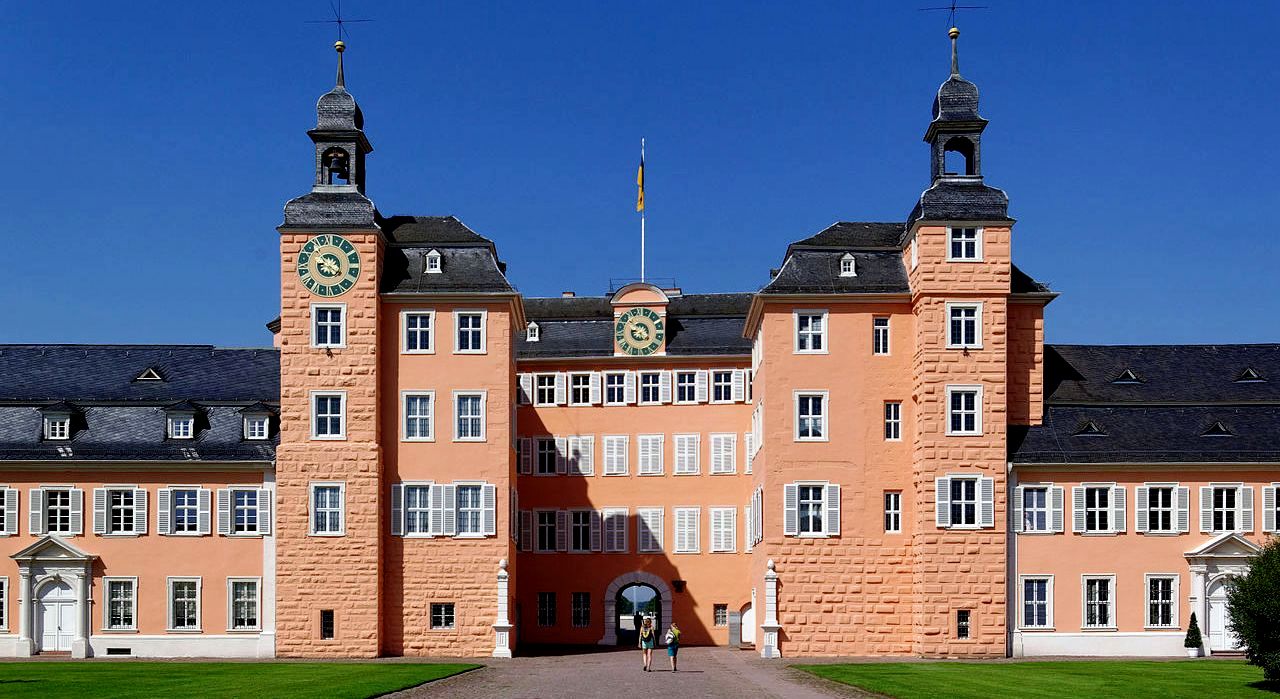
Schloss Schwetzingen, or Schwetzingen Palace is a castle located not far from Heidelberg in Baden-Württemberg. Schwetzingen was the summer residence of the Electors Palatine Charles III Philip and Charles IV Theodore (of the House of Wittelsbach). It is situated in Schwetzingen, roughly equidistant from the electors’ seats at Heidelberg and Mannheim, and is most notable for its spacious and ornate gardens. Other than these exceptionally well preserved gardens and the palace proper, the compound also features the Schlosstheatre Schwetzingen, the principal venue for the annual Schwetzingen Festival. The main building replaces a 17th-century hunting lodge built on the foundations of an older moated castle of which it also retains some foundations and walling (hence the slightly irregular layout). It was built in its current form in several building campaigns between 1700 and 1750. (Carl Ludwig Fuchs, Claus Reisinger: Schloss und Garten zu Schwetzingen. 2. Auflage. Wernersche Verlagsgesellschaft, Worms 2001)
(Marius745 Photo)
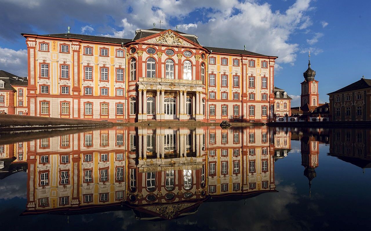
Bruchsal Palace (Schloss Bruchsal), also called the Damiansburg, is a Baroque palace complex located in Bruchsal. The complex is made up of over 50 buildings. These include a three-winged residential building with an attached chapel, four pavilions separated by a road, some smaller utility buildings, and a garden. It is noted for its fine Roccoco decoration and in particular its entrance staircase, which is regarded as one of the finest examples of its kind in any Baroque palace.
The palace was built in the first half of the 18th century by Damian Hugo Philipp von Schönborn, Prince-Bishop of Speyer. Schönborn drew on family connections to recruit building staff and experts in the Baroque style, most notably Balthasar Neumann. Although intended to be the permanent residence of the Prince-Bishops, they occupied it for less than a century.
On 1 March 1945, only two months before the end of the Second World War, much of the palace was destroyed in an American air raid directed against nearby railway installations. It has since been completely rebuilt in a restoration project that lasted until 1996. The interiors have been partly restored and the palace now houses two museums. The two main museums at Bruchsal Palace are the Deutsches Musikautomaten-Museum (German music machine museum), maintained by the Baden State Museum, and the Municipal History Museum.
(Gunter Josef Radig Photo)
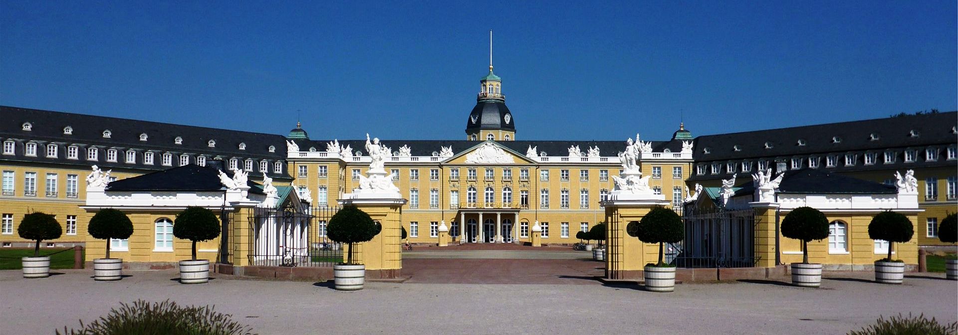
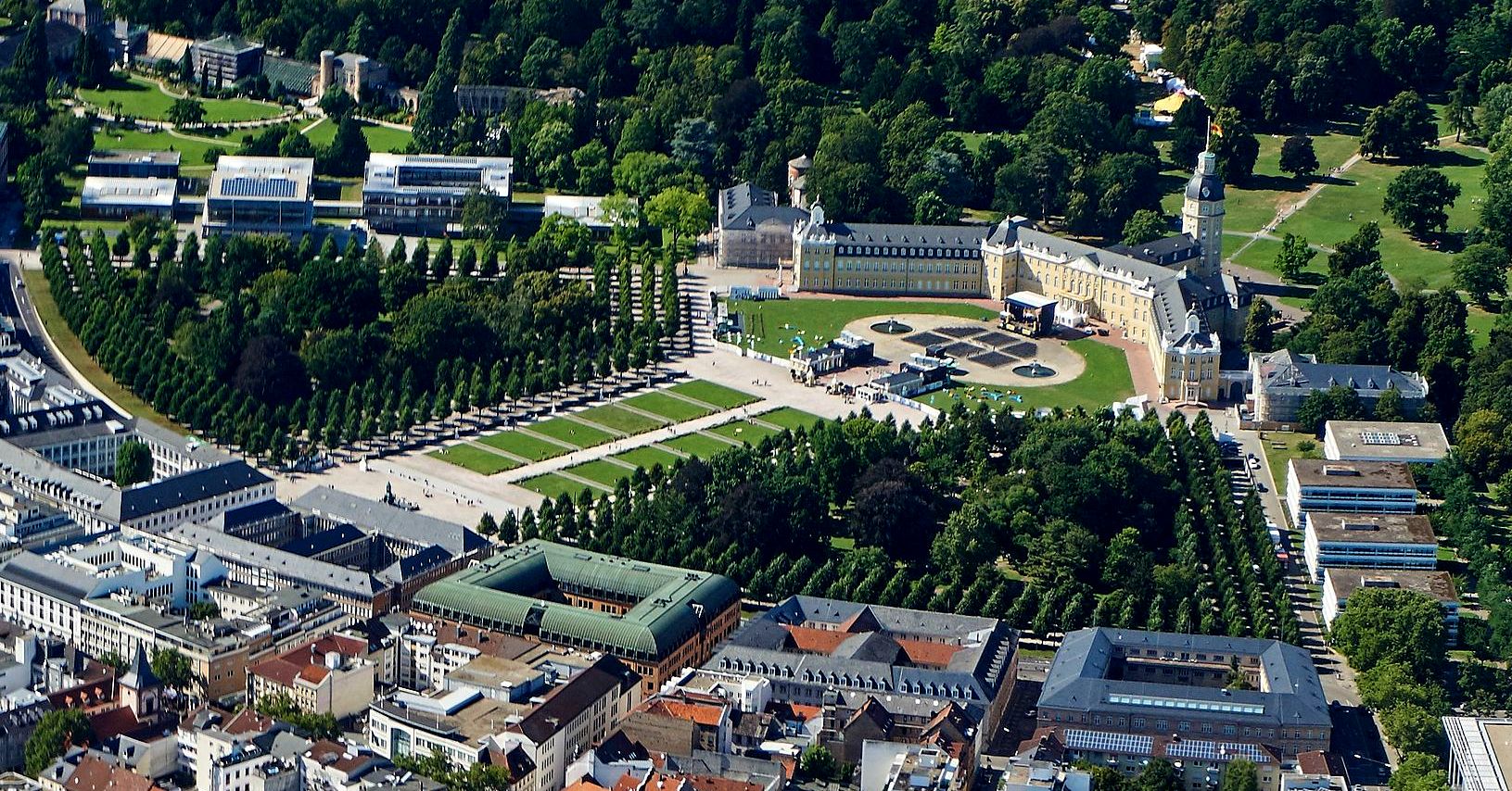
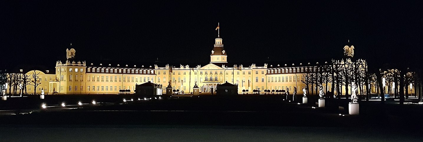
Karlsruhe Palace was erected in 1715 by Margrave Charles III William of Baden-Durlach, after a dispute with the citizens of his previous capital, Durlach. The city of Karlsruhe has since grown around it. The first building was constructed by Jakob Friedrich von Batzendorf. The city was planned with the tower of the palace (Schloss) at the centre and 32 streets radiating out from it like spokes on a wheel or ribs on a folding fan, so that a nickname for Karlsruhe in German is the “fan city” (Fächerstadt).
Originally partially made of wood, the palace had to be rebuilt in 1746, using stone. Charles Frederick, Margrave of Baden-Durlach at the time, and who eventually became Charles Frederick, Grand Duke of Baden, then had the palace altered by Balthasar Neumann and Friedrich von Kesslau until 1770, adding larger windows and doors, pavilions and wings. In 1785, Wilhelm Jeremias Müller shortened the tower, adding a cupola.
During the Revolutions of 1848, Leopold, Grand Duke of Baden, was expelled in 1849 for some time. In 1918, the last monarch Frederick II, Grand Duke of Baden, had to move out. The former residence of the Rulers of Baden has since used as Badisches Landesmuseum Karlsruhe. Much of the city centre, including the palace, was reduced to rubble by Allied bombing during the Second World War, but was quickly rebuilt after the war. (Badisches Landesmuseum Karlsruhe)
(Karsten Naber Photo)
Aerial view of Karlsuhe Palace.
(Lacu Schienred Photo)
Karlsruhe Palace at night.

(Bradley Rentz Photo)
Karlsuhe Palace.
(P Schmelzle Photo)
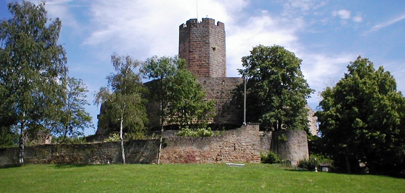
Steinsberg Castle is a in the village of Weiler, a suburb of Sinsheim, Baden-Württemberg. The castle was first mentioned in the year 1109. In the thirteenth century the owners of the castle were the Counts of Oettingen. Later the castle became home to the Counts Palatine of the Rhine. In 1517 the castle was purchased by the Lords of Venningen. Shortly after this purchase the castle was burnt down during the Peasants’ revolt. The rebellious peasants had to pay 5000 Gulden for the rebuilding of the castle. After a lightning strike in 1777 caused heavy damage, the castle was left in disrepair. Since 1973 the castle has been owned by the Sinsheim council, who had large parts of the castle restored. The keep, the moat and the towers have been preserved.
(Martin Dürrschnabel Photo)
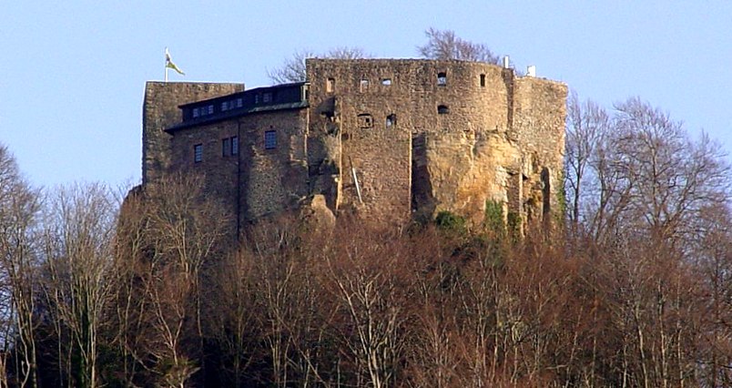
The ruins of Alt-Eberstein are the remains of the former Schloss Eberstein (Eberstein Castle), located on a hill near the town of Ebersteinburg and directly upstream of Baden-Baden, in the state of Baden-Württemberg. The original structure was built in 1100 as the primary residence of the Counts of Eberstein, but by the end of the 16th century had been abandoned and much of the castle was torn down to provide materials for other structures.
A spur castle situated on a once-strategic mountain peak, the fortress was constructed as the seat of the Counts of Eberstein perhaps as early as 1100. The oldest part of the castle remaining intact are the ramparts. The first historical mention of the castle occurs in 1197 as Castrum Eberstein. In the second half of the 13th century, the Ebersteins began construction on Castle Neu-Eberstein and the older seat declined in prominence and ultimately fell into disrepair; by 1573, it was uninhabited and thereafter became a quarry used by both the Eberstein descendants and locals. Starting in the 1800s, efforts have been made to preserve the site (which now consists solely of elements of the curtain wall and keep) and it is presently one of the State Palaces and Gardens of Baden-Wuerttemberg, housing a restaurant and garden open to tourists. (Dieter Buck: Burgen und Ruinen im nördlichen Schwarzwald – 33 Ausflüge auf den Spuren der Ritter. Konrad Theiss Verlag, Stuttgart 2002)
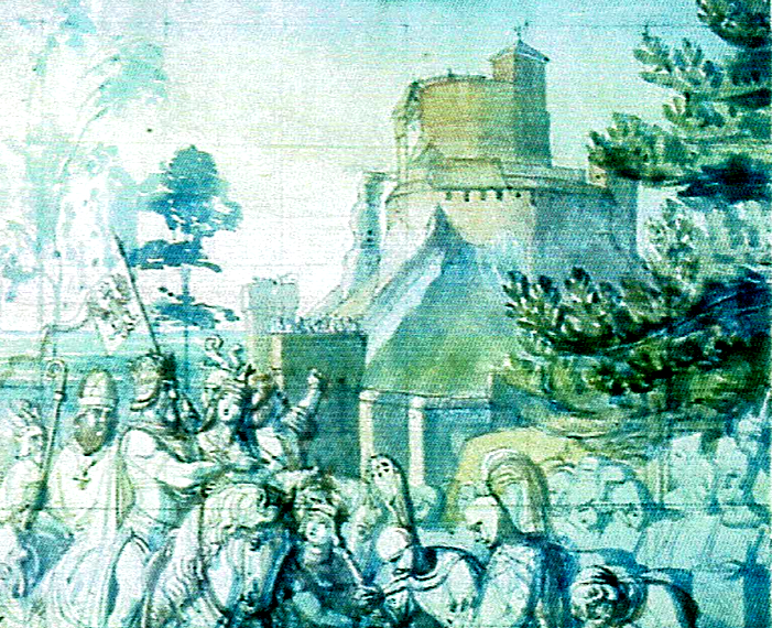
Alt-Eberstein, c1500s, watercolour.
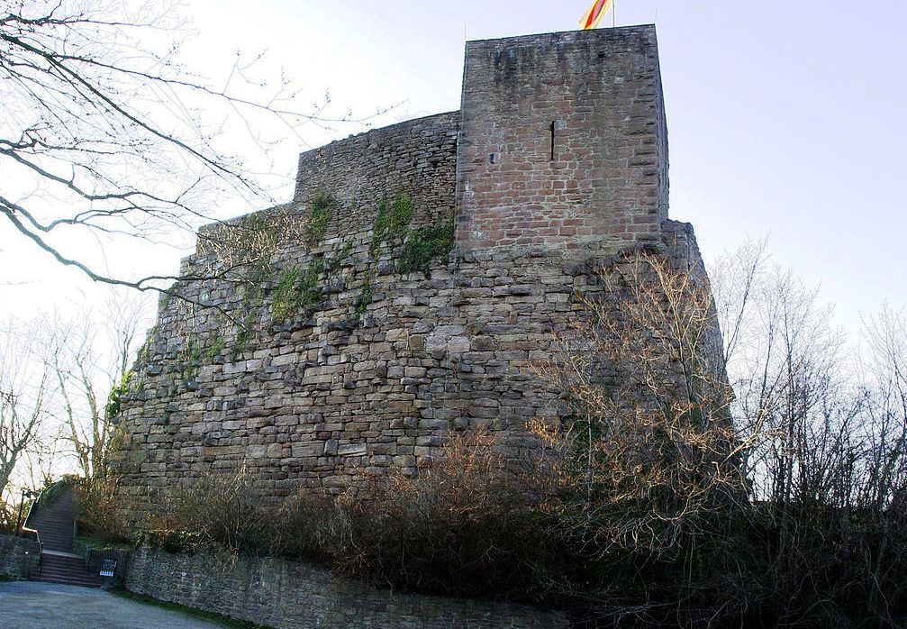
(Martin Dürrschnabel Photo)
Alt-Eberstein.
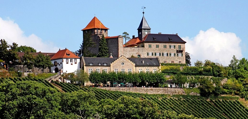
(Gerd Eichmann Photo)
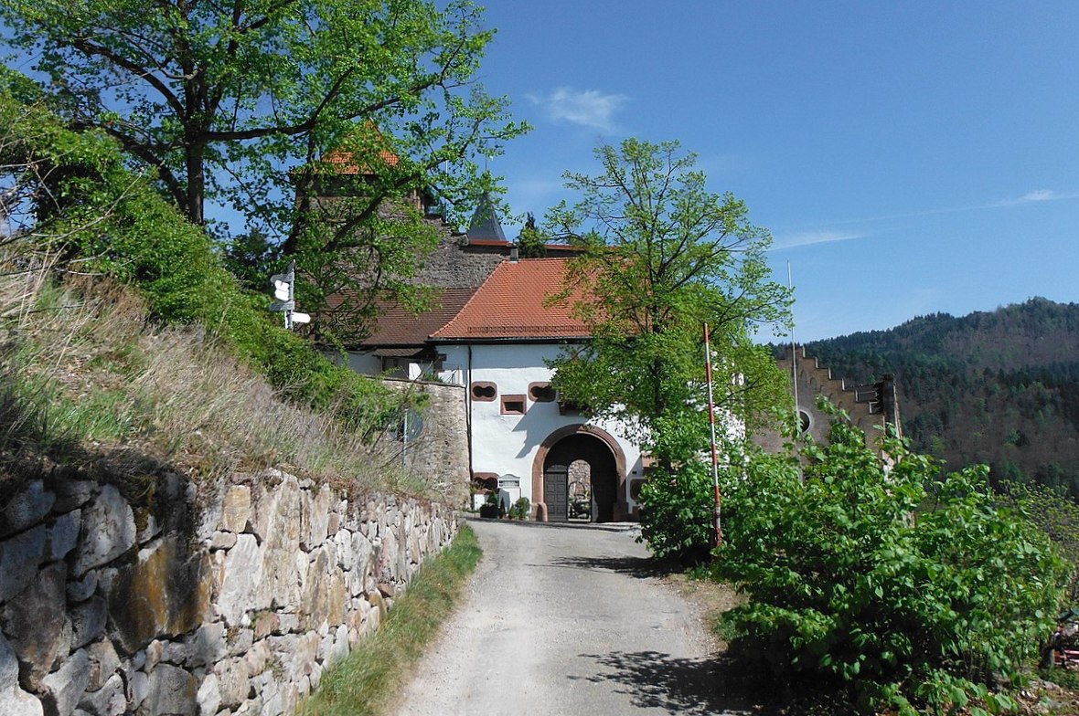
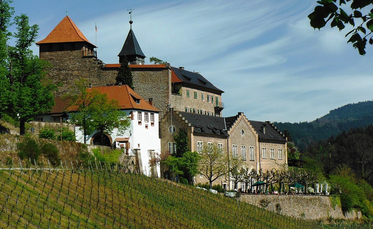
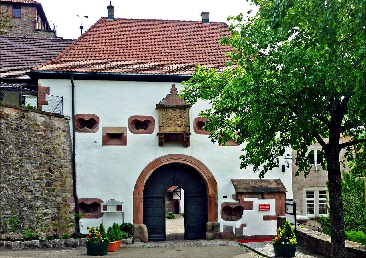
Eberstein Castle, also known as Neu-Eberstein or Neueberstein, is a castle in Gernsbach-Obertsrot in the Rastatt district of Baden-Württemberg. It was originally a spur castle of the Counts of Eberstein with a shield wall on the slope, the mountain side of which was reinforced by the rectangular keep. The complex was expanded several times and converted into a country palace at the beginning of the 19th century by the ruling family from Baden. Today Eberstein Castle is used as a hotel, restaurant, winery and private residence.
The castle is 130 meters above the valley floor of the Murg on a mountain nose in the north of the Obertsrot district of Gernsbach, which marks the transition from the deeply cut central Murg valley to the lower Murg valley, which widens near Gernsbach. The rock of Forbach granite exposed on the slope of the Murg is known as the Grafensprung. Neu-Eberstein was first mentioned as Novum Castrum Eberstein in 1272 and, in addition to Alt-Eberstein Castle, served as the seat of the lords of the Eberstein County. Otto I. von Eberstein (1207–1279) is considered the builder and first lord of the castle. The shield wall and the stump of the keep are among the oldest components. The complex was significantly expanded in the 16th century under Wilhelm IV von Eberstein (1497–1562), who had fountains, stair towers, the upper
floor of the residential building, an archive building, a castle chapel and various walls built. In the early 17th century, Philip III von Eberstein († 1609) added the new gatehouse, the outer works in the east and west as well as additional walls.
After their extinction with the death of Count Casimir (1639–1660), the property of the Ebersteiner fell partly to the margraviate of Baden and partly to Württemberg-Neuenstadt. In the future, the complex was no longer used as a manor house, but was only the residence of the Baden and Württemberg administrators. At the time of the Palatinate War of Succession, the castle was a safe place for Prince Leopold Wilhelm, the Baden-Baden archives and for the nuns of the Holy Sepulcher. In 1691 part of the complex burned down. After that, the castle was only used as a workshop and warehouse. Over time, the Württemberg shares of the former Eberstein property gradually came to Baden. In 1798 the Margrave of Baden, Karl Friedrich, handed the complex over to his son Friedrich. From 1802 he had the castle converted into a palace in the neo-Gothic style by the Karlsruhe builder Friedrich Weinbrenner.
From around 1830, under Grand Duke Leopold, the buildings were also redesigned in the neo-Gothic style. According to plans by Weinbrenner’s student Heinrich Hübsch, today’s restaurant building was also built in place of the old stables. The executive foreman Johann Belzer was also responsible for further renovations in the late 19th century. Grand Duke Leopold also acquired numerous art treasures that he exhibited in the palace, including historical glass paintings from the parish church in Dühren and Ottersweier, a Gothic crucifixion group from 1464 from the former Cistercian monastery Herrenalb and Romanesque reliefs from the 12th century from the demolished monastery church in Petershausen. Leopold had the house chapel furnished with paintings by Moritz von Schwind and the court painter Albert Graefle.
During the Baden Revolution, at the end of June 1849, Palatine militants under the command of Ludwig Blenker and Elise Blenker looted the castle. The local poet, gardener and farmer Heinrich Würtenberger worked as a castle administrator at Eberstein Castle in the late 19th and early 20th centuries. In 1902, Grand Duke Friedrich I appointed him economic councilor. The keep took its present shape in 1951 according to plans by Otto Linde.
In 2000, Max Markgraf von Baden sold the castle to Gerd Overlack, a Cologne-based industrial insurance broker from Gernsbach, who also bought Gymnich Castle in 2012. He had the listed castle extensively restored. The vineyard was also newly laid out and terraced on five hectares facing south. The vineyard had been cleared by the margrave in 1994 because the management no longer seemed profitable. The clearing had led to considerable resentment in Gernsbach and Obertsrot,
as the vineyard shapes the landscape. Schloss Eberstein is a four-star restaurant and hotel. (Wolfgang Froese, Martin Walter (Hrsg.): Schloss Eberstein. Menschen, Geschichte, Architektur. (Sonderveröffentlichung des Kreisarchivs Rastatt, Band 7). Casimir Katz Verlag, Gernsbach 2009) .
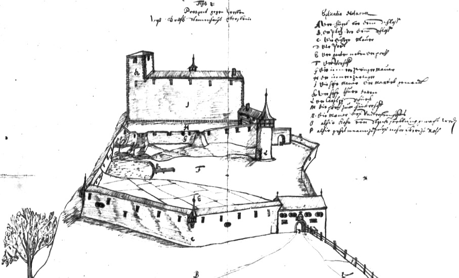
17th century engraving of Schloss Eberstein.
(Sven1987 Photo)
Schloss Eberstein.
(Sven1987 Photo)
Schloss Eberstein.
(SchiDD Photo)Schloss Eberstein.
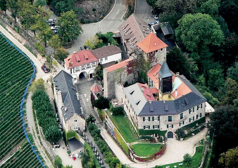
(Lothar Neumann Photo)
Aerial view of Schloss Eberstein.
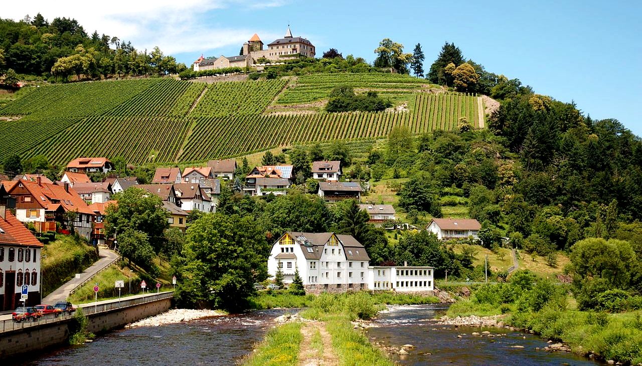
(Vladislav Vesrukov Photo)
Schloss Eberstein.
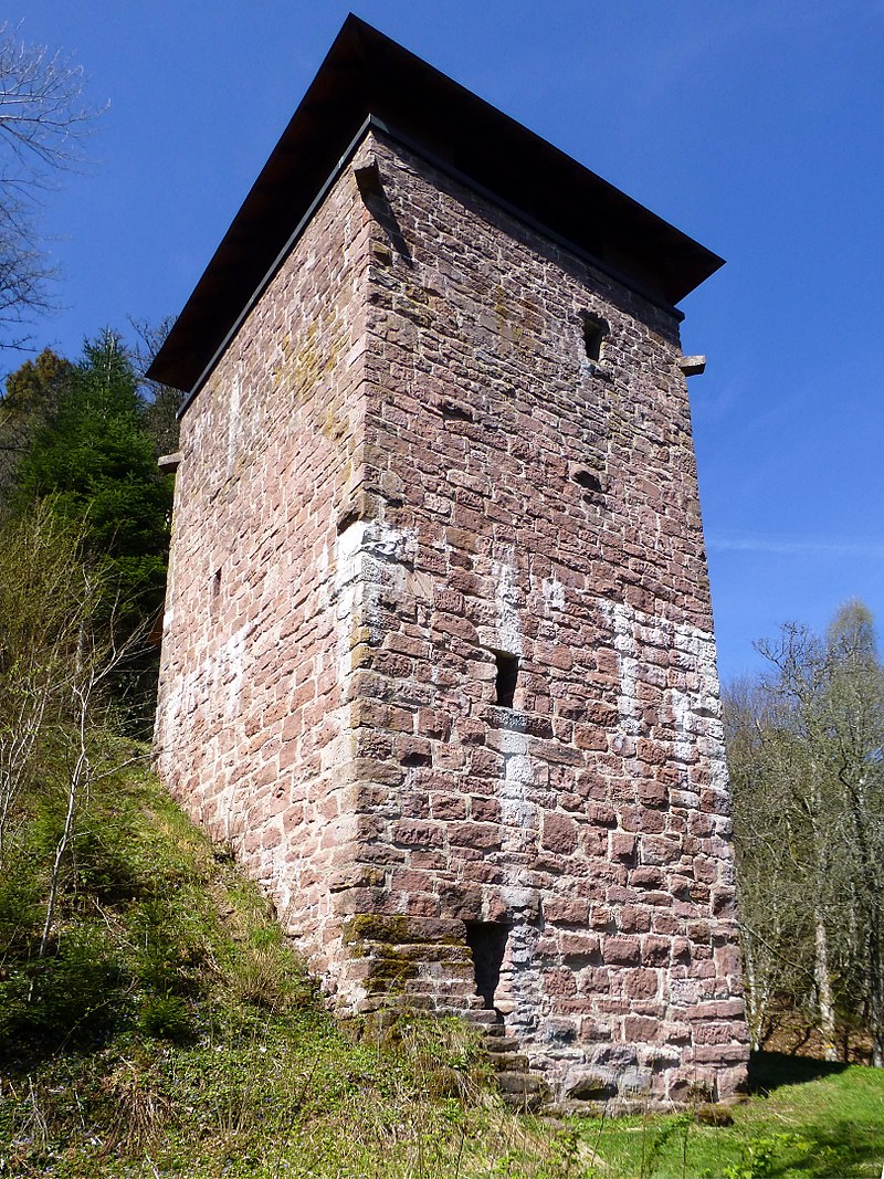
(Muck Photo)
Bergfried Fautsberg. The Fautsburg is a ruined castle above the Rehmühle in the Aichelberg district of the city of Bad Wildbad in the Calw district in Baden-Württemberg. With the exception of the keep rebuilt in the 20th century and some remains of the wall, there are no more visible traces of the hillside castle. It is assumed that the castle was built by the Counts of Calw, as the castle was mentioned in their possession in 1276. This is also the year of the first written mention, which is dated 23 February 1276. It is possible that the castle was built by the Counts of Hohenberg at the end of the 12th or beginning of the 13th century. Several documents from this time indicate a ministerial seat of the knights from Vogtesberg. Their heirs, the Lords of Hornberg, sold half of the castle to Count Eberhard von Württemberg in 1323 for £ 300 Heller. The other half later came to the House of Württemberg via Count Palatine Rudolf IV of Tübingen. The administration of the castle was incumbent on the lower nobility of the region.
In 1476, Count Eberhard von Württemberg granted Domdechant Count Johann von Helfenstein refuge in the castle from the Strasbourg Bishop Rupprecht, whom he had previously criticized. In 1561 the reformer Johannes Brenz received the Fautsburg as a fief. In 1570 Brenz returned the fito the Württemberg people. In the same year, Duke Ludwig von Württemberg enfeoffed the Hirsau monastery with the property. In 1594 the forester Eberhard Zangmeister was enfeoffed with the property by Duke Friedrich von Württemberg, which fell back to Württemberg in 1603. In 1604 a forester was named as a resident of the already dilapidated Fautsburg. It later came into the possession of the Rehmüller family, who used the walls as a quarry. In the middle of the 19th century the forest usage rights were bought up by the state and redistributed. The property with the Fautsburg was added to Johann Georg Rentschler. In 1910 and 1939, security work was carried out on the ruins for the first time. At the beginning of the 1960s, the keep was rebuilt as a lookout tower and in 1967 the ruins were opened to the public, although shortly afterwards the walls grew over again and were forgotten.
In 2000 the castle was exposed again and the first castle festival was held in 2004. In 2007 the tower received a roof. The keep has a footprint of 7.15 by 6.7 meters and a wall thickness of around two meters. In addition, some remains of the wall have been preserved. A superficial examination of the castle complex took place in 1930. To the west of the tower there was probably a shield wall three meters thick. Since no interlocking with the tower could be established in 1930, the wall may be younger than the tower. The hall was probably connected to the shield wall, opposite were the farm buildings. A gate kennel was found in the northeast.
With the roof, the tower reaches a height of around 20 m. Access is from the higher north side via an access path with stairs to a small wooden bridge at the high entrance, which is now covered and flanked by a man-high wooden figure. In the tower there is a wooden staircase with 33 steps, which leads over an intermediate platform to the 14.3 m high viewing platform. From here there is a good view of the valley of the Kleine Enz. (Friedrich-Wilhelm Krahe: Burgen des deutschen Mittelalters.
Grundriss-Lexikon. Stürtz Verlag, Würzburg 2000)
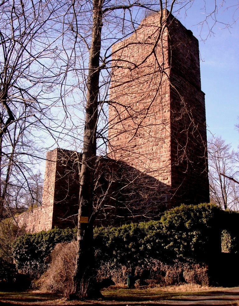
(Til132 Photo)
The ruins of Liebeneck Castle were once a high medieval spur castle in the southwestern part of the Heckengäu, a forested region southeast of the village of Würm, in the county of Pforzheim. The castle ruins are situated on heights above the River Würm with a view over the Würm valley. They lie in a Bannwald, a protected forest, at 415 metres above sea level. The ruins of Liebeneck cannot be reached by car; only forest tracks such as the Ostweg lead to it.
The original castle was probably built in the 12th century. It is first mentioned in 1236 on the occasion of the transfer of the castle and village of Würm from the lords of Weißenstein at Kräheneck to Margrave Rudolph of Baden. The castle was intended to guard the rafting toll station by the river. Later the castle was an inherited fief of the lords of Weißenstein before ending up in the possession of the lords of Leutrum von Ertingen.
In 1692, during the Orleans War, the castle was razed. In 1828 it was transferred to the state of Baden. The site was then deliberately destroyed so that “no riff-raff will find shelter there” (“Gesindel dort keinen Unterschlupf findet”). From 1968 to 1977 the 30-metre-high bergfried was renovated. Of the original castle, the bergfried and several walls surrounding the castle courtyard survive. The double, pentagonal enceinte with its foreworks and zwingers are a feature of this heritage site. The ruins are maintained by the Hochbauamt (construction department). Immediately by the ruins is an information board with details of the castle. (Hermann Diruf, Christoph Timm and Matthias Köhler: Kunst- und Kulturdenkmale in Pforzheim und im Enzkreis. Stuttgart, 2002)
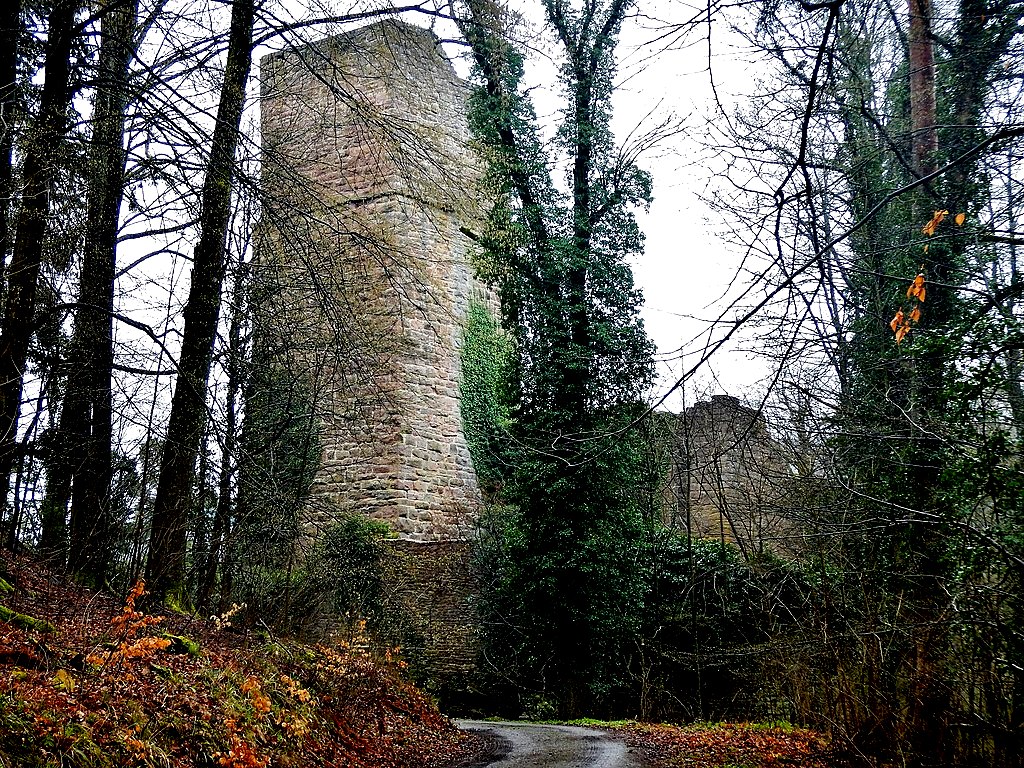
(qwesy Photo)
Liebeneck Castle.
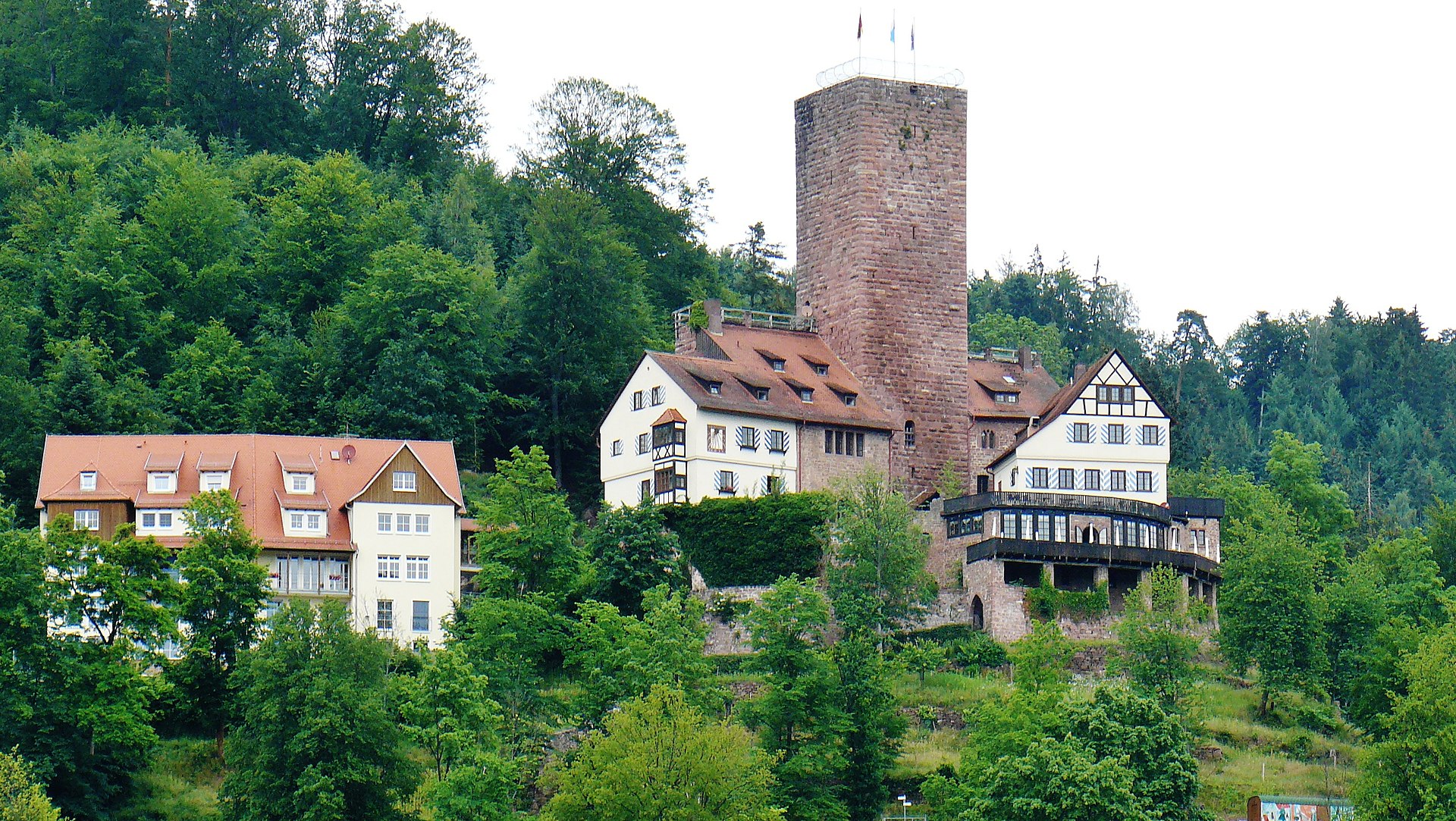
(qwesy Photo)
Liebenzell Castle (Burg Liebenzell) is a hill castle on a sloping hill spur on the sides of the Schlossberg (“castle hill”) above the town of Bad Liebenzell in the district of Calw. The fortification was once the most important castle in the Württemberg part of the Black Forest. The castle was built in the 12th century by the counts of Calw. In 1196 the counts of Eberstein were recorded as the castle’s owners. From 1220 to 1230 the castle was extended. It was destroyed in the 16th century and in 1692 and rebuilt in 1954. Today the castle is owned by the International Forum of Liebenzell Castle. It is used as a youth training centre for the Bad Liebenzell International Youth Forum and has a restaurant.
The castle comprises an irregular, pentagonal fortification with a mighty shield wall, into which a square bergfried with a garderobe has been integrated. The great hall (Palas) is decorated with ornamental ogival openings (Spitzbogenöffnungen). The six-storey bergfried has a height of 32 metres and has an entrance six metres in height, a wall thickness of two metres and an area of about 9 by 9 metres. (Zimmermann, Wolfgang (1981). Unterwegs zu Burgen und Schlössern im Schwarzwald.
Ausflüge und Wanderungen zu den schönsten und interessantesten Burgen und Schlössern. Fink-Kümmerly und Frey, Ostfildern)
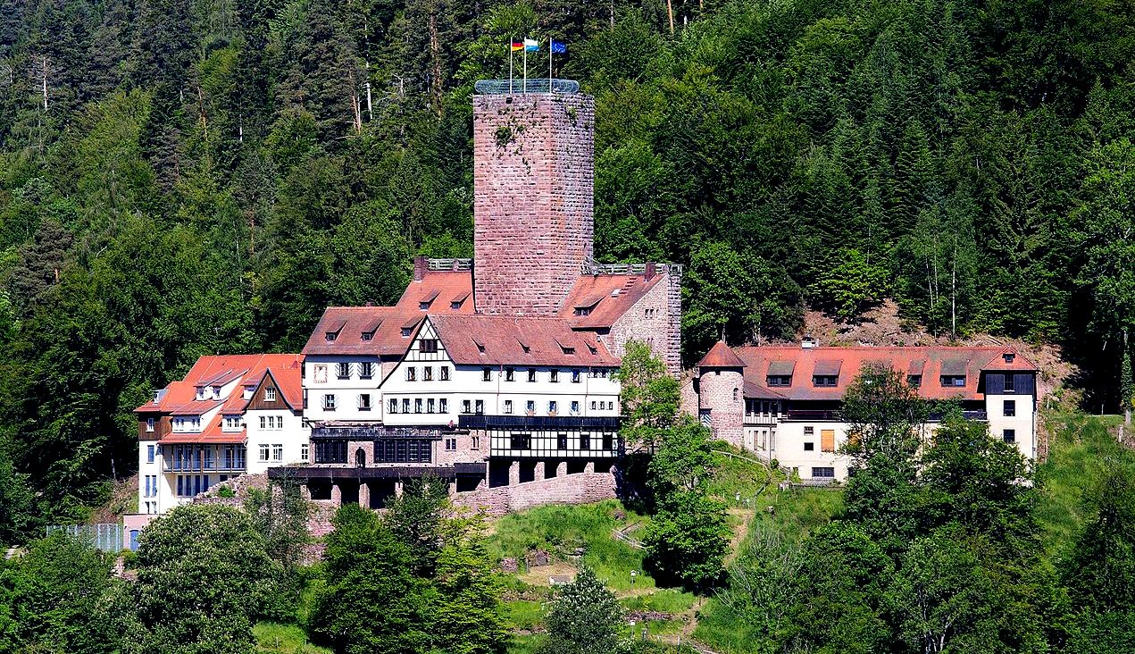
(Stefan Karl Photo)
Burg Liebenzell.
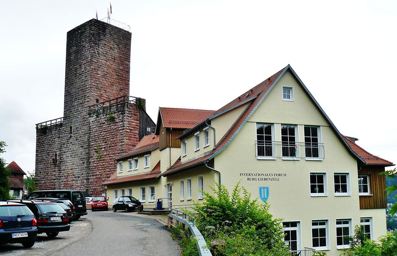
(qwesy Photo)
Burg Liebenzell.
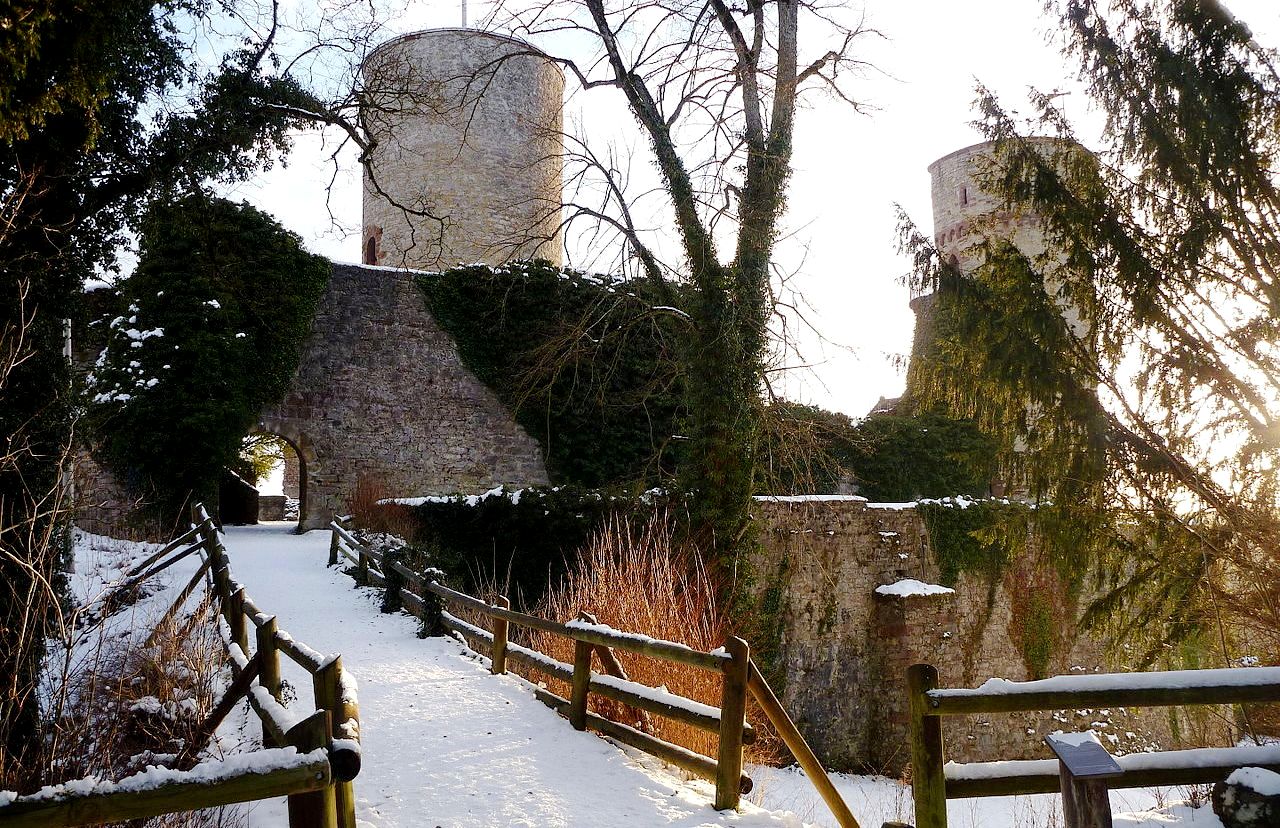
(Paul Kernen Photo)
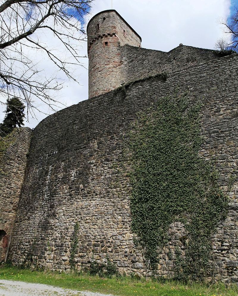
Hohennagold Castle is a ruined castle situated on a hill, the so-called Schlossberg (castle mountain), overlooking the Black Forest town of Nagold. The hill consists predominantly of porphyritic rock. The ruins represent a relatively well-preserved 12th-century castle. The keep behind the curtain walls, a tower in the north-western corner of the complex as well as the outer ward with half-round and angular towers, are still visible. There appears to have been a moat around the castle. An early medieval fortification was possibly erected at the location of the future castle around 750 by Count Ruodbrecht, one of Charlemagne’s uncles. The original castle was built around 1100 by the Counts of Nagold, who became the Counts Palatine of Tübingen in 1145. The castle complex was extensively expanded between 1153 and 1162.
In the middle of the 13th century the castle passed into the possession of the Counts of Hohenberg. Thereafter, one branch of this family called itself Counts of Nagold and had the castle transformed into their residence in the 13th and 14th century. In 1364 they sold the castle to the Counts of Württemberg. The new owners added bastions and towers to the outer ward and had the castle occupied by their ministeriales. Towards the end of the Thirty Years’ War, the castle was conquered by Bavarian troops in 1645 and severely damaged. In 1646 the remnants of the castle were pulled down. In 1945 the northwest tower was destroyed by a low-level attack carried out by Allied aircraft. The castle remains were tentatively restored after the Second World War, trying to preserve the castle as a ruin.

(Frank Vincentz Photo)
Burg Hohennagold, main entrance.
(Frank Vincentz Photo)
Burg Hohennagold, shield wall.

(Frank Vincentz Photo)
Burg Hohennagold, above the lower court.
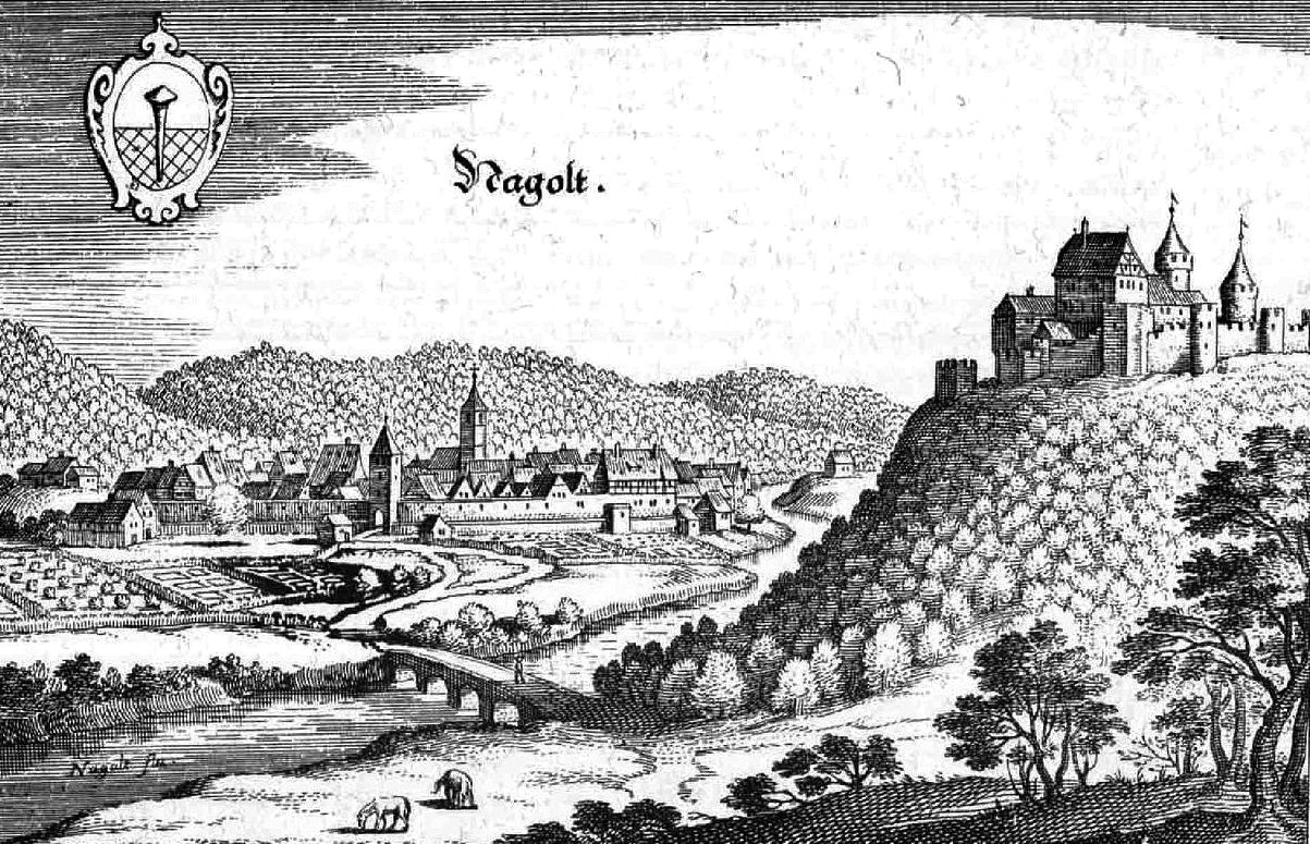
Engraving of Burg Hohennagold, 1643. Matthaus Merian.

17th century watercolour of Burg Hohennagold.
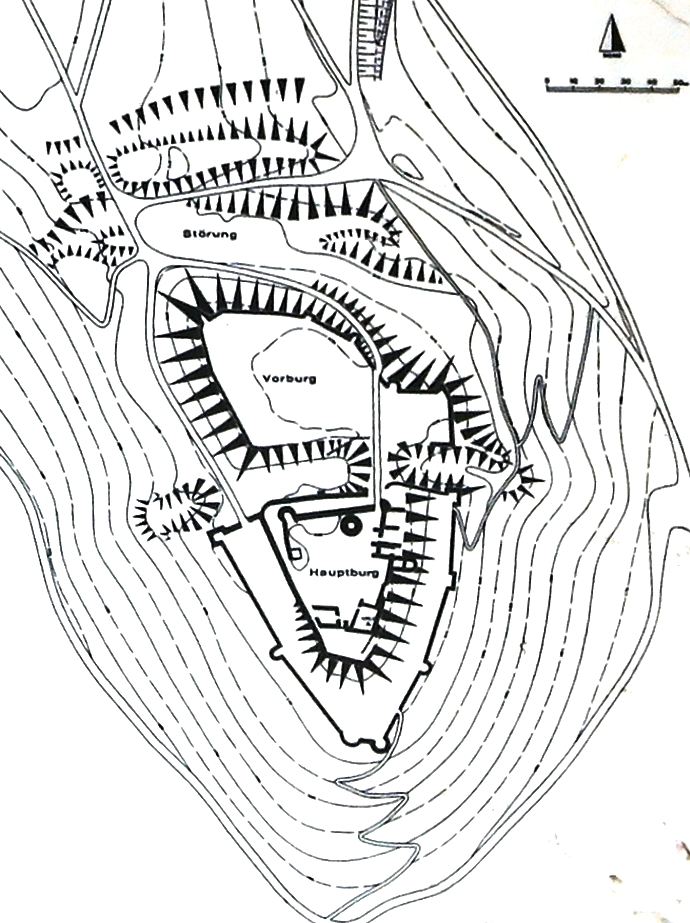
Ground Plan of Burg Hohennagold.
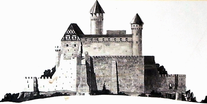
Artist’s profile view of Burg Hohennagold before its destruction.
(JORIT Photo)
Berg Hohennagold, defence tower (Wehrturm).
(H Helmlechner Photo)
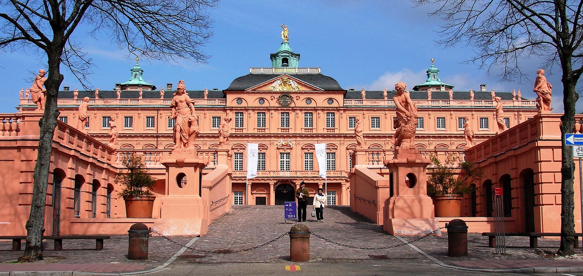
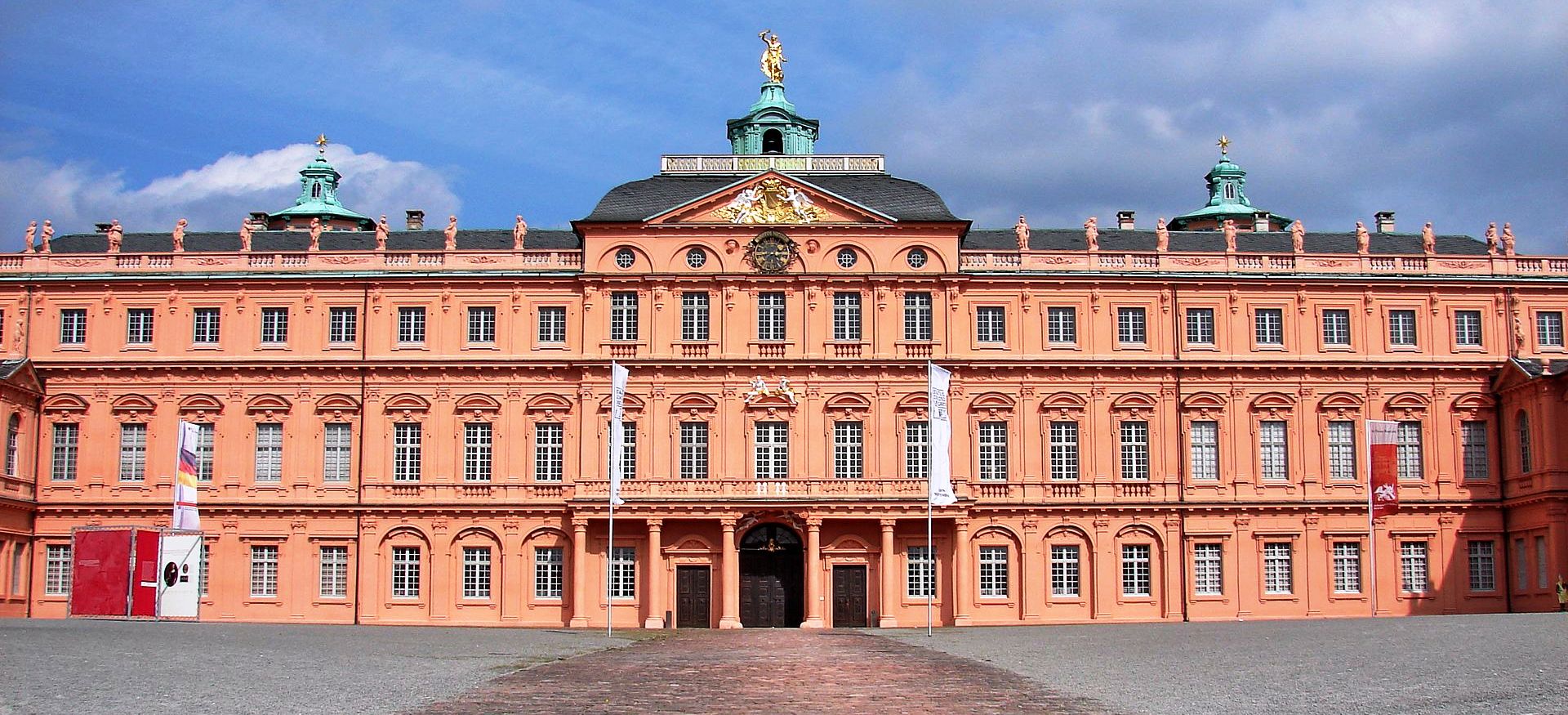
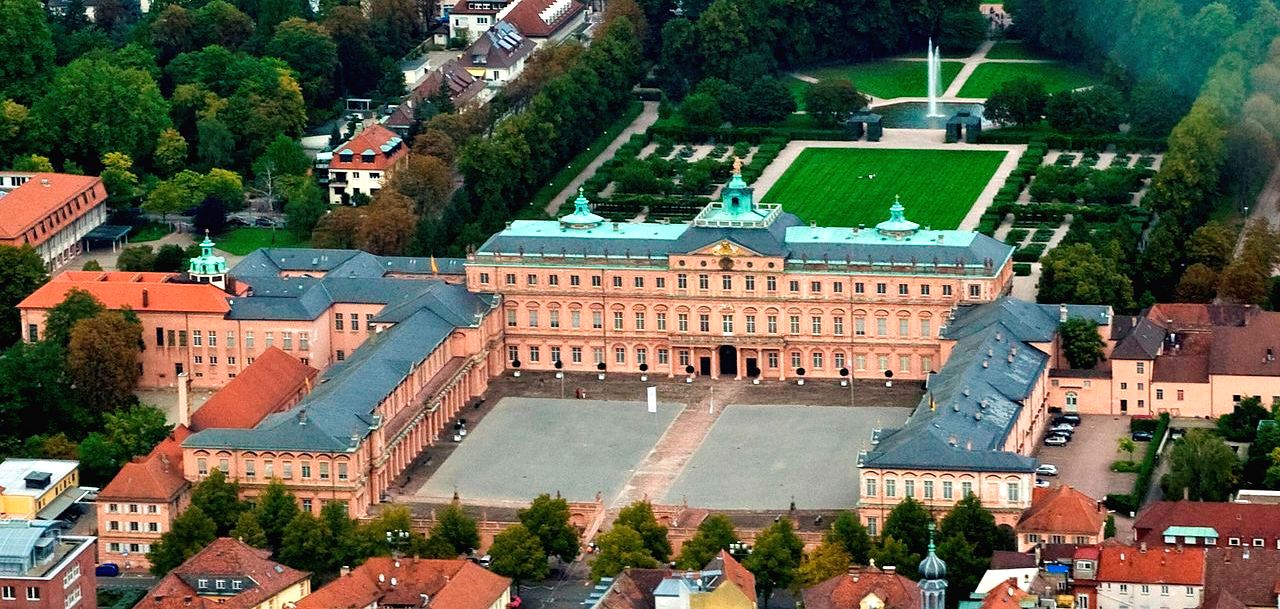
Schloss Rastatt, also known as Residenzschloss Rastatt, is a Baroque schloss in Rastatt, Germany. The palace and the garden were built between 1700 and 1707 by the Italian architect Domenico Egidio Rossi for Margrave Louis William of Baden-Baden. Visitors can tour the restored Baroque interior and gardens. The residence in Rastatt is the oldest Baroque residence in the German Upper-Rhine area. It was built according to the example of the French Palace of Versailles. During the 19th century, the palace was used as a headquarters. The palace was not damaged during the Second World War. It is now owned by the State of Baden-Württemberg. The palace is also home to two museums, the “Wehrgeschichtliches Museum” (military history museum) and the memorial site for the German liberation movement.
(H Helmlechner Photo)

Front profile diagram of Residenzschloss Rastatt |Palace, c 1750.
(Martin Durrschnabel Photo)
Aerial view of Rastatt Palace.
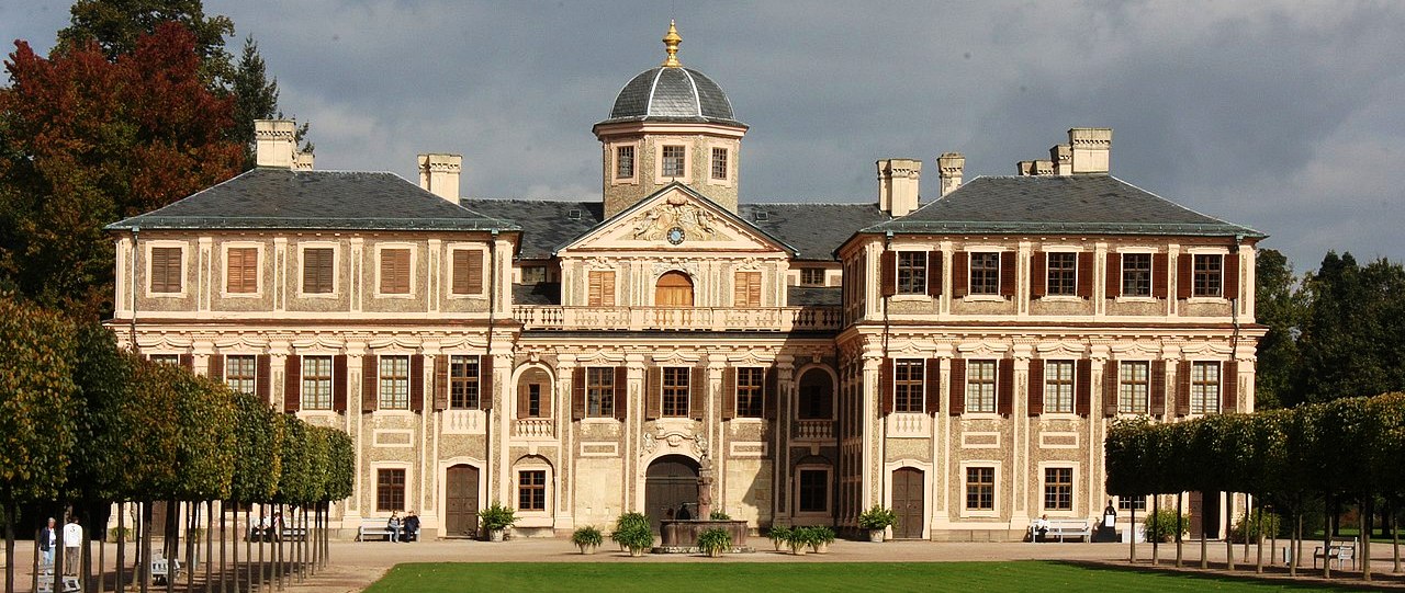
(Dhuendel Photo)
Schloss Favorite on the outskirts of Rastatt-Förch in Baden-Wurttemberg. Built by Johann Michael Ludwig Roher between 1710 and 1730, it was created as a hunting lodge and maison de plaisance (pleasure palace) for Margravine Sibylla Augusta, the widow of Louis William, Margrave of Baden-Baden (Türkenlouis). It was only used for several weeks per year as a summer residence, and it is not far from Schloss Rastatt. Schloss Favorite houses a large collection of Chinese porcelain, black Lacquerwork and Schwartz Porcelain. It is the oldest of the German so-called “porcelain palaces”, and the only one to survive intact to this day. (Sigrid Gensichen/Ulrike Grimm, Schloss Favorite Rastatt-Förch. Verlag K. F. Schimper, 2001)
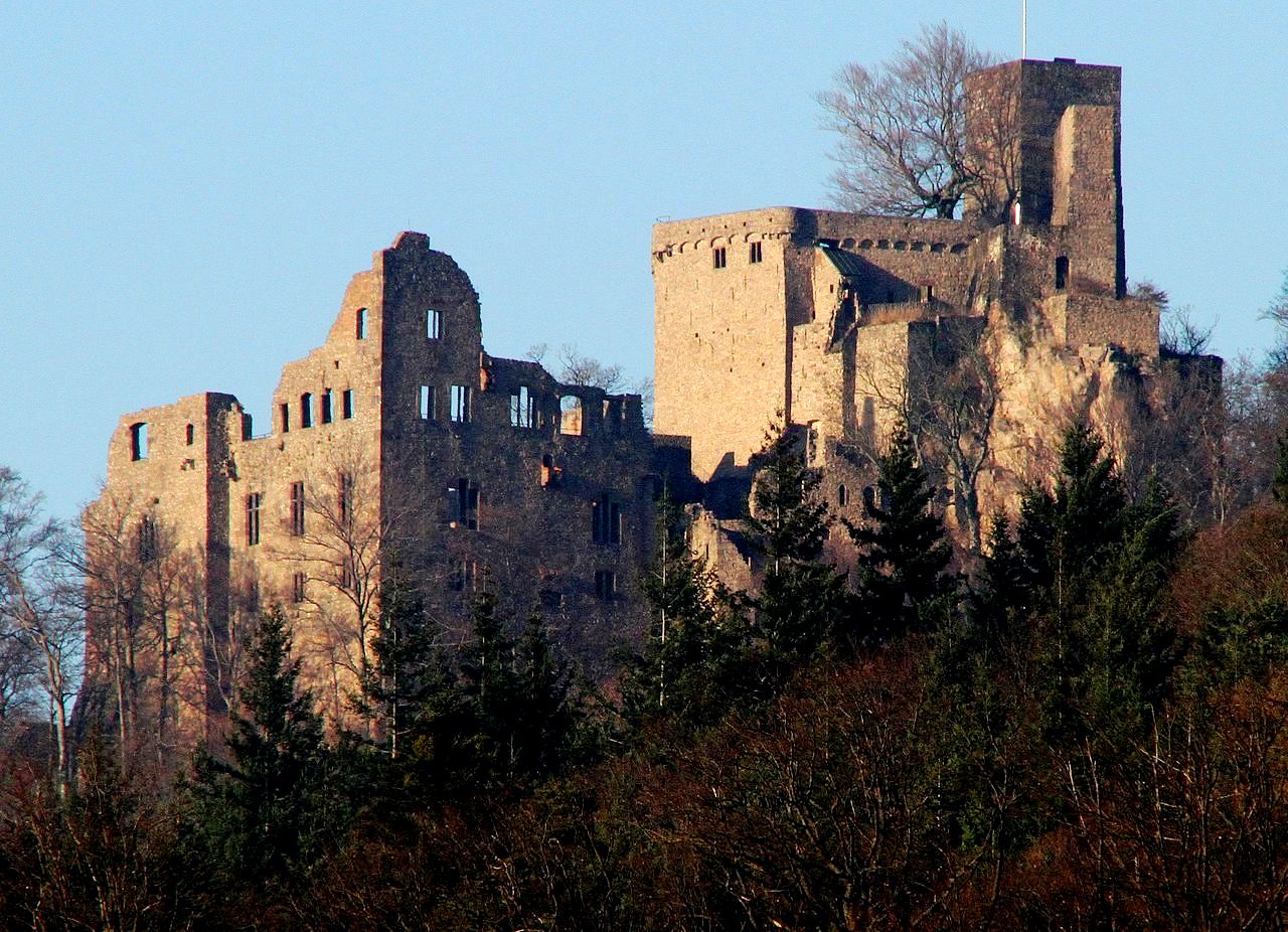
(Gerd Eichmann Photo)
Burg Hohenbaden, aka Alten Schloß Baden-Baden, was the seat of the Margraves of Baden in the Middle Ages. They named themselves after the castle, which gave the state of Baden its name. The castle was built as the first dominion center of the Margraves of Limburg after the relocation of their rule to the Upper Rhine on the western slope of the rocky mountain Battert above what was then called Baden. The construction of the upper castle, the so-called Hermannsbaus, by Margrave Hermann II (1074–1130) is assumed to have started around 1100. From 1112 the Margraves of Baden named themselves after the castle. Under Margrave Bernhard I of Baden (1372–1431) the Gothic lower castle was built, which was expanded by Margrave Jakob I (1431–1453) to become the representative center of the margravate.
The most important component is the Bernhard Building (around 1400), whose column on the ground floor with a coat of arms carried by angels once supported the mighty vault. In its heyday, the castle had 100 rooms. In the same century, Margrave Christoph I expanded the New Castle, which was begun in 1370, in the city of Baden and moved the residence there in 1479. The old castle then served as a widow’s residence, but in 1599 it was destroyed by fire. The ruins were not structurally secured until after 1830. It was later looked after by the State Palaces and Gardens of Baden-Württemberg.
The old castle has belonged to Wolfgang Scheidtweiler since 2017. From its tower you have a good panoramic view of Baden-Baden and a distant view of the Rhine plain and the Vosges. The castle courtyard of the ruin is also worth seeing. The castle and tower can be visited free of charge. There is a restaurant in the castle. The castle is a popular starting point for hikes on the Battert with its scenic, protected climbing rocks and a protected forest. A large wind harp stands in the ruins of the great hall of the old castle. The harp, which was set up in 1999, has a total height of 4.10 meters and 120 strings, it was developed and built by the local musician and harp maker Rüdiger Oppermann, who called it the largest wind harp in Europe. The nylon strings are stimulated by the draft to produce the basic notes C and G. From 1851 to 1920 there was a small wind harp in the knight’s hall of the old castle. (Baden-Württemberg I. Die Regierungsbezirke Stuttgart und Karlsruhe. München 1993)
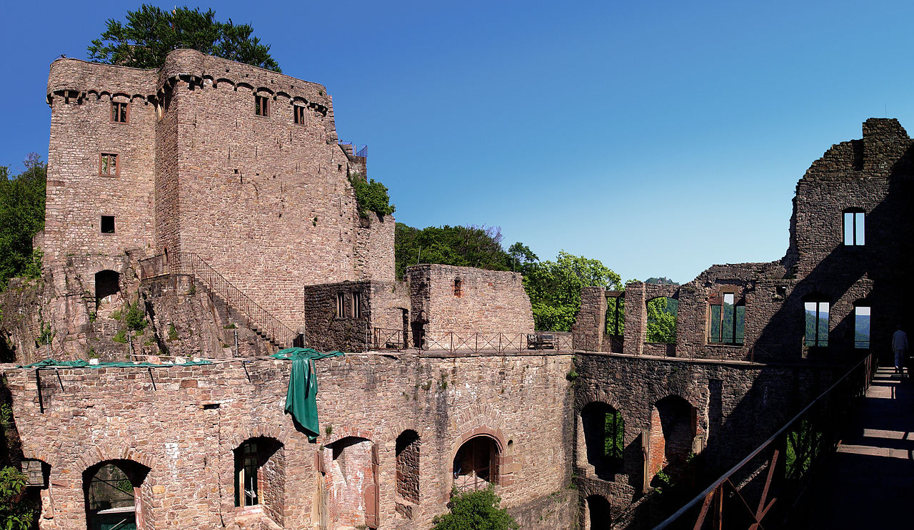
(Martin Dürrschnabel Photo)
Burg Hohenbaden.
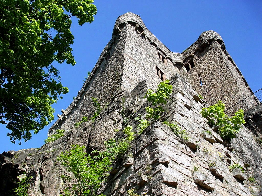
(Martin Dürrschnabel Photo)
Burg Hohenbaden Festungmauer (Fortress Wall).
(Muck Photo)
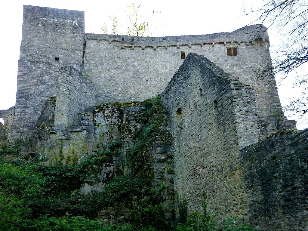
Burg Hohenbaden, fortress wall.
(Gerd Eichmann Photo)
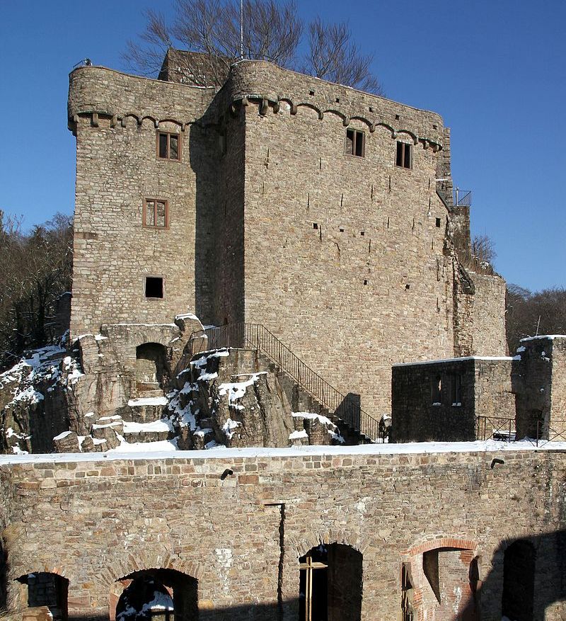
Burg Hohenbaden.
(Wolkenkratzer Photo)
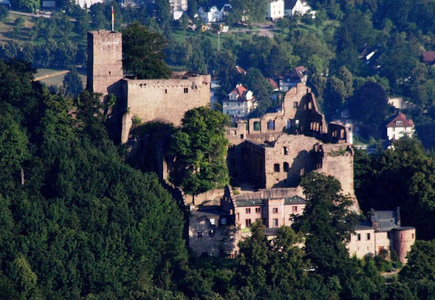
Burg Hohenbaden, aerial view.
(Stadtwiki Photo)
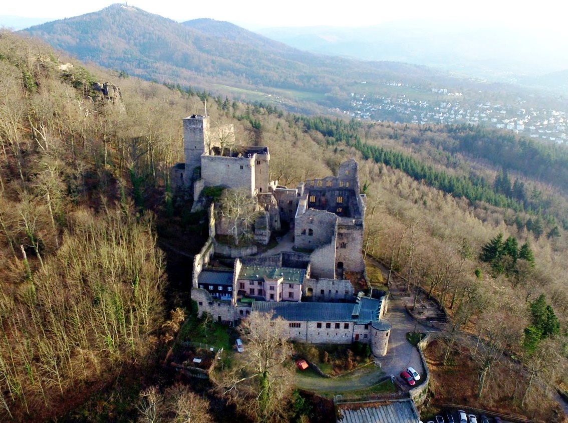
Aerial view of Burg Hohenbaden.
(Gerd Eichmann Photo)
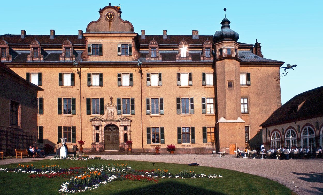
Neues Schloss Baden-Baden.
(Gerd Eichmann Photo)
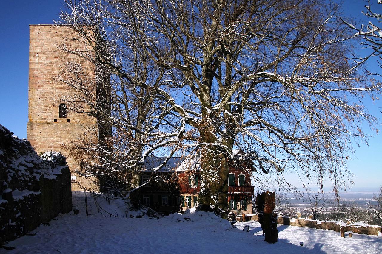
Yburg castle ruin standing on a hill above the town of Yberg, on the western edge of the Black Forest near Baden-Baden, in southwestern Germany, 67 km North of Lahr. The layout of the Yburg includes a bergfried (tall tower) to the west, built around 1200, and the enceinte (main defensive enclosure of the fortification) to the east, built in the 13th or 14th centuries. An elliptically-shaped curtain wall at the top of the Yberg encloses both portions and is one of the castle’s oldest features. The castle was entered through a tower-zwinger. The bergfried stands 20 meters (66 ft) tall and has an entryway 9 meters (30 ft) tall itself. There was a residential building and a keep in the enceinte.
A zwinger is an open kill zone area between two defensive walls that is used for defensive purposes. Zwingers were built to improve the defence of castles and town walls. The term is German and is linked with zwingen, “to force”, perhaps because the Zwinger forced an enemy to negotiate it before assaulting the main defensive line. The main purpose of this feature was so that the besieging force could not reach the actual castle wall very easily with battering rams or belfries, forcing them to stop at the lower, outer wall. This also enabled two ranks of archers, behind and above one another, to fire upon the approaching enemy.
In 1190, Herman V, Margrave of baden-Baden, inherited the rights to the villages of Steinbach and Sinzheim. As the Yburg would have secured the Margraviate of Baden’s new southwest border, it can be assumed that they built it at this time. The surrounding territory increasingly came under Baden’s influence from mid-13th century on. Eberstein Castle was constructed nearby, Hohenbaden Castle was enlarged, and Steinbach was fortified and given the status of a township. Until 1369, the Yburg was administered by the Röder von Rodeck family, who served the House of Baden as civil servants. In the 15th century, under Margrave Bernhard I, a bailiff resided at Yburg, and it is likely the castle received its eastern annex for their residence.
The Yburg was destroyed in 1525 during the German Peasant’s War. In 1535, the Margraviate of Baden split into the rival Margraviates of Baden-Durlach and Baden-Baden, which then further split with the Baden-Rodemacher line. When the Baden-Baden line died out in 1588, Baden-Rodemacher’s scion, Edward Fortunatus inherited Baden-Baden. According to legend, he and two alchemists practiced black magic in the castle. Edward Fortunatus attempted to assassinate his cousin and rival Ernest Frederick, Margrave of Baden-Durlach, who proceeded to occupy Baden-Baden. The Margraves of Baden-Durlach would control the margraviate from 1594 to 1622, when Ferdinand II, the Holy Roman Emperoro, reinstated Edward Fortunatus’s son William as Margrave of Baden-Baden. Georg Friedrich, Margrave of Baden-Durlach, rebuilt the Yburg in 1620. The castle was again destroyed in 1689 by French troops participating in the Nine Years’ War. The castle’s ruins were partially restored from 1888 to 1913. A restaurant was established within the castle in 1892. (Staatliche Schlösser und Gärten Baden-Württemberg)
(Author Photos)
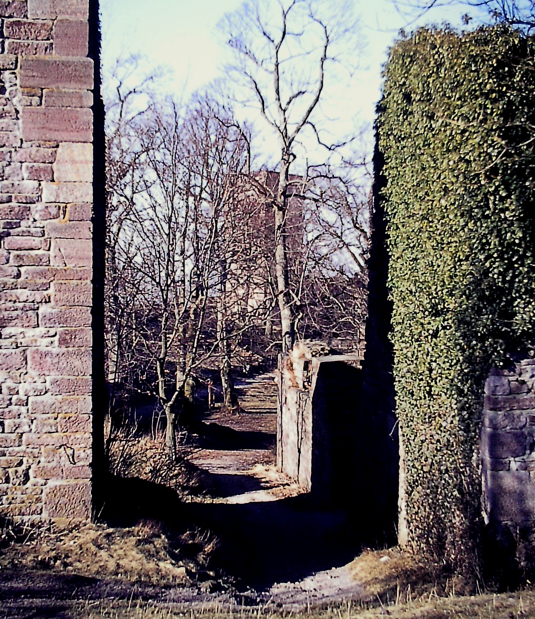
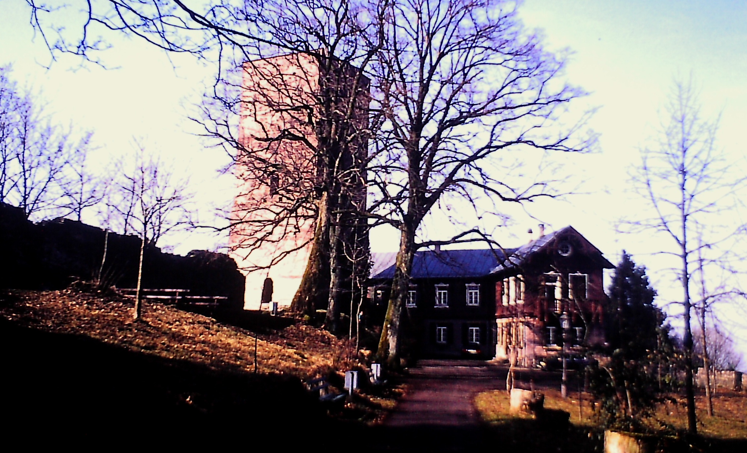
Yburg castle ruin.
(Gerd Eichmann Photo)
Yburg castle ruin.
(SchiDD Photo)
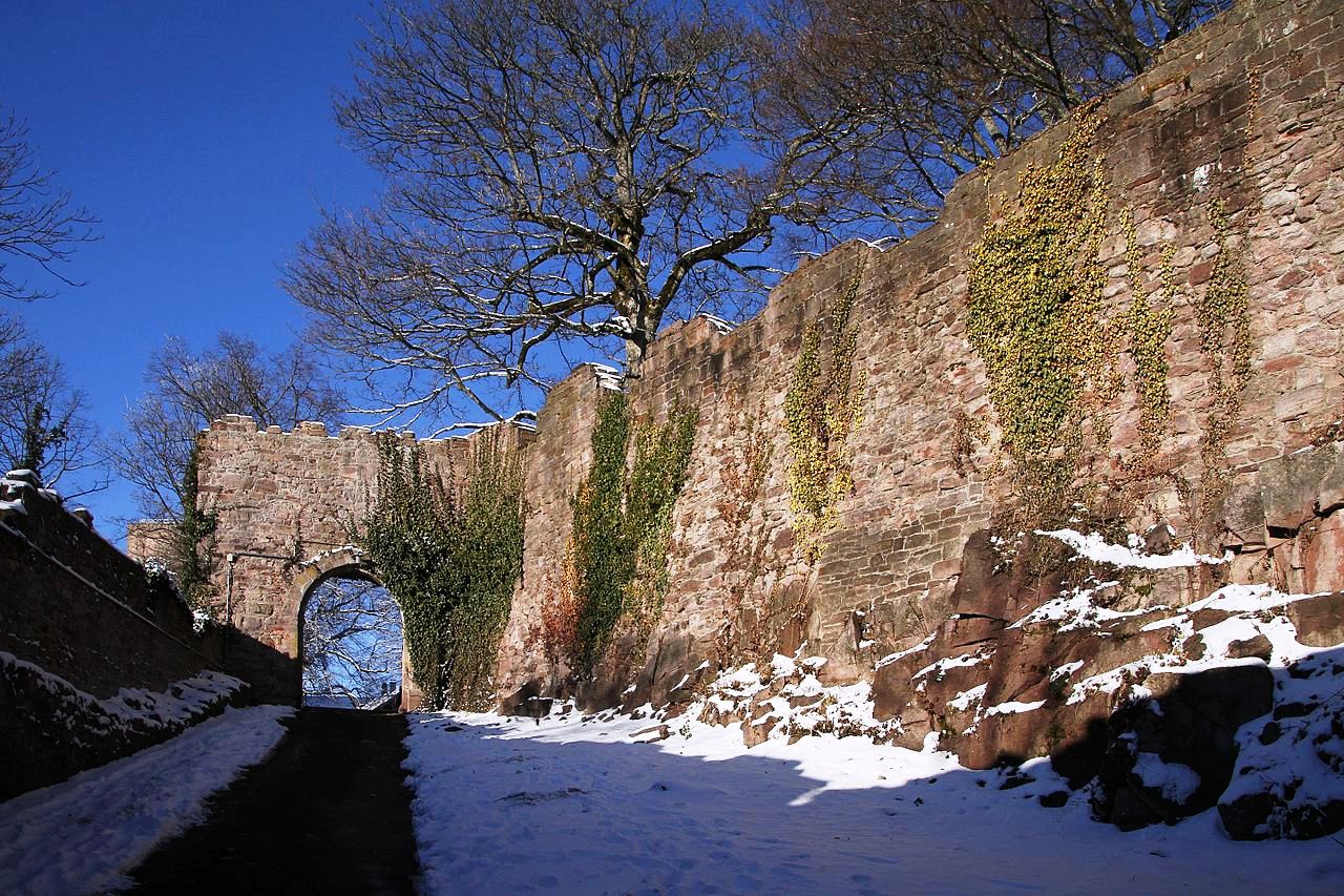
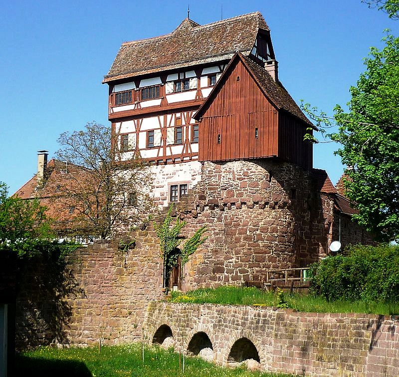
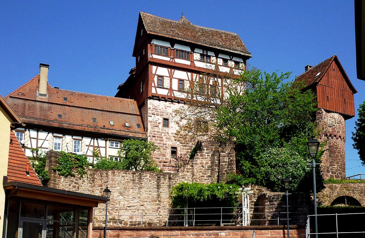
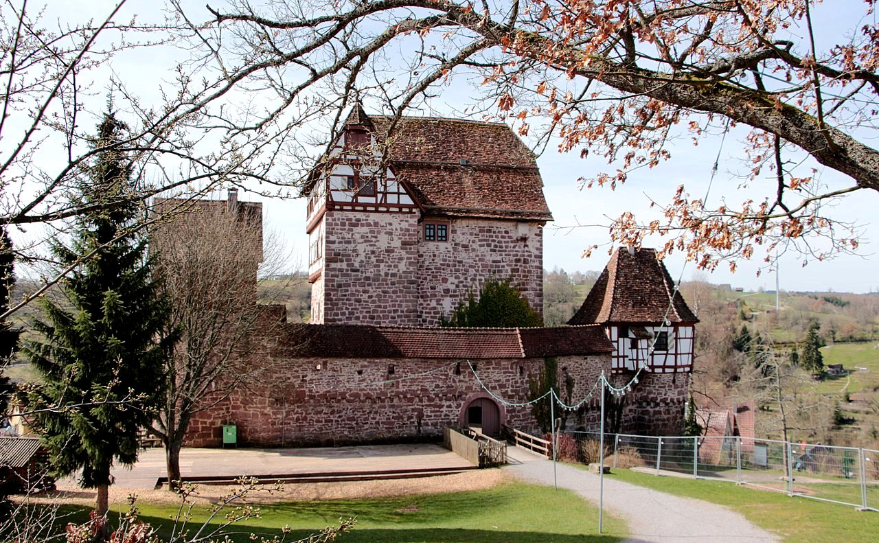
Altensteig Castle aka Altensteiger Schloss, is a castle complex on the northern edge of the old town of Altensteig in the Calw district in Baden-Württemberg. The old castle emerged from a high medieval castle. The New Palace was built in the early 17th century. Today there is a museum in the old castle. The castle, on the walls of which the old castle was built, probably dates from the 12th century. The castle was first mentioned in 1287, owned by the Counts of Hohenberg. Hermann, son of Margrave Rudolf von Baden, conquered the city, but had to return it to Count Burkhard von Hohenberg in 1288. [1] In 1398 the Hohenbergers sold the Altensteig estate to the margraves of Baden. The castle became the seat of the Baden bailiffs.
In 1603 Altensteig came to the Duchy of Württemberg as part of an area swap. From 1605 Heinrich Schickhardt built the New Palace as the official and residence of the Württemberg Obervogts. The old castle served as a fruit store from the 18th century. The lower part of the striking residential tower with a floor area of around 11 meters by 16 meters consists of sandstone masonry. The construction method suggests that it was built in the 12th and 13th centuries. An Alemannic timber frame building was probably built on top of it in the 15th century. The cellar, Dürnitz, kitchen, living room and servants’ rooms were housed on the six floors. The largest room,
known today as the “Knight’s Hall”, is located on the second floor.
On the north side, the palace complex was protected by a wall with a battlement and two towers. The towers were once used as a prison. While the western tower called “Heaven” allowed a view of the outside through barred windows, the eastern tower called “Hell” contained a 15-meter-deep dungeon. The city wall was attached to the fortification. The half-timbered building on a stone base is in front of the old castle on the valley side. In between there is a small courtyard. In Jacob Ramminger’s Seebuch from 1613, the new castle is shown with two bay windows on the south side, which are no longer preserved.From 1977 the state of Baden-Württemberg had the new castle renovated, which later housed the forest administration. In 1982, the renovation work began in the old castle. With the support of the Heimat- und Geschichtsverein founded for this purpose, the museum in the Old Castle was opened in 1985 and expanded in the following years. [3] In the historical rooms, the museum shows exhibits on the history of the region, on rafting and handicrafts in the Black Forest. (Fritz Kalmbach: Auf den Spuren von Heinrich Schickhardt in
Stadt und Amt Altensteig. In: Kreisgeschichtsverein Calw (Hrsg.): Einst & Heute. Beiträge aus dem Kreisgeschichtsverein Calw. Heft 19, 2009/2010)
(SchiDD Photo)
Altensteiger Schloss.
(BohunkaNika Photo)
Altensteiger Schloss.
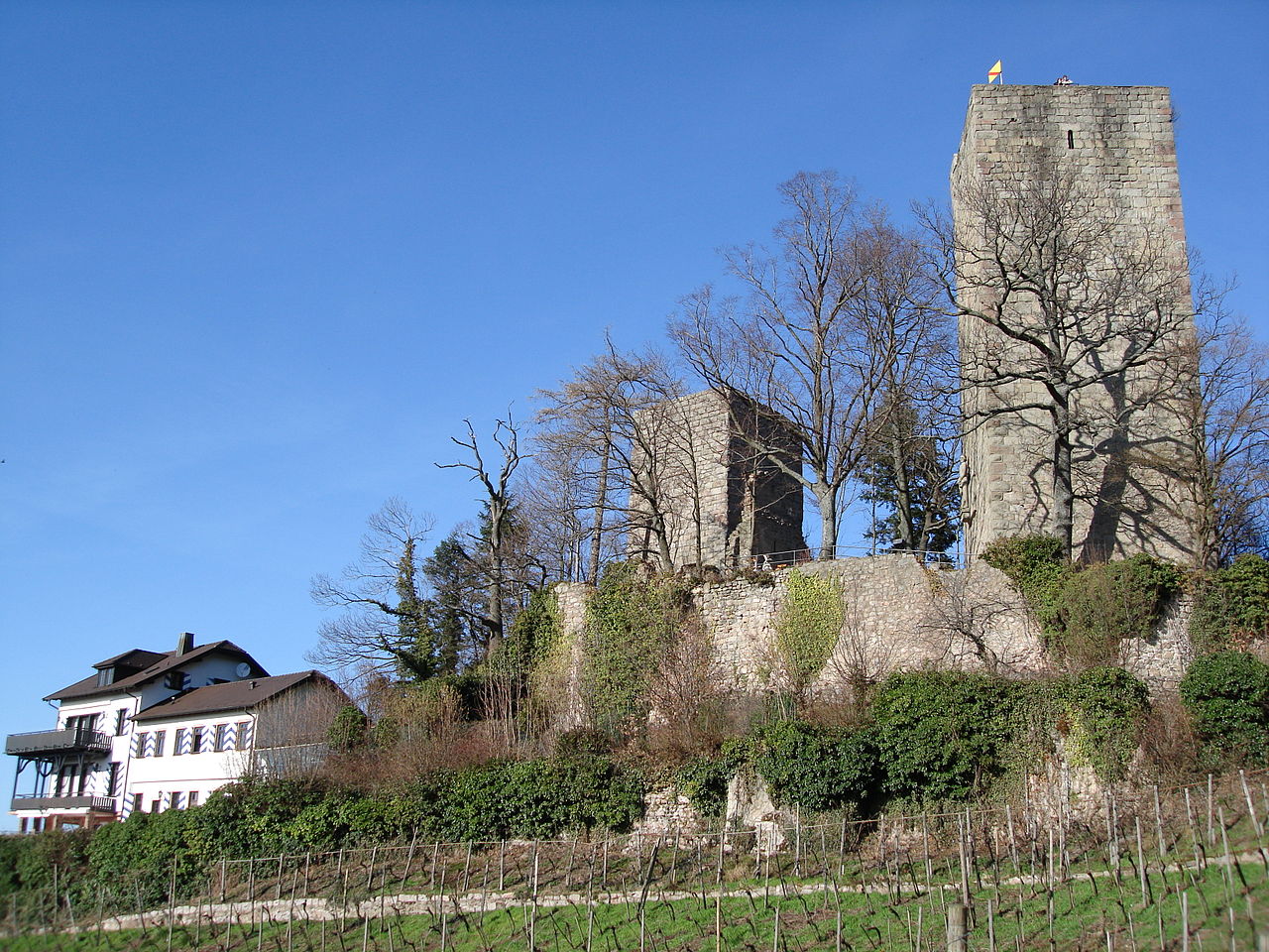
(Aares75 Photo)
Burg Alt-Windeck stands in ruins in the Black Forest on a 378-metre-high spur in the Bühl district of Kappelwindeck, in the county of Rastatt in the German state of Baden-Württemberg. 44 km (27 Mi) North of Lahr. The castle was built around 1200 by the lords of Windeck. The family, probably of Franconian origin and based in the Oretnau, owned wealthy estates and held numerous fiefs from various liege lords. The first documentary evidence dates to 1212 when a certain Melchior von Windeck comes to light, and, in 1248, the lords of Windeck are mentioned in a document at Schwarzach Abbey. The castle itself, however, is first mentioned in 1335. It became a jointly-managed castle or Ganerbenburg very early on as a result of divisions of inheritance. In the early 13th century the New Windeck Castle (Burg Neu-Windeck) was built by a branch of the family near Lauf within sight of Old Windeck. During the course of the 13th and 14th centuries, the lords of Windeck came into conflict many times with neighbouring territorial lords, the city of Straßburg and the counts of Württemberg in alliance with the Martinsvögel during the so-called Schlegler Wars, during which the castle was besieged, but never captured and so remained largely undamaged. In the late 14th century, however, it was damaged by a devastating fire. Stables and domestic buildings were razed, and the valuable archives, the basis of numerous legal titles, were destroyed. Reinhard von Windeck had the damaged buildings rebuilt.
In 1466, the last heir of Old Windeck, Anna, only child of Burkhard von Windeck, married and so the castle went to the family of her husband, Baron Berthold IV of New Windeck. His descendants occupied the castle until the 16th century, but from 1561 it was used as a quarry for other buildings in Bühl, such as the Kappelwindeck Church. Its owner thus moved into the more modern Schlosshof (today a hotel) in Bühl. The last heir, Jakob von Windeck, died in Venice in 1592. The fief was returned to the Empire, the remaining allotments went in equal portions to his two sisters: Old Windeck to Ursula and New Windeck to Elizabeth.
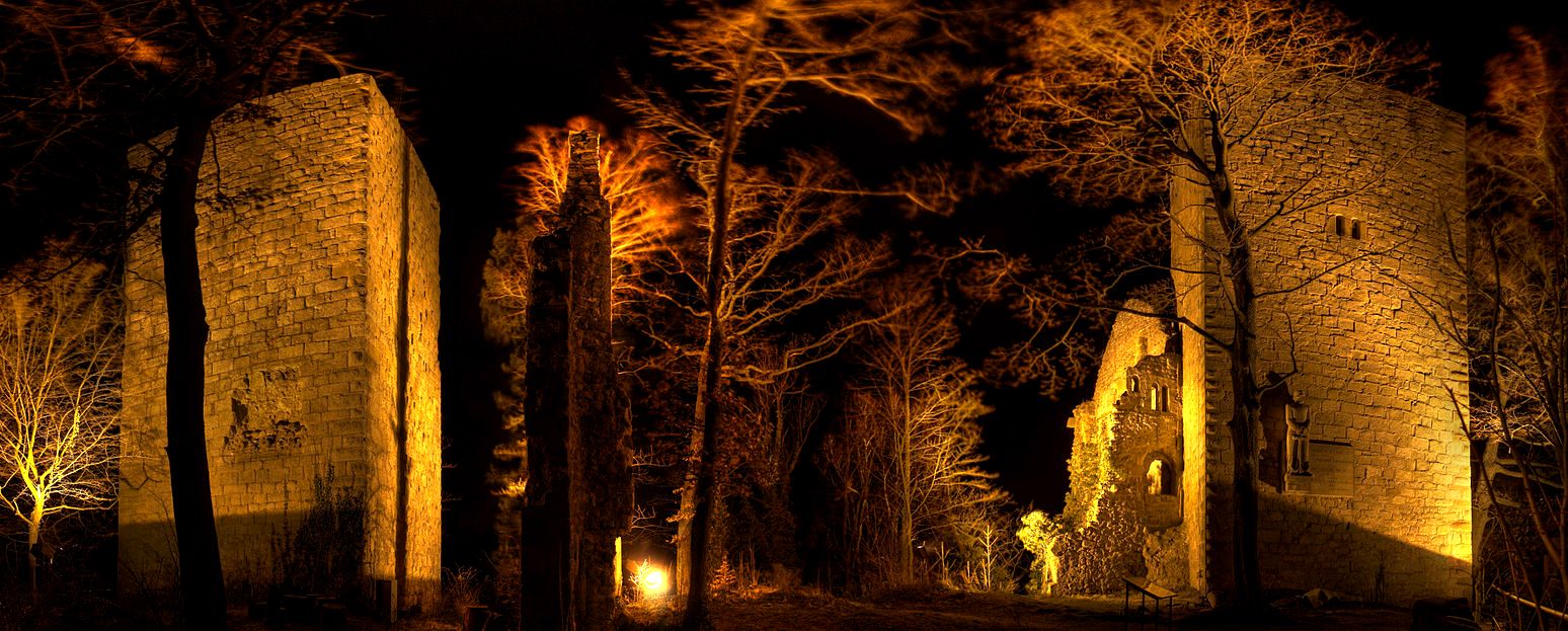
(Christian Barth Photo)
Burg Alt Windeck at night. All that remains of the castle today is a bergfried, a tower and parts of the curtain wall. They may be visited in good weather. The castle probably consisted of an outer and an inner ward that each had its own bergfried and palas. The smaller, northern bergfried, with a ground plan measuring 8.5 metres square, guarded the castle gate and the downhill side of the site. The surviving southern bergfried, 27.6 metres high, has a floor area of 9.6 x 9.8 metres. Its lower floor was probably used as a dungeon or store room. In wartime, its thick walls made it a strong refuge for the castle’s residents. On the first and second floors of the attached palas were probably reception rooms such as the great hall. At the foot of the castle ruins are the hotel and restaurant, Burg Windeck, and the Pferdestall snack bar. (Wikipedia)
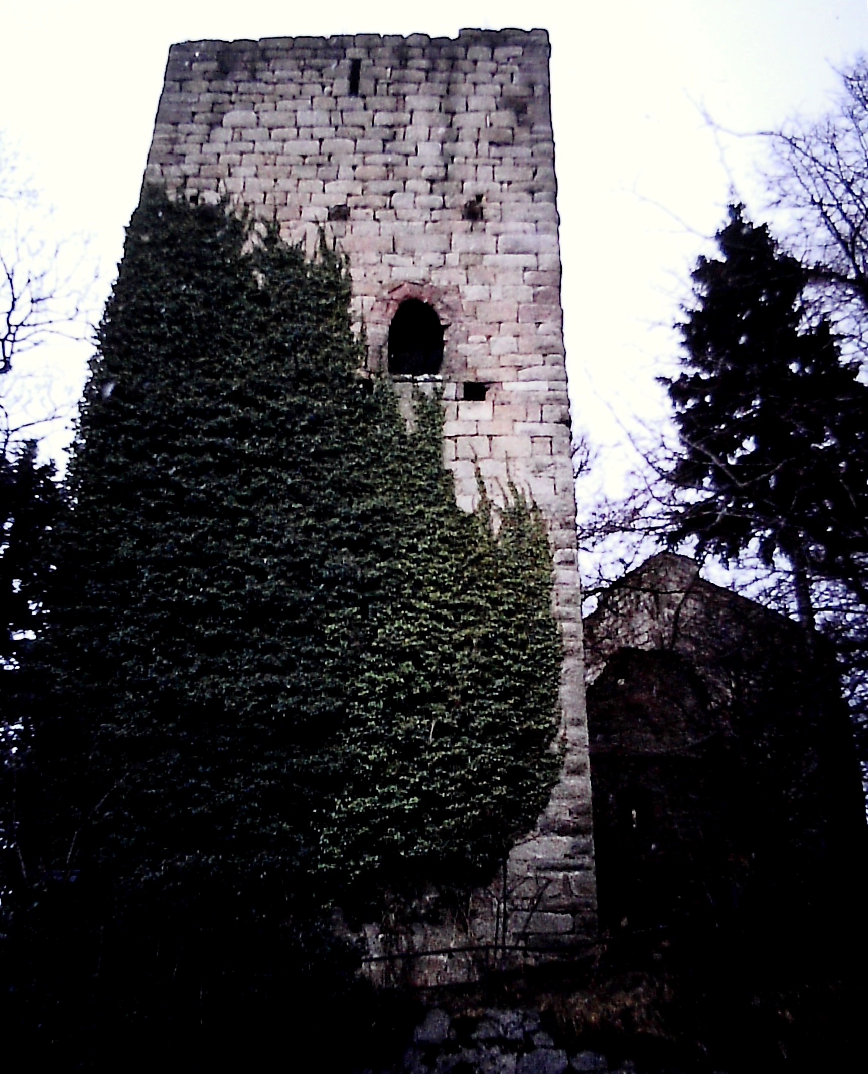
(Author Photo)
Burg Alt Windeck.
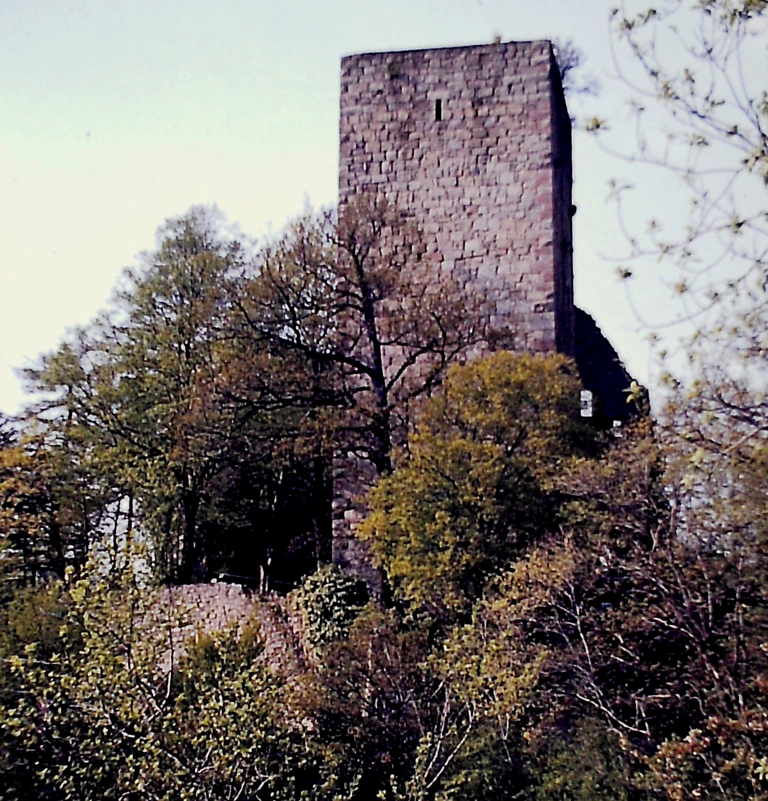
(Author Photo)
Burg Alt Windeck.
(Gerd Eichmann Photo)
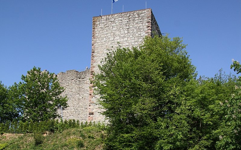
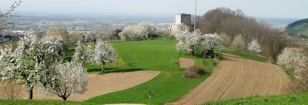
Burg Neu-Windeck, also known as Burg Neuwindeck, Burg Lauf or Laufer Schloss, is a castle ruin on the Schlossberg, a hill southeast of Lauf in the Ortenaukreis in Baden-Württemberg, 56 km North of Lahr.
(Dr Manfred Holz Photo)
Burg Neu-Windeck, Lauf. 56 km North of Lahr.
(Kerish Photo)
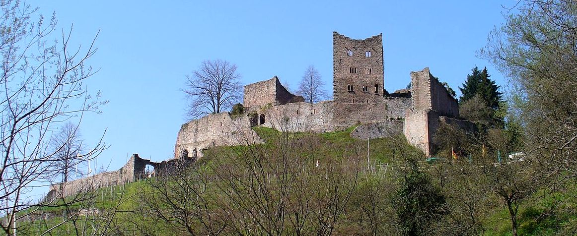
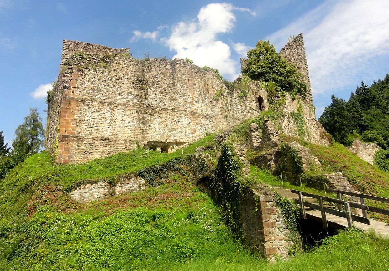
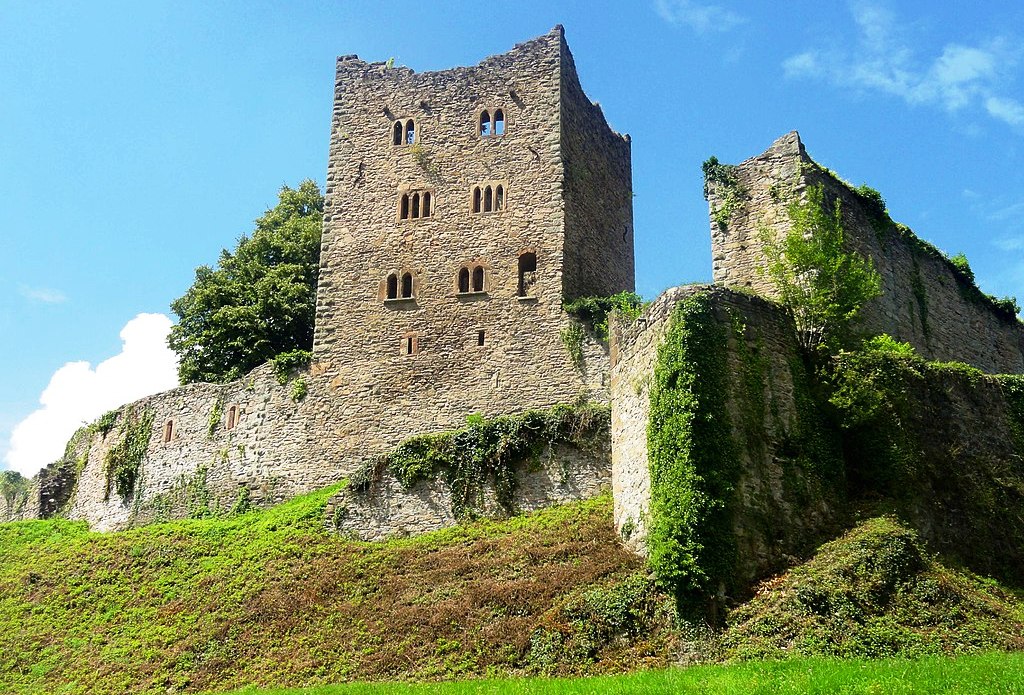
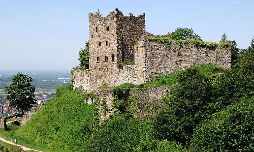
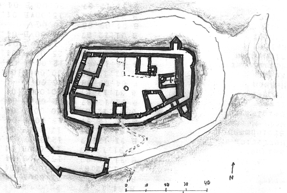
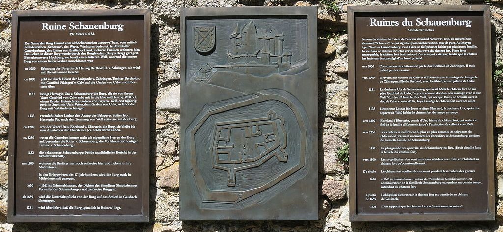
Schauenburg ruin near Oberkirch. This castle ruin stand on a 367-metre-high (1,204 ft) hill spur overlooking the Rench river valley above the town of Gaisbach, Baden-Würtemberg, 43 km North of Lahr. The castle was built c1050 by Duke Berthold II of Zähringen, and was first mentioned in a written text in 1120. The well-preserved ruin includes the remains of two towers with living quarters, a gate tower, a rampart, and a shield wall with a chapel attached. The original castle included at least one additional tower with living quarters. The remains of an outer bailey are surrounded by a dry moat and a second shield wall. There is a small museum in the cellar of the former castle chapel and a restaurant.
The Schauenburg was held in the Platinate by Gottfried von Calw (d 1131). The castle came into the possession of the Count of Calw, Count-Palatine of bei Rhein, (1113–1126) through his marriage to Liutgard von Zähringen. On his death it passed to his granddaughter Uta, Duchess of Eberstein. The Schauenburg became part of the dowry upon Uta’s marriage in 1131 to Duke Welf VI, a brother of Henry X, Duke of Bavaria. After Uta’s death, it is recorded in the Sindelfinger Chronicles that the castle passed to Uta’s brother Eberhard, founder of the All Saints’ Abbey. The Schauenburg remained in the possession of the Counts of Eberstein until the financial ruin of Wolf von Eberstein. In 1386, half of the possessions of the Ebersteins, including Schauenburg Castle, were sold to Rudolf VII, Margrave of Baden-Baden (d 1391).
The knights of Schauenburg became a separate noble family, under the Ebersteins, working as “Ministerialis” (German knights). Both men and women held ministerial status, and the laws on ministeriales made no distinction between the sexes in how they were treated). Many served as “Burgmann” (a member of the nobility), who weres obligated to guard and defend the castle. The role is roughly equivalent to the English castellan and the name derives from the German word for castle, Burg. After the death of Ludwig Winterbach von Schauenburg, the last of his line, there was a dispute between Heinrich Truchseß von Höfingen and the other line of the Schauenburg family as to who possessed the fiefdom. The family Schauenburg wanted the Schauenburg to remain a Ganerburg (a castle occupied and managed by several families or family lines at the same time. These families shared common areas of the castle including the courtyard, well and chapel whilst maintaining their own private living quarters.They occurred primarily in medieval Germany. The Heinrich family, however, wanted sole fiefdom. This led to the Feud of the lords of Schauenburg with Bernhard von Baden, a two-year war from 1402 to 1403. This resulted, in 1404, with the Schauenburg remaining with the Eberstein family.
During its time as an active castle, it was besieged many times and overrun twice. After at least two different demolitions (probably during 1689 by Vuban and Mélac in the Nine Year’s War, the castle was ruined, and, in the 17th Century, stones from the castle were used in the building of Gaisbach Castle by Hans Jakob Christoffel von Grimmelshausen. The castle has been a preserved ruin since the 18th century and is currently owned by the Freiherren von Schauenburg. (Berta von Schauenburg: Die Fehde der Herren von Schauenburg mit dem Markgrafen Bernhard von Baden, 1402–1403 in: Die Ortenau: Zeitschrift des Historischen Vereins für Mittelbaden, Verlag des Historischen Vereins für Mittelbaden, Offenburg 1941, S.121–126)
(Peter Poschadel Photo)
Ruin Schauenburg near Oberkirch.
(Peter Poschadel Photo)
Ruin Schauenburg near Oberkirch.
(Stefan Karl Photo)
Ruin Schauenburg near Oberkirch.
(Stefan Karl Photo)
Ruin Schauenburg near Oberkirch.
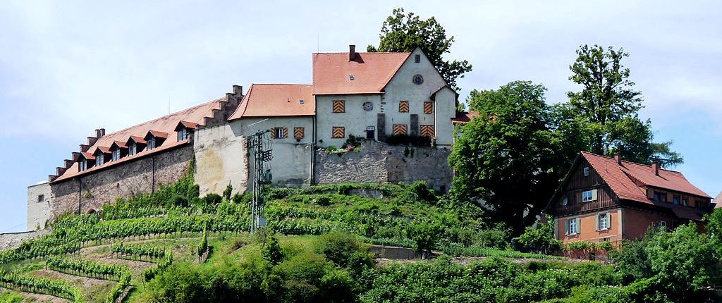
(Ji-Elle Photo)
Schloss Staufenberg, Durbach. Staufenberg Castle, also known as Staufenburg or Stauffenberg and now known as Weingut Schloss Staufenberg, is a hilltop castle on a 383 meter high rock face north above the Staufenberg district of the municipality of Durbach in the Ortenaukreis in Baden-Württemberg.
Although none of the original building structure from the 11th and 12th centuries has survived, the builders of the castle were the lords and counts of Staufenberg mentioned between 1188 and 1132 in the donation book of the Reichenbach priory in Hirsau and in the founding notes of the St. Georgen monastery (“Stouffenberg”) or the Ministerials of the Dukes of Zähringen recorded in 1148. After 1218 the castle came into the possession of various noble families and was damaged in the Thirty Years War (1618 – 1648), and last plundered by French “marauders” in 1689. At times, Staufenberg Castle served as a residence for eight families as a Ganerbeburg. In 1693, Margrave Ludwig Wilhelm von Baden-Baden bought the castle. From 1832 the castle was expanded into a palace by the Margraves of Baden in the Romantic style and is still privately owned by the Baden family as the Margravial Badische Weinkellerei.
The castle complex rises 10 meters above the neck ditch, which today serves as a parking lot. The buildings in the rear, the oldest part of the complex with the hall, contain elements of the keep. The castle tavern leads to the western platform, which today serves as a terrace. (Heiko Wagner, Theiss-Burgenführer Oberrhein. 66 Burgen von Basel bis Karlsruhe, Stuttgart 2003)
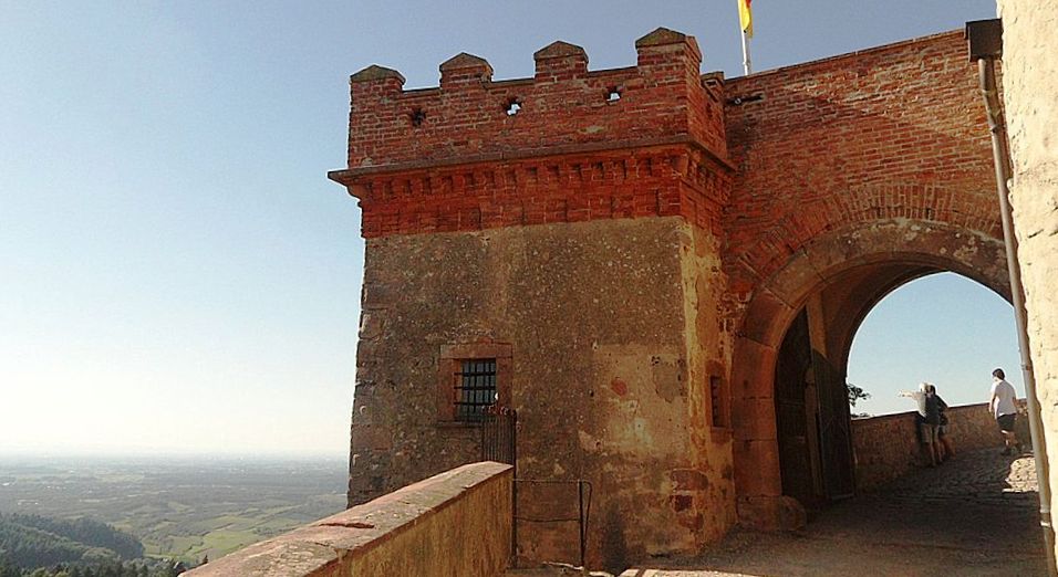
(Mattias Nonnenmacher Photo)
Burg Staufenberg, Durbach, with a view towards Oberrheinebene. The castles listed to the North of Lahr, have been mentioned above, including the Storchenturm in Lahr. The remaining castles listed here are to the South and East of Lahr.
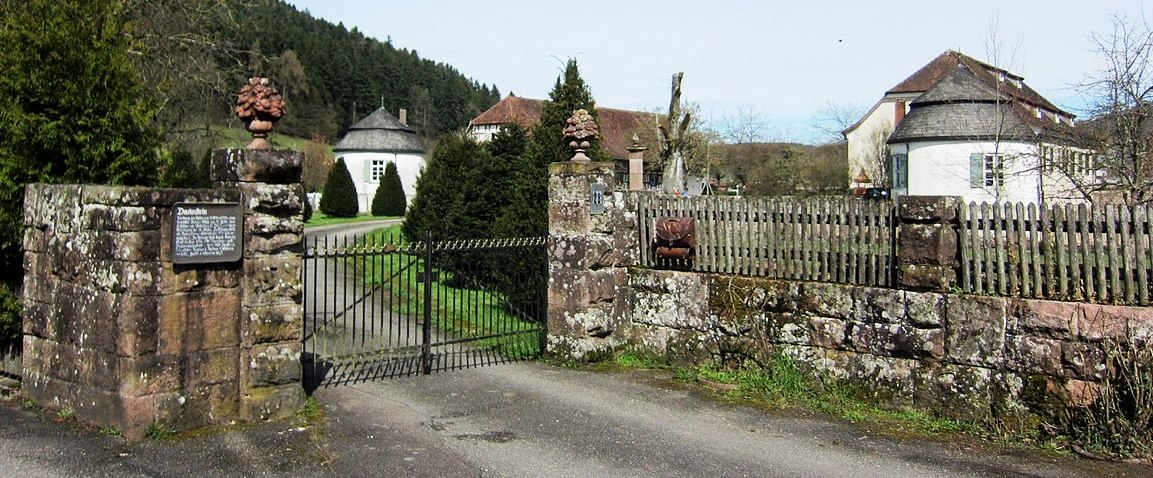
(Lutz H Photo)
Schloss Dautenstein, Seelbach. Schloss Dautenstein, Seelbach. Dautenstein Castle, also known as Tutenstein, Duttenstein or Dutenstein, is a former moated castle near Dautenstein in the area of what is now the community of Seelbach in the Ortenaukreis in Baden-Württemberg. This Hohenstaufen low level castle was constructed using a Hohenstaufen building layout, with a rectangular floor plan and four round corner towers. It was initially known as the Tiefburg Lahr, and was probably built c1235 by the Reichsministeriale von Dautenstein. It formed a fortress line with the Schwanau and Lahr Tiefburgs. The Tiefburg Dautenstein was destroyed in the Peasants’ War, bought by Jakob von Hohengeroldseck in 1584. It was enlarged to make a residence for the Hohengeroldseck rule in the late Renaissance style until 1599. Jakob died in Dautenstein in 1634 without male descendants. Two years later the castle was burned down by Count von Gallas and remained in ruins for decades. In 1812, the privy councilor of Prince Leyche, Philipp Carl Schmidt, acquired the partly restored property and had it rebuilt.The current building complex, which is privately owned, goes back to the new building in the first half of the 19th century and only takes up part of the complex. Dautenstein is included in the list of monuments of the state of Baden-Württemberg and was raised in 2005 by the regional association Badische Heimat to the status of a “cultural heritage of the state”. (Kurt Klein:
Burgen, Schlösser und Ruinen. Zeugen der Vergangenheit im Ortenaukreis. Reiff Schwarzwaldverlag, Offenburg 1997)

(Lutz H Photo)
Schloss Dautenstein, Seelbach.
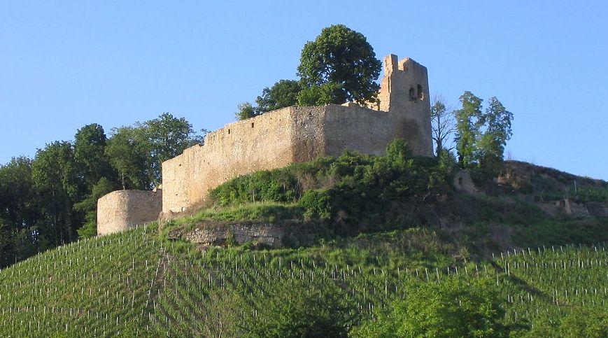
(Flominator Photo)
Burgruin Lichteneck, Kenzingen. The castle was probably built by the Counts of Freiburg between 1265 and 1272 and was mentioned in 1290 as “Liehtenekke”. Lichteneck later came into the possession of the Count Palatine of Tübingen-Lichteneck. The castle was destroyed in the Geroldseck War in 1433, rebuilt in the 16th century and finally destroyed on 15 April 151675 in the Dutch War by French troops under General Nicolas de Bautru, Marquis de Vaubrun. Since then, the fortress has been almost untouched above the village of Hecklingen. (Gerhard Flemming: 15 Jahre Restaurierungsarbeit an der Burg Lichteneck. In: Die Pforte, herausgegeben von der Arbeitsgemeinschaft für Geschichte und Landeskunde in Kenzingen e.V., 21., 22. und 23. Jahrgang (2001–2003))
(Joergens Photo)
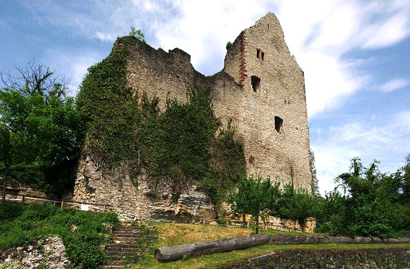
Burg Landeck, Emmendingen. Landeck Castle, also known as Schadelandeck, is the ruin of a spur castle at 285 m above sea level, on a limestone rock in the village of the same name Landeck, a district of Teningen, north of the city of Emmendingen in the district of Emmendingen in Baden-Württemberg. The ruin is one of the few well-preserved ruins in the Breisgau. The time of origin of the upper and lower castle can be dated to around 1269. In 1260 “Dietrich, the Vogt von Landecke”, a follower
of the Lords von Geroldseck, is mentioned in a document. In 1277 the castle came into the joint ownership of the brothers Heinrich and Walther von Geroldseck. In 1298 it was besieged by Count Egino II of Freiburg and the citizens of Freiburg, in 1300 it came from Heinrich von Geroldseck via the Order of St. John to the Freiburg citizen Johann Snewlin. There was a “little town” near the castle, which went down again before 1400.
The castle chapel of St. Katharina was first mentioned in 1315 by the co-owner Heinrich von Rappoltstein. In 1354 Konrad Snewlin first called himself “Schnewlin von Landeck”, from 1394 Hanmann Snewlin von Landeck lived in the castle with his cousin Heinrich von Wiesneck. In the same year Snewelin pledged half of the castle to him, namely the “lower castle” including the goat barn, bakery and the cellar under the chapel. In 1428 Hanmann’s three sons shared the castle. In 1490 Anthony and Bastian Snewlin von Landeck litigated about the division of the castle, eight years later the indebted Landeck family had to take Margrave Christoph von Baden’s fief. In 1511 Bastian Snewlin von Landeck sold half of the castle to his feudal lord, the Margrave of Baden. In 1525 the castle was destroyed by rebellious farmers and not rebuilt. Margrave Ernst von Baden bought the rest of the castle site with the village of Köndringen in 1538.
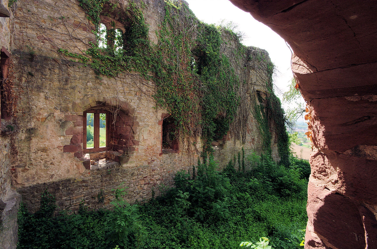
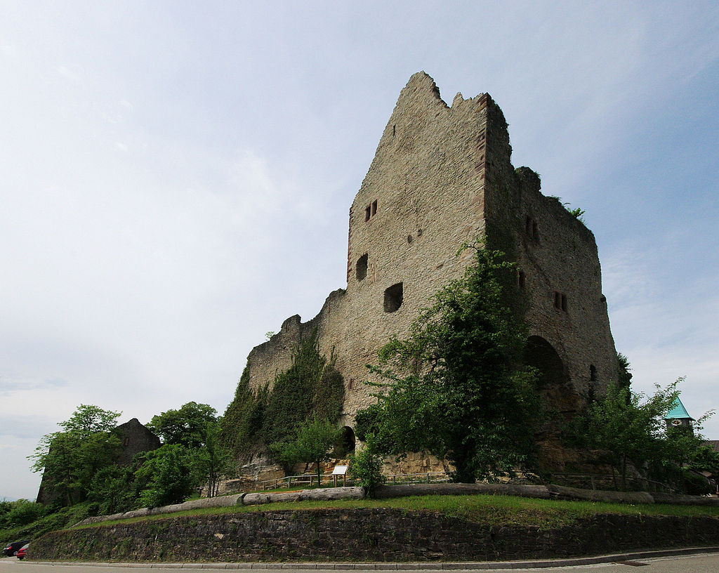
The castle complex was divided into an upper and a lower castle. The upper castle presents itself as a roughly longitudinally rectangular system, which is surrounded on all sides by a circular wall. The main building of the upper castle is a high, tower-like hall, the most representative part of the castle. It had four floors with three chimneys and rich windows, especially on the north side, its front side.
Three sides of the palace are formed by the curtain wall, the south side faces the former courtyard. The upper one is separated from the lower castle by a section ditch that is now only shallow. The roughly triangular lower castle is also dominated by a wide hall (20 × 10 meters) with late Romanesque and early Gothic double windows. A castle chapel with a Gothic choir arch, windows with a ribbed vault and console figures is attached to its narrow northeastern side. Immediately to the west of the two parts of the castle, remains of masonry indicate a presumable outer bailey.
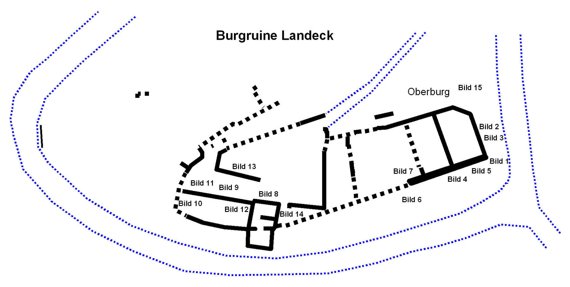
Plan view of Burg Landeck.
(Joergens Photo)
Burgruin Landeck, Emmendingen.
(Joergens Photo)
Burgruin Landeck, Emmendingen.
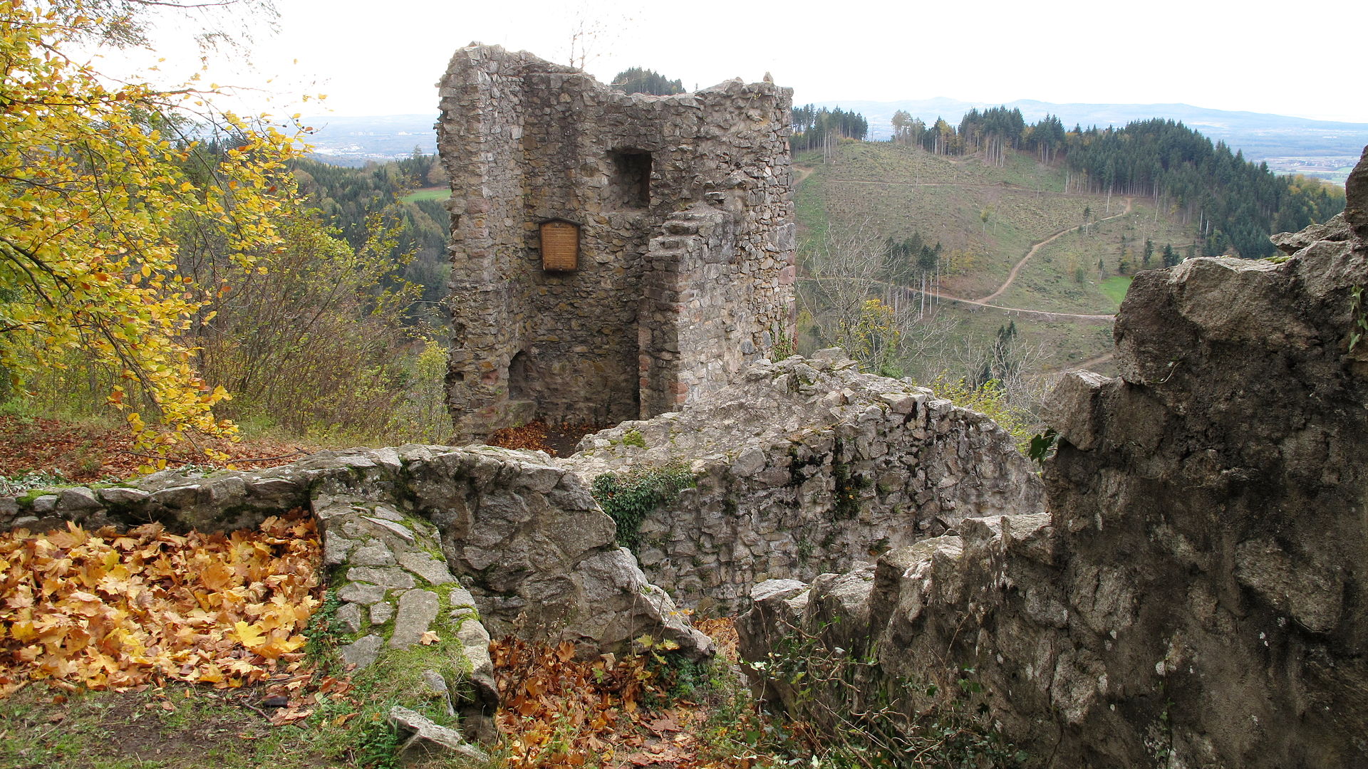
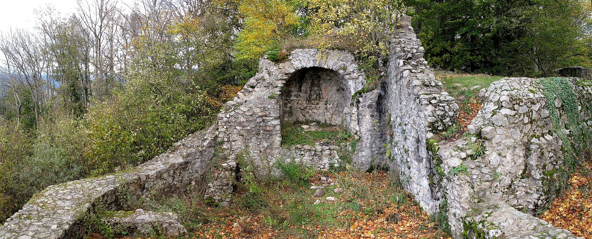
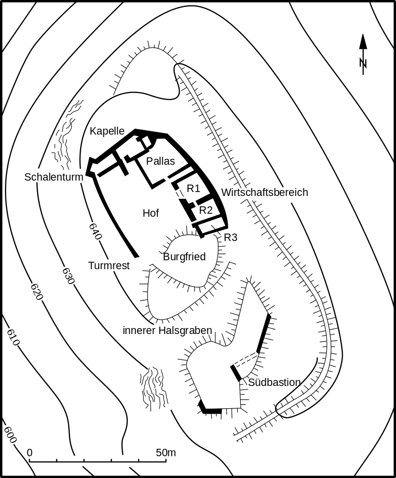
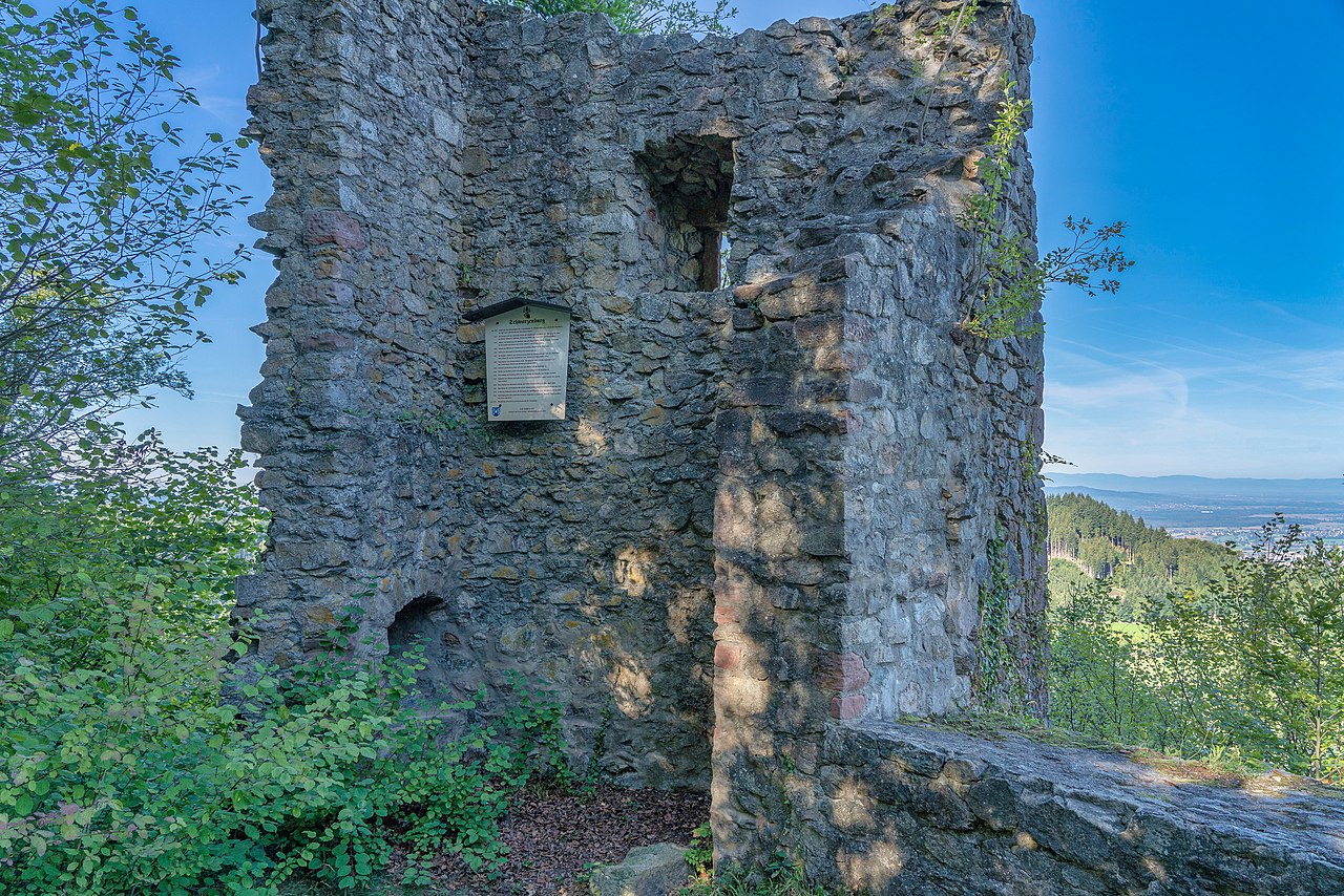
(Joachim Haller Photo)The Schwarzenburg (Black Castle), historically called Schwarzenberg (Black Mountain), is a fortified castle ruin near Waldkirch in the district of Emmendinger in the southwest of Baden-Wurttemberg. Along with the Kastelburg, the less well known Schwarzenburg is one of two ruined castles owned by the town of Waldkirch. The ruins of the former hill castle, 656.2 m (2153 ft) above sea level on the top of the Schwarzenberg (‘Black Mountain’), a spur of the Kandel have decayed to such an extent that only a few wall foundation are visible.
The castle was probably built as a refuge as well as for security, possibly to protect the political power of the Schwarzenberg family. Such a castle, on a vantage point visible from far away in the Rhine valley, was clear evidence of their status as free noblemen, subordinate in rank only to the Holy Roman Emperor. In sharp contrast to Waldkirch and the Kastelburg, which was built later, the Schwarzburg was not a fief of Further Austria, but the allodial property of the Schwarzenbergs until they died out
in the mid-15th century.
The Schwarzenburg was built around 1120 by the patrons of the St. Margaret monastery in Waldkirch under Conrad Waldkilcha, who after 1120 called himself Conrad of Suarzinberg and thus became the founder of the noble family of Schwarzenberg. With Conrad, the male branch of the Conradines of Waldkirch died out. In 1213, their estates were transferred to Conrad’s sister, Adelheid, wife of Walter I of Eschenbach-Schnabelburg. In 1270, John, a descendant of Adelheid who came with his nephew William from Switzerland, inherited the territory and called himself John I of Schwarzenberg. On 8 August 1300, John and William of Schwarzenberg granted Waldkirch town privileges. In 1315, the territory was divided: John took over the Kastelburg and William remained on the Schwarzenburg. The Schwarzenberg family line died out in 1347 with Lord Ulrich II of Schwarzenberg. He was succeeded by John III of the Kastelberg line. This led to the reunification of the two lines.
After the death of Hans Werner of Schwarzenberg in 1459, his son-in-law, Henry of Rechenberg zu Hohenrechberg, inherited the estate and the office of bailiff (Amtmann). In 1503, Martin of Rechenberg succeeded his late father, Henry; he, in turn, was succeeded in 1540 by his son Hans Louis of Rechberg. After the death of Hans Louis in 1542, Sebastian of Ehingen acquired the estate. During the wedding ceremony of his daughter in 1559, he was stabbed by his son, whereupon the rule of Schwarzenberg was transferred to Hans Raphael Reischach as a fief in 1560.
In 1567, Ferdinand II, Archduke of Austria, took over the debt-ridden territory. He ordered the demolition and removal of the dilapidated Schwarzenburg castle in 1578. This order was not carried out, however. An inspection in 1583, by the Further Austrian government agency of Ensisheim led to a report indicating the castle was badly dilapidated. In accordance with the report of an annalist of the Margarethenstift Waldkirch of 1590, very little was left of the roof-structure and the walls had collapsed. The ruin was eventually used as a quarry. Since 1975, the castle has been successively researched and restored and, since 1980, has been accessible to the public. In 1995, the town of Waldkirch erected an information board of the history of the castle next to the ruins. (Alfons Zettler, Thomas Zotz: Die Burgen im mittelalterlichen Breisgau, I. Nördlicher Teil: Halbband L-Z (the castles in the medieval Breisgau, I. northern part: half volume L-Z). Jan Thorbecke Verlag, Ostfildern, 2006)
(Joachim Haller Photo)
Schwarzenberg.
Schwarzenburg, ground plan.
(PantaRhei Photo)
Schwarzenburg.
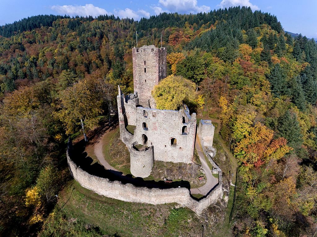
(Volatus Photo)
The Kastelburg is a ruined castle above Waldkirch in the district Emmendingen in Baden-Württemberg. It stands on a hill about 100 meters (330 feet) above the center of Waldkirch in Breisgau. The Kastelburg was built between 1260 and 1270 by the Lords of Schwarzenberg. Like the Schwarzenburg on the opposite side of the valley, its purpose was to defend the town of Waldkirch and to control the trade route through the Elz valley. The first inhabitant of the castle was Johann I of Schwarzenberg. The Schwarzenbergs died out already in 1345 and the castle was sold to Martin Malterer from Freiburg who fell in 1386 in the Battle of Sempach. In 1429 the castle was passed on to Berthold of Staufen.
In the Thirty Years’ War the castle was destroyed by troops of the Kaiser on 14 March 1634, so that it would not fall into the hands of the advancing Swedish troops. In recent years attempts have been made to conserve the edificial structure of the ruin that is standing romantically above the historic center of Waldkirch (Action Kastelburg). (Alfons Zettler, Thomas Zotz: Die Burgen im mittelalterlichen Breisgau, I. Nördlicher Teil: Halbband L-Z. Jan Thorbecke Verlag, Ostfildern 2006)
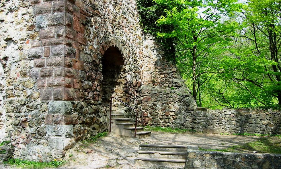
(Kopaltra Photo)
Kastelburg.
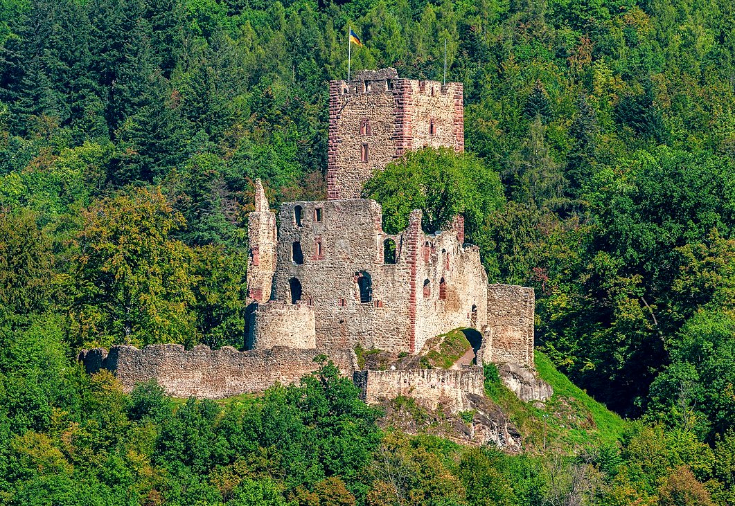
(PantaRhei Photo)
Kastelburg.
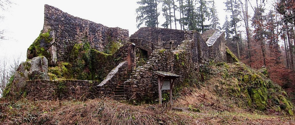
(Lutz H Photo)
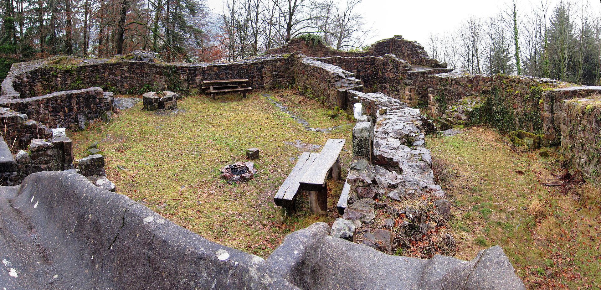
Keppenbach Castle is the ruin of a hilltop castle at 455.1 m above sea level, on an elongated mountain spur of the Schlossberg above the hamlet Sägplatz and the district Reichenbach of the municipality of Freiamt in the district of Emmendingen in Baden-Württemberg. In 1161 Hartmut von Keppenbach (Hartmuot de Keppenbach) was mentioned as the Zähringer ministerial. The castle became the headquarters of the Lords of Keppenbach. In 1276 the castle was first mentioned in a feudal letter. From 1336 at the latest, Keppenbach Castle was a Ganerbeburg, in which the Schnewlin family also held a share. After the Keppenbachers had become robber knights, the castle was destroyed in 1396 at the behest of the Habsburgs, who had extended their sphere of influence to the Breisgau and Freiburg im Breisgau.
The castle was rebuilt by the lords of Keppenbach – now Habsburg feudal people – at the beginning of the 15th century. In 1525 the castle was destroyed again in the Peasants’ War.The former hilltop castle was a small, compact, three-sided shield wall castle, which consisted of an upper, middle and lower castle with a double-folded shield wall, which was 2.3 meters thick and 7.5 meters high, surrounded by a neck ditch with a width of about 30 meters. It apparently served to protect the silver mining in the Brettenbachtal. From the former castle complex there are still considerable remains of the main castle wall. Since the castle complex does not have a keep, it is
assumed that the tower 70 meters further north and 38 meters below the castle belonged to the complex as a keep and was connected to the outer bailey. Finds from the castle can be viewed in the local history museum in the Ottoschwanden district. (Martin Gruber, Ursula Gruber, Jürgen Schneider: Burgruine Keppenbach. Die Geschichte der Burg und ihrer Ausgrabungsarbeiten. Hrsg. vom Heimatverein Freiamt e.V. pk-Verlag, Freiamt 2003)
(Lutz H Photo)
Burg Keppenbach, interior.
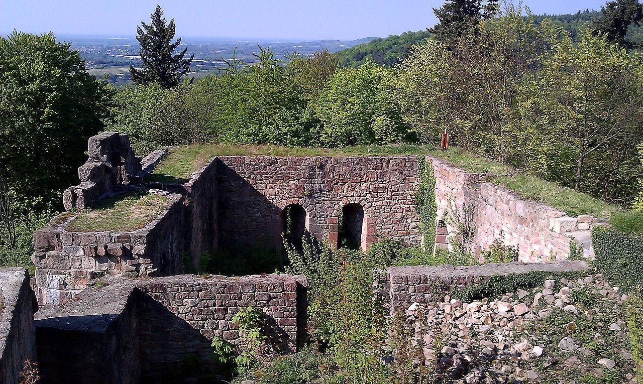
(Gfis Photo)The Kirnburg, also called Kürnburg or Kürnberg, is the ruin of a spur castle on a mountain spur of the Kirnberg 382.5 m above sea level, east of the Bleichheim district of the city of Herbolzheim in the Emmendingen district in Baden-Württemberg.Around 1200 Rudolf I. von Üsenberg probably built the first oldest area of the Kirnburg. In 1219 the castle was mentioned as “castro nostro Kvrinberc”. In the 13th century the Lords of Üsenberg expanded the outer bailey. In 1352 the castle and the associated rule went to Heinrich IV von Hachberg, who temporarily resided at the castle. Later, the castle and the rule of Kirnberg were pledged to regional noble families, such as the influential Freiburg noble family the Schnewlin-Landeck, the knights Martin Malterer and Konrad von Weinsberg and, from 1424, the bishops of Strasbourg, who expanded the castle one last time and according to the time fortified.
In 1372 the rule of Kürnberg fell to the Dukes Albrecht and Leopold of Austria when the Landgraviate of Breisgau was taken over. It remained with the Habsburgs and was awarded as a fief until the end of Upper Austria. In 1515, a few years before the outbreak of the Peasant War, Wolf von Hürnheim zum Tuttenstein acquired the Kirnburg as a fief. After the castle was in poor condition at the beginning of the Thirty Years War, it was quickly captured and razed by the troops of Duke Bernhard von Weimar, who passed through. From 1682 to 1967 the castle ruins were fiefdoms of the Counts of Kageneck and then came into the possession of the state of Baden-Württemberg. In 1938 the ruin was uncovered and since 1978 security and restoration measures have been carried out to preserve it as a historical monument.
The castle has ab area of 60 by 80 meters, the castle complex had a core castle with farm buildings, a palace on the north side and a 2.3-meter-thick shield wall as well as an outer bailey in the west and a ditch in the south. The keep had a footprint of around 10 by 10 meters and a wall thickness of one meter. Valuable stove tiles from the Strasbourg period (from 1424) have been preserved. (Alfons Zettler, Thomas Zotz: Die Burgen im mittelalterlichen Breisgau. Halbband 1. A – K. Nördlicher Teil. (Archäologie und Geschichte. Freiburger Forschungen zum ersten Jahrtausend in Südwestdeutschland, Band 14). Jan Thorbecke Verlag, Ostfildern 2003)
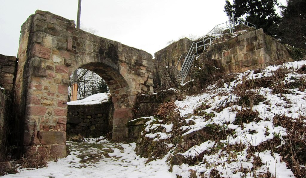
(Lutz H Photo)
Kirnburg, remains of the gate and keep.

(Jettcom Photo)
The Hochburg (“high castle”) is a castle ruin situated between the city of Emmendingen and the village of Sexau in the region of Baden, located in the southwest of Germany. It was presumably built in the 11th century and was originally known as castle Hachberg. The line of nobles known as the Margraves of Baden-Hachberg most likely derive their name from this castle and before it was razed by the French it was the second largest fortification in Baden.
Historians are uncertain about where the name Hachberg comes from. One theory is that an estate in the region was given to a man referred to as Hacho who was a part of Charlemagnes retinue. This hypothesis is also supported by an engraved plaque added to the castle by Karl II and a document dating back to 1161 mentions it as Castro Hahberc. In any case, whoever the true builder of the castle is most likely chose its name for their lineage, resulting in the family sidebranch of the house of Baden known as Baden-Hachberg. Dietrich von Emmendingen (who later called himself von Hachberg) most likely founded the castle to harvest the forests surrounding it for lumber. Its first mention dates back to a document from 1127. The further development of later property documents suggests that Erkenbold von Hachberg, the last of his name, gave his holdings to the Zähringer to finance his participation in the crusades (1147–1149).
A document on the talks about the founding of the monastery Tennenbach from 1161 implies that Herman IV von Baden was the reigning lord of castle Hachberg at the time. When his sons Herman V and Heinrich I divided the margraviate among each other in 1212 the castle became the centre of power for the Margraves of Baden-Hachberg. The Margraves of Baden-Hachberg 1212-1415: Margrave Bernhard I of the main family of Baden acquired the castle from the highly indebted Margrave Otto II von Baden-Hachberg.
The Margraves of Baden 1415-1535. The castle survived the war of the Oberrheinischer Städtebund versus Bernhard I in 1424 and even withstood siege during the German Peasant’s War in 1525. The Margraves of Baden-Durlach 1535-1771: Karl II greatly enhanced the castle’s defences in 1553 and turned it into a more modern, renaissance style fortification. Margrave Georg Friedrich added 7 bastions around the castle’s perimeter and gave some the names of Hachbergs sister castles in Baden all of which laid in the realm of Margraves of Baden-Durlach. (Bastion Rötteln; Bastion Sausenberg; and Bastion Badenweiler).
The castle was besieged for two years during the Thirty Years’ War in 1634 and was slighted for the first time after surrendering to the attackers. However, in 1660 Margrave Friedrich VI induced the reconstruction of the castle. In 1681 the defences were destroyed voluntarily by the French after they had taken many of the holdings in Baden through the Treaty of the Peace of Nijmegen and a manned castle Hachberg could have posed a sizable threat to their new territory. Only three years later peasants caused a fire which destroyed the remaining living quarters. In 1688 French troops destroyed what little remained of the fortification, turning it into a ruin.
The first steps at preserving the ruin were taken towards the end of the 19th century and continue to this day. In 1991 a small museum was added in the cellar. The castle has been depicted in several paintings and has many mythical tales surrounding it, speaking of hidden treasure and restless knights, waiting to return. (Rolf Brinkmann: Die Hochburg bei Emmendingen, Deutscher Kunstverlag München Berlin 2007)
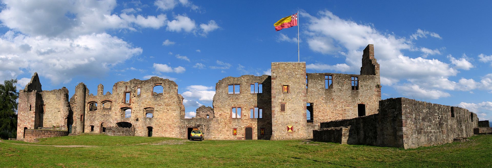
(CrazyD Photo)
Hochburg interior view.
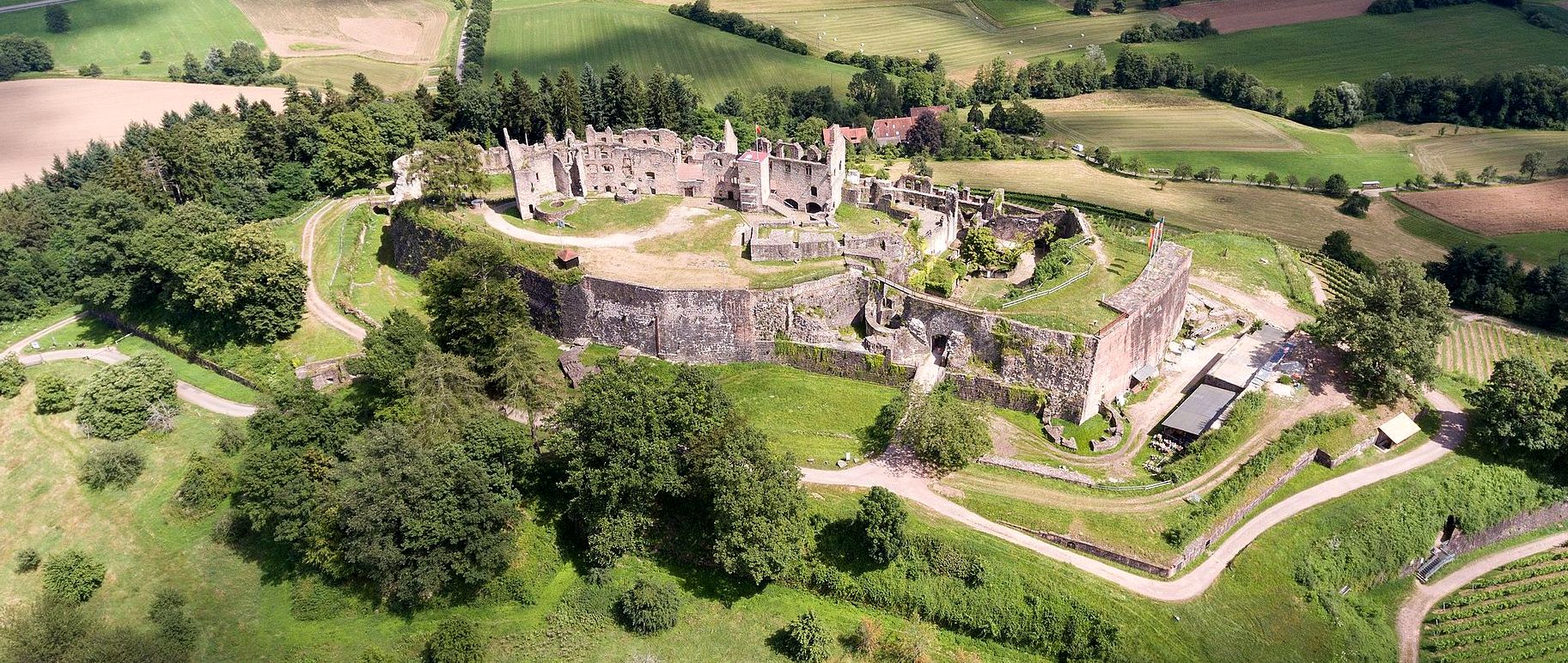
(Volatus Photo)
Hochberg, aerial view.
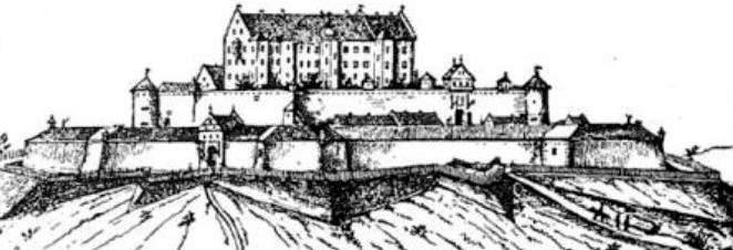
The Hochburg in 1609.
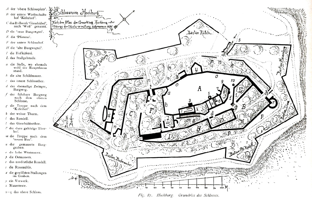
Hochburg ground plan, 1904.
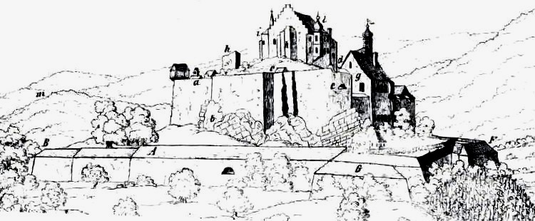
The Hochburg in 1670.
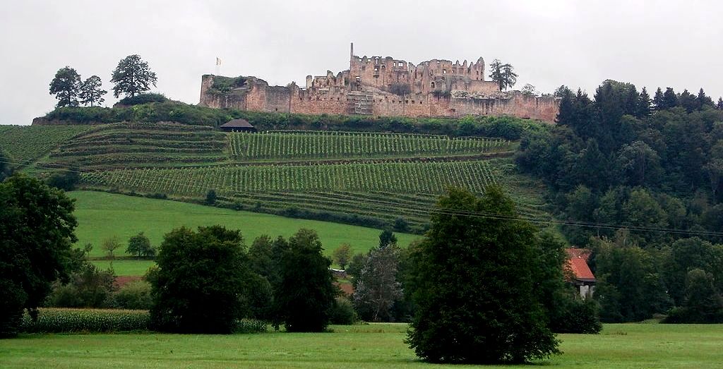
(CyCo-23 Photo)
Hochburg Castle. In 1525, an unsuccessful attempt by insurgent farmers to storm the castle. Between 1553 – 1577, there was a fundamental structural redesign of the castle . At the beginning of the 17th century it was expanded to a state fortress under Margrave Georg Friedrich, with the construction of seven bastions around the castle. Between 1634 – 1636, the castle was under siege by troops of the Catholic League in the Thirty Years’ War. The defenders surrendered after the two year siege. Some demolition was carried out on parts of the fortress, but between 1660 – 1678 reconstruction and modernization of the fortress was carried out. In 1679, The Peace of Nymwegen ended the Dutch War, resulting in the award of Breisach and Freiburg to the French. In 1681, voluntary destruction of the external works was carried out to counteract a preventive strike by the French. In 1684, a fire destroyed the upper castle.
In 1688, the castle was occupied by the troops of the French King Louis XIV and the remaining inner fortifications were demolished. In 1698, a plan for reconstruction was rejected because of the high costs and the proven ineffectiveness of the fortress without the appropriate support from field armies. The destroyed buildings largely fell into disrepair. Some repairs were carried out in the later years, but the remains were never restored beyond the current state of preservation.
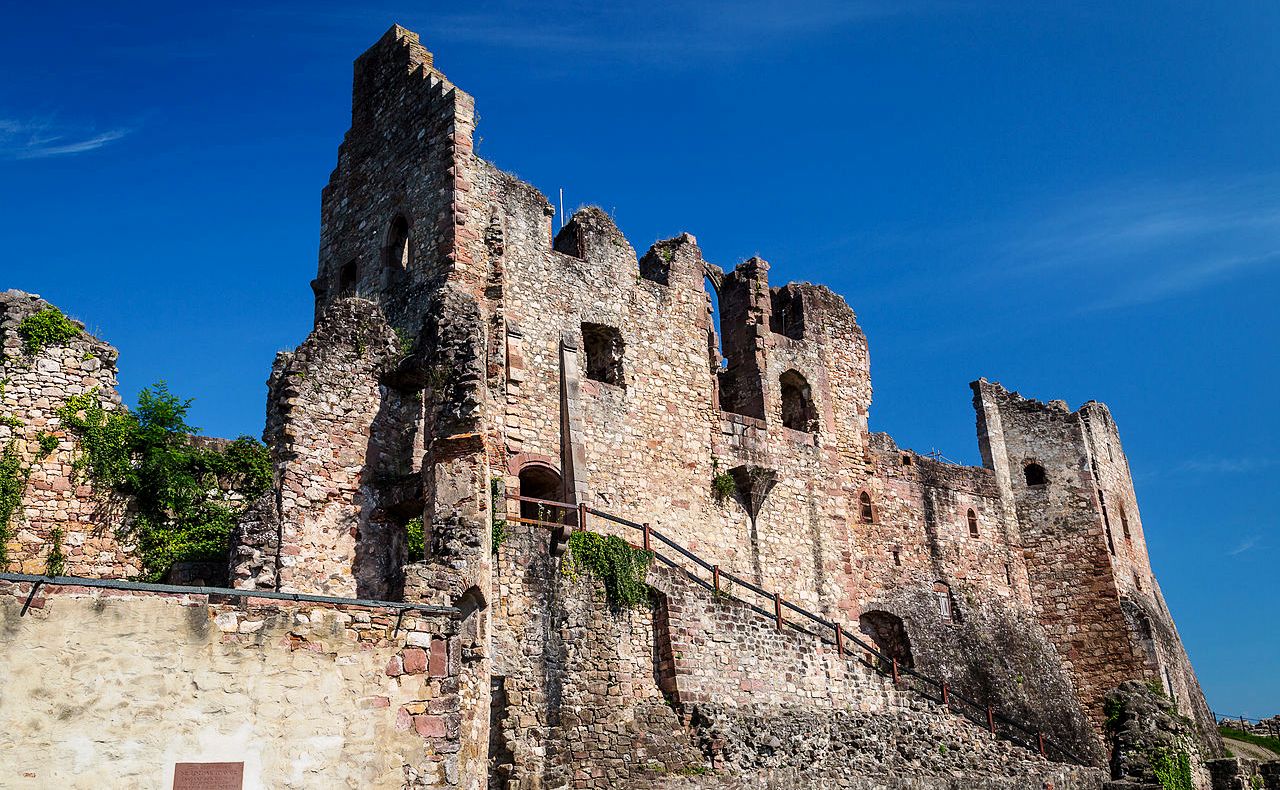
(Carsten Frenzl Photo)
Hochburg Castle.
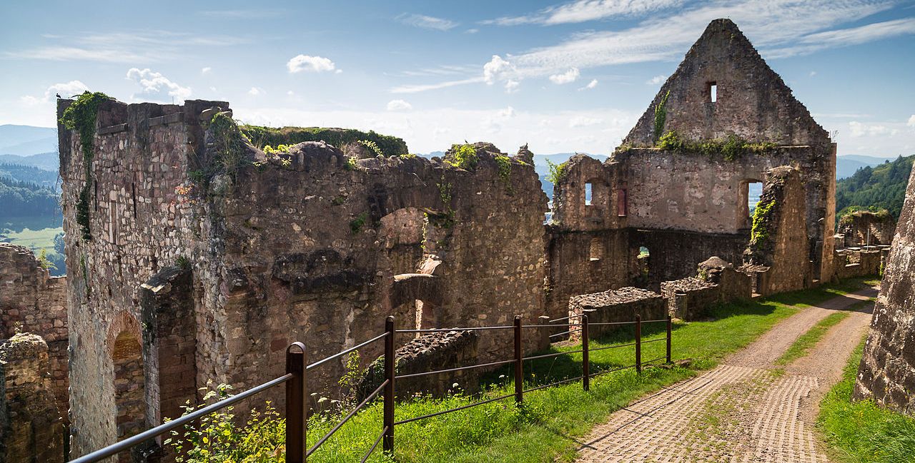
(Carsten Frenzl Photo)
Hochburg Castle.
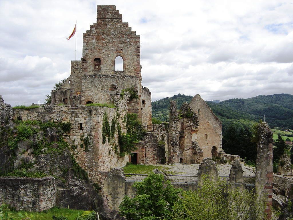
(Michael Schmalenstroer Photo)
Hochburg Castle.
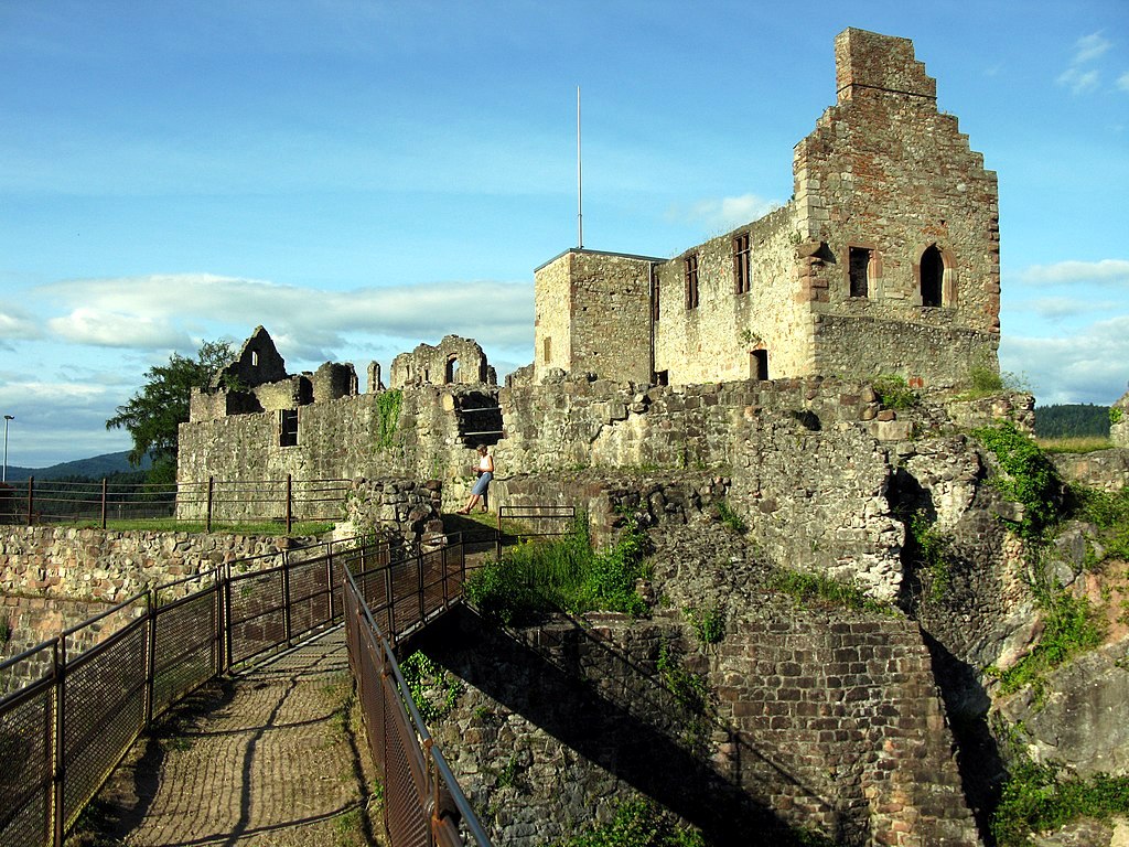
(Andreas Schwartzkopf Photo)
Hochburg Castle.
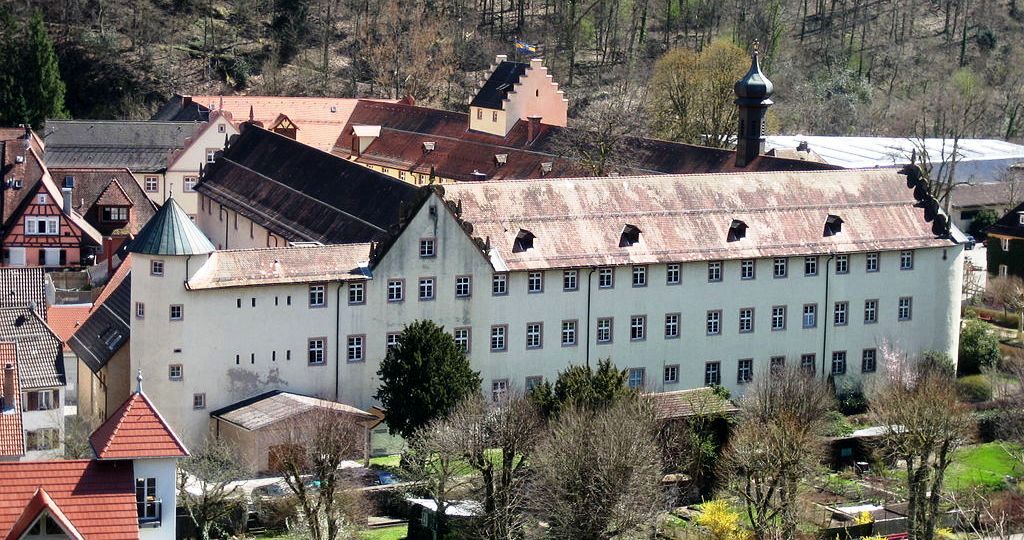
(Marion Schneider & Christoph Aistleitner Photo)
Schloss Wolfach, also called Fürstenberg Castle, is a Fürstenberg Castle in the town of Wolfach in the Black Forest in Ortenau. The Fürstenbergers had already acquired Wolfach Castle through marriage. The new castle was based on a smaller previous building from the time of Count Heinrich VI. von Fürstenberg (d 1490) built in the city centre. At this time, Mr. zu Wolfach was Count Wolfgang von Fürstenberg. During the Thirty Years War it suffered damage from billeting. In 1664 Hermann Egon from the Fürstenberg-Heiligenberg line and his spiritual brothers Franz Egon (Bishop of Strasbourg) and Wilhelm Egon (Cardinal) were elevated to the rank of prince by Emperor Leopold. In 1671 Maximilian Franz von Fürstenberg had the castle in Wolfach extended and expanded significantly by the stonemason Hans Georg Brachet from Radolfzell and the carpenter Hans Jakob Glöckler, a descendant of Hans Ulrich Glöckler from Waldshut. However, the planned large ballroom was never completed.
In 1806 the district office was housed in the castle. Today the tax office, the district court Wolfach and the forest administration as well as a police station are located here . In 1947 a fire destroyed the entire north wing and with it numerous art treasures, such as the carved ceiling of the jury room. The north wing was then rebuilt in a modern way. Today the Wolfach City Museum is housed in the castle. The Wolfach Castle Chapel has also been preserved. (ans Harter: Adel und Burgen im oberen Kinziggebiet. Studien zur Besiedelung und hochmittelalterlichen Herrschaftsbildung im mittleren Schwarzwald. Freiburg 1992)
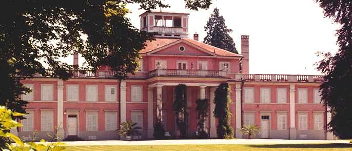
(Max Hohenzollern Photo)
Schloss Umkirch. Umkirch Castle, also called Hohenzollern Castle or Royal Romanian Castle, is a castle of the Swabian Hohenzollern in Umkirch in the district of Breisgau-Hochschwarzwald in Baden-Württemberg. In the 14th century, the moated castle of the Lords stood on the site of today’s castle. Among the various noble families who had their seat in Umkirch in the Middle Ages, the lords of Tübingen are believed to have lived in the castle in 1474. Members of the Roggenbach and Beroldingen families succeeded in increasing their property before it was transferred to the Kageneck Majorat in 1740. After the old castle was demolished in 1743, the middle section was rebuilt. The two side wings followed between 1788 and 1789.
In 1785 the property was converted into an allod for Flora von Kageneck (1779–1857). She was the daughter of Friedrich von Kageneck and Maria Theresia von Salm-Reifferscheidt and the cousin of the Austrian statesman Metternich. Flora von Kageneck married Count Eugen von Wrbna on June 20, 1798. In 1816/17 the castle was expanded in the Italian country house style and the belvedere was added. The coat of arms of the Kageneck-Wrbna can still be found in the gable.
In 1827 the palace was acquired by Grand Duchess Stéphanie von Baden for 345,000 guilders. The building served as a summer residence in July and August. In the inheritance contract of 29 June 1860, the Grand Duchess decreed that her daughter Princess Josephine von Baden should receive the castle property. The princess was the wife of Karl Anton von Hohenzollern. On 3 May 1887, Josephine made Umkirch an ancestral property, that is, an inalienable property. The property came on 19 June 1900 to her son Karl, who was the Romanian king. The king died in 1914. At the end of 1916, the castle went to Prince Friedrich Victor von Hohenzollern-Sigmaringen,
who used it as a summer residence. The onset of the First World War had delayed inheritance. In addition to Friedrich Wilhelm von Hohenzollern (1924–2010), the two princes Ferfried von Hohenzollern and Leopold von Bayern were born in the palace in 1943.
During the Second World War, from September 1944 to April 1945, the princely family was forced to be evacuated and interned at Wilflingen Castle. After the war, the south of Baden became part of the French occupation zone and General Pierre Pène resided in the castle as governor for the state of Baden on behalf of the French occupying forces from 1946 to 1952, so that Friedrich Wilhelm partly lived in his sister’s country house next door. After Friedrich Victor’s death in 1965, his son Friedrich Wilhelm received the castle property, which is still owned by the Swabian Hohenzollern. The owner has been Karl Friedrich von Hohenzollern since 2010. (Historie des Schlossgutes Umkirch, queen-auguste-victoria-park.de, abgerufen am 15. Mai 2013)
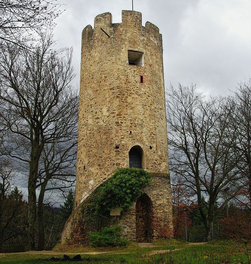
(Joergens Photo)
Zähringer Burg. The ruins of Zähringen castle is what remains of the ancestral seat of the Zähringer Alemannic noble family, located near Freiburg im Breisgau. The Zähringer family became a powerful ducal dynasty in the area of what is now Southern Germany and Switzerland in the high-medieval period. They founded several cities, including Freiburg im Breisgau, Villingen, Neuenburg, Freiburg im Üechtland, Bern, Thun, Rheinfelden and Murten. The name Zähringen is mentioned for the first time in records dating back to the early 11th century. However, it is not clear without ambiguity whether they refer already to a fortification on the hilltop or to the village, the present day suburb of Freiburg. The first unambiguous mention of the castle is in the “Rotulus Sanpetrinus“, a parchment roll issued in the nearby Abbey of St. Peter,
dated to 1128. The document was written in Latin and contains the passage “apud castrum Zaringen” (castrum is the Latin word for castle).
The castle was the seat of Berthold II of Zähringen until 1091, when he moved out of this castle to Freiburg Castle on the Schlossberg of Freiburg. He had ordered the construction of that new castle, because he considered that location to be more advantageous both from commercial and strategical perspectives. The castle was besieged and taken in the context of the feud between Welf VI and Conrad III by the young Frederick Barbarossa in 1146. After the House of Zähringen died out in 1218, Emperor Frederick II confiscated Zähringen castle as imperial fief.
Between 1275 and 1281, in the wake of controversies between the emperor and the Counts of Urach regarding territorial possessions, the castle was destroyed and rebuilt. In 1422 the Margrave of Baden acquired a part of the compound. The castle was destroyed during the German Peasant’s War in 1525. In 1815 the castle hill became the property of the House of Baden and today the area belongs to the municipality of Gundelfingen. What remains intact is a large round tower that was built in the 13th century. It has an observation deck that is surrounded by merlons. On the castle hill there is also a restaurant which provides diners with a view of the valley. The area is accessible by car only from Zähringen following the Pochgasse.
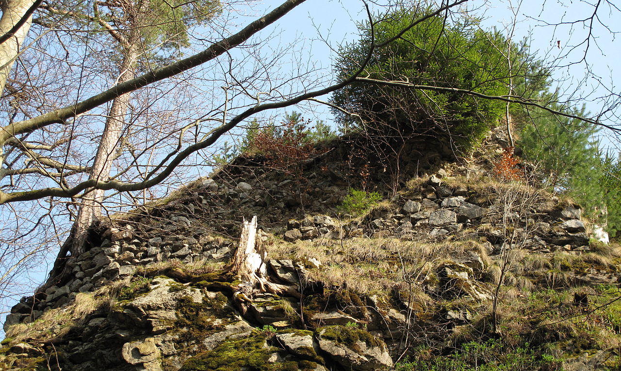
(Joachim Haller Photo)
Burg Falkenstein, Falkenstein Castle, is a ruined hill castle near Freiburg im Breisgau on the territory of the present-day municipality of Breitnau in the county of Breisgau-Hochschwarzwald in the German state of Baden-Württemberg. The castle site lies in a triangle formed by the entrance of the Höllental valley – the Lower Höllental and the Engenbach valley, not far from the Buchenbach village of Falkensteig, 617.6 m above sea level on a rocky crag that is very difficult to get to today. Of the castle itself only a few wall remains are left. It is one of the less well preserved ruins in the Breisgau.
The castle may have been built around 1200 on a steep eminence at the lower entrance to the Höllental, also known as the Falkensteige, by a Zähringen ministerialis family. (The aristocratic surname “von Falkenstein” could however also indicate an earlier construction date of around 1150, but no records confirm this). Its founders probably came from the Wittental valley from the lords of Weiler and Blankenberg and are first recorded from 1137 to 1148 as the lords of Falkenstein. In the ensuing period they rose to become one of the circle of important aristocratic families in the Breisgau. The valley was named Falkensteiner Tal after them and their castle, and only changed to Höllental later on. The castle was supposed to guard the important communication route through the valley which linked the Breisgau the Baar region and Lake Constance. The lords of the castle soon reigned over an area that extended up the valley to Hinterzarten and Titisee. Other castles built by the Falkensteins were Falkenbühl Castle, Bickenreute near Kirchzarten and Bubenstein Castle, also called Neufalkenstein (“New Falkenstein”).
After the toll road, which had brought the Falkensteins substantial revenue, met with competition from the route through the Wagensteig valley built in 1310-1379, according to legend, the knights are said to have operated more and more as robber barons. In a conflict between an aristocratic coalition under the leadership of Count Eberhard II of Württemberg against the Swabian League, Werner von Falkenstein, on the orders of his overlord, blocked roads and plundered the League’s citizens.
Affected by the economic decline of the low nobility in the late 14th century, it was probably financial pressure that drove the Falkensteins to extend this approach to innocent travellers. This behaviour was the reason that, on 6 December 1388, Freiburg attacked and destroyed Falkenstein Castle. Other historians blame its destruction, however, on Freiburg’s hunger for power. The castle chapel apparently survived the demise of the castle. In 1460, it is first mentioned as St. Nicholas’ Chapel. In 1606 it was moved into the valley by the Höllenbach stream, today known as the Rotbach.
The irregular and very inaccessible castle site rises through four levels. It is described here in four sections. First, is the lower ward (Unterburg, A) whose fragmented wall remains are up to six metres high and three metres thick, and run from the southwest side of the castle rock up to, and along, its northern flank. Here, there are more, very substantial, staggered sections of wall and what is assumed to be the old entrance area and castle gate (5) above the Engenbach valley and present day entrance at its western tip. Second, there is an adjoining neck ditch, about 20 metres long, 4 to 6 metres wide and up to 12 metres deep (D), cutting through the ridge to the northeast. Third, is a small middle ward (Mittelburg, B) on a roughly six-metre-high rock step rising above the lower ward – which lies to its west and north – on the upper part of the castle rock, and extending northeast to a point above the neck ditch.
Fourth, is the upper ward (Oberburg) or inner ward (Kernburg) (C) on the ascending, elongated rocky ridge that is up to 55 metres long, between 12 and 16 metres wide and runs from southwest to northeast. Among other large sections of surviving wall at the south and southwestern tip are: a wall about ten metres long and three metres high facing the valley which is believed to belong to the castle kitchen (10); another wall, six metres wide and about 2.5 metres high (11), which could be the site of the chapel; a further prominent, tooth-like wall in the centre on the southeastern cliff edge – easily visible from the Höllental valley when approaching from Hirschsprung – and finally the remains of a quadrangle with walls measuring about nine by nine metres – probably the former bergfried – on a lofty site at the northeastern end of the castle rock. (Alfons Zettler, Thomas Zotz: Die Burgen im mittelalterlichen Breisgau. Halbband 1. A – K. Nördlicher Teil. Ostfildern. In. Archäologie und Geschichte. Freiburger Forschungen zum ersten Jahrtausend in Südwestdeutschland, Heft 14. Jan Thorbecke Verlag, Sigmaringen, 2003)
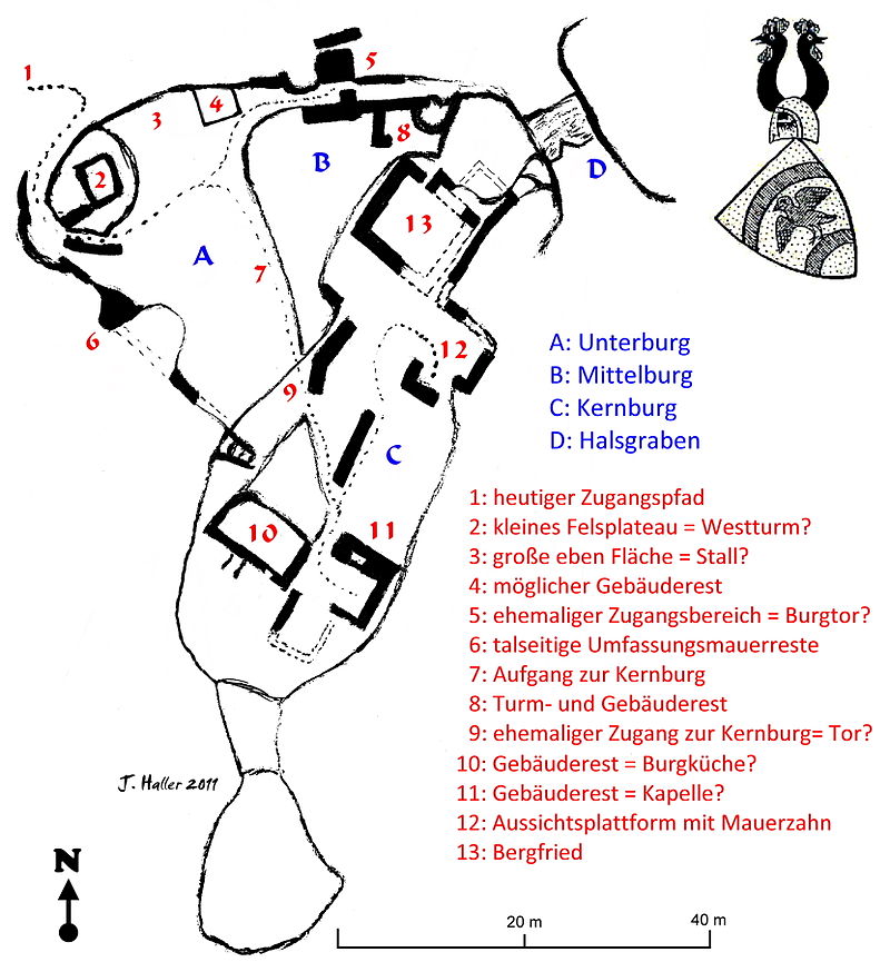
Burg Falkenstein, plan view. Key: A: Lower Ward; B: Middle Ward; C: Inner Ward; D: Neck Ditch; 1: present access path; 2: small rock plateau = West Tower? 3: large flat area = Stables? 4: possible building remains; 5: former entrance area = Castle Gate? 6: valley-facing remains of the enceinte; 7: ascent to the Inner Ward; 8: Tower and building remains; 9: former entrance to the Inner Ward = Gate? 10: building remains = Kitchen? 11: building remains = Chapel? 12: viewing platform and projecting wall section; 13: Bergfried.
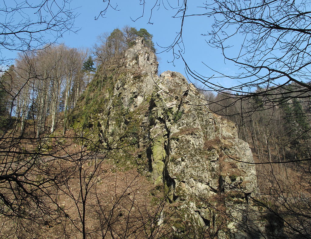
(Joachim Haller Photo)
Burg Falkenstein.
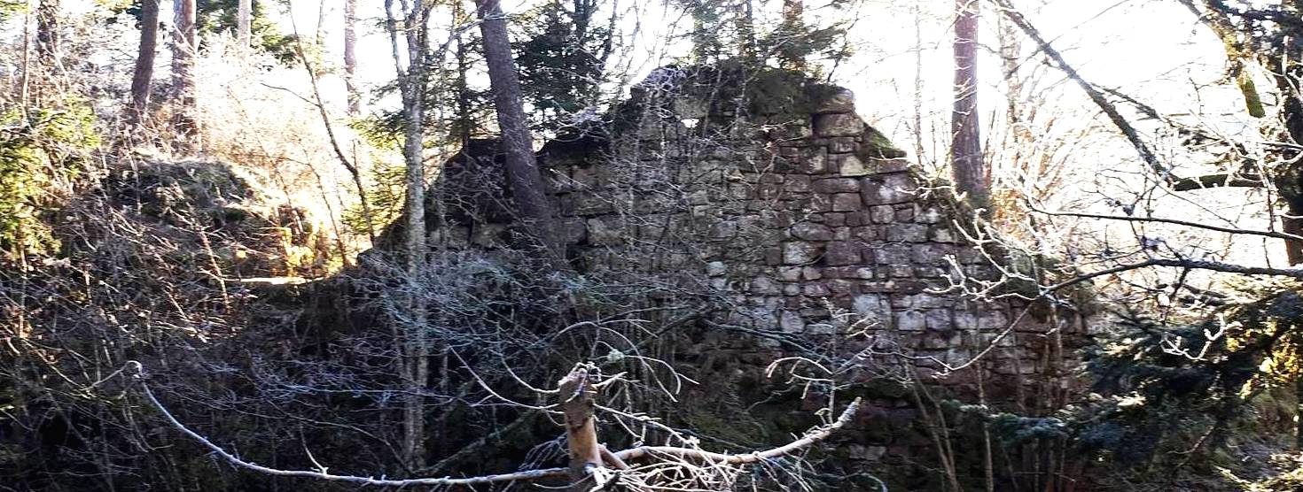
(Komoot Photo)
Ruin Ramstein, Schramberg. The Ramstein ruin is a hilltop castle on a wooded ridge at 688 meters above sea level in the valley of the upper Schiltach and was built before 1137. It was the eponymous political center of the Lords of Ramstein, which emerged from the Lords of Oberschach. This line died out around 1280, after which their rule passed to the lords of Falkenstein-Ramstein.
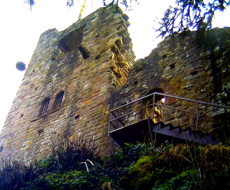
(Afr66 Photo)
Burg Falkenstein. The Falkenstein castle ruins are one of the oldest castles in the Schramberg district. It was built around 1150 and completely renovated around 1900. The fortress is divided into upper and lower Falkenstein. A local noble family from the village of Kappel near today’s Villingen-Schwenningen probably built the castle here in the 11th century. It was first mentioned in 1030 when Duke Ernst of Swabia, who was considered a rebel and enemy of the Reich, took refuge in a certain castle called Falchenstein. He and his comrade in arms and friend Werner von Kyburg died on August 17, 1030 in a battle near the castle.
In 1250 the Lords of Falkenstein bought the neighboring Ramstein Castle. At the beginning of the 14th century, the Falkenstein family split into the lines Falkenstein on Falkenstein and Falkenstein on Ramstein. The Lords of Falkenstein had a strong influence in the Middle Ages as abbots, canons and canons in Strasbourg and in the monasteries of St. Georgen, Reichenau, St. Gallen and Einsiedeln. Messrs. Jakob and Konrad von Falkenstein sold the castle and most of the possessions to Count Ludwig von Württemberg between 1444 and 1449. In the middle of the 15th century, Hans von Rechberg acquired the Falkenstein and Ramstein castles, had the Hohenschramberg castle built and with this founded the Schramberg rule. Falkenstein Castle was destroyed in 1491. In the 19th century the castle was bought and renovated by Commerce Councilor Arthur Junghans. Today the castle ruins are looked after by the Falkenstein Citizens’ Association.
The castle consists of three parts, the outer bailey, a residential tower and the core bailey. With the outer bailey, of which the wall remains, the castle was protected from the valley side. Between the outer bailey and the inner bailey there is a ditch through which an old staircase leads to the outer bailey. In the main castle, the remains of the palace can be easily seen.(Bernhard Rüth, Dorothee Ade, Cajetan Schaub (Hrsg.): Adelssitze zwischen Schwarzwald und Schwäbischer Alb. Kommissionsverlag
Belser, Stuttgart 2014)
Burg Kastenbuck, Herbolzheim. Kastenbuck Castle is a lost hilltop castle at 240 m above sea level, in the lower area of the northeast slope of the Kirnberg in the “Kastenbuck” corridor not far from the Mattenmühle and the Kirnhalterhof in the Bleichheim district of the city of Herbolzheim in the Emmendingen district in Baden-Württemberg. The Hangburg was possibly the ancestral home of the Meier von Kastenhofen family. It was built in the 12th century, mentioned in 1203 and named again in 1405 as “Castilhovin”. In the 19th century, the remains of a tower-like building were still visible, as a drawing by Franz Joseph Lederle from 1879 shows. The castle was verified by measurements in 1999 on a castle area of 60 by 40 meters with a tower hill on the southern corner. It is unlikely that it was a predecessor to the Kirnburg. The tower hill, moats and the contours of a 10 by 20 meter building have been preserved from the former castle complex. According to a new theory, Kastenbuck Castle could have been a fortified granary. (Alfons Zettler, Thomas Zotz: Die Burgen im mittelalterlichen Breisgau, 1: Nördlicher Teil, Halbband 1: A–K (= Archäologie und Geschichte. Freiburger Forschungen zum ersten Jahrtausend in Südwestdeutschland. Bd. 15).
Thorbecke, Ostfildern 2003)
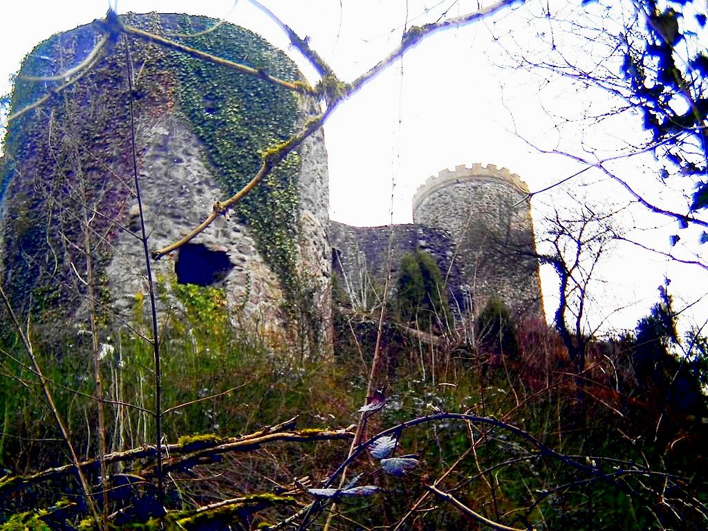
(Afr66 Photo)
Burg Hausach, aka Husen Castle, now a ruin, recorded for the first time in 1246 as castrum Husen, according to a Gregorian record before 1584. This castle ruin is located 25 km east of Lahr. It is located in the valley of the Kinzig in the Black Forest, sited above the town of Hausach. The original hill castle was probably built here by the Dukes of Zähringen in the 12th century. It later went into the possession of the Counts of Freiburg. In 1303, the castle went to the Counts of Fürstenberg as a result of the marriage of Verena of Freiburg. Count Henry IV of Fürstenberg had the castle extensively remodelled and expanded from 1453 to 1477. A neck ditch and an outer ward guarded the heart of the castle with its palas and bergfried. The castle was the residence of the prince’s castellans (Burgvögte).
In 1632 it burned down and was rebuilt. In 1643 French-Weimar troops under Jean Baptiste Budes de Guébriant destroyed the castle. Later the ruins were incorporated into fortified earthworks or schanzen in order to defend the valley against enemy troops. In 1896 the bergfried was given battlements instead of the tower’s conical roof. In 1968 the town of Hausach purchased the ruins from the House of Fürstenberg. Today, parts of the palas wall, the so-called battery tower and the bergfried survive. (Kurt Klein: Burgen, Schlösser und Ruinen – Zeugen der Vergangenheit im Ortenaukreis. Reiff Black Forestverlag, Offenburg, 1997)
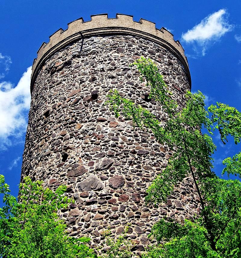
(Demonwhip Photo)
Burg Hausach bergfried.
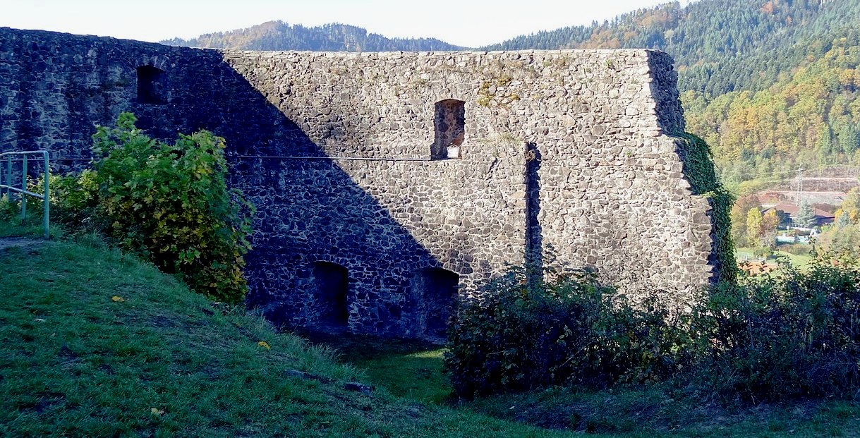
(Peter Poschadel Photo)
Burg Hausach.
(Author Photos)
Burg ruin Husen. Husen Castle is a ruined hill castle of the high medieval period in the valley of the Kinzig in the Black Forest. It is sited above the town of Hausach in the county of Ortenaukreis in the German state of Baden-Württemberg.
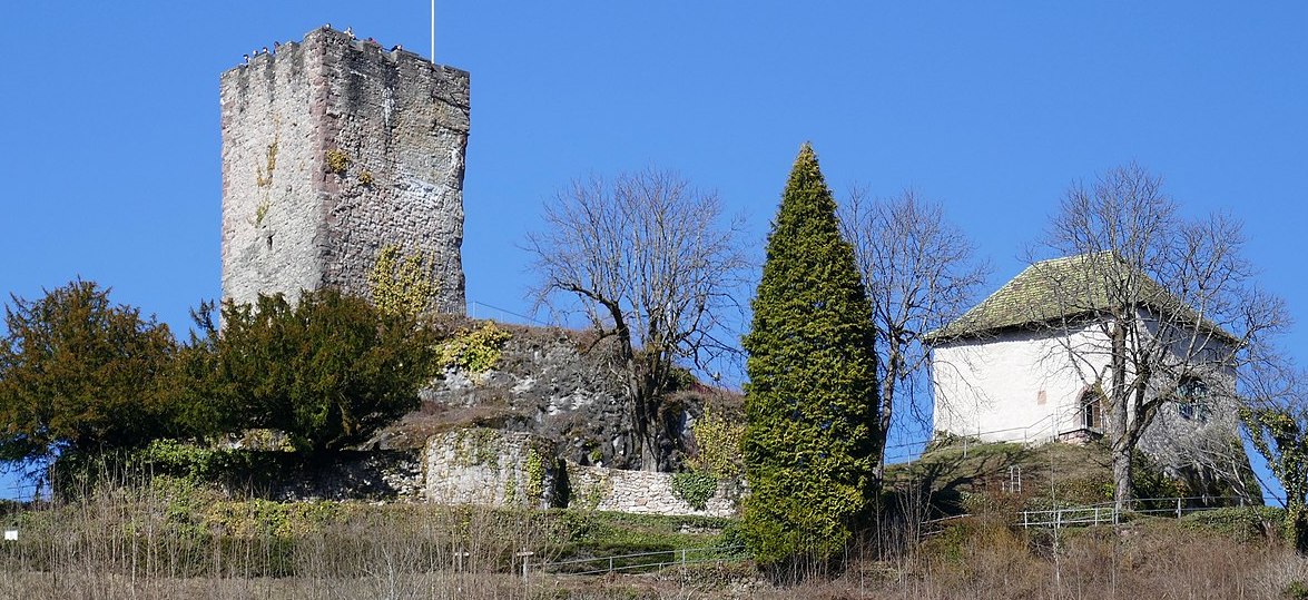
(1971markus Photo)
Burg Hornberg, aka Schloss Hornberg, Ortenau. The original foundation of this castle was built in the 1300s. The present fortifications date from 1735. The term Schloss Hornberg (also Schloss Neu-Hornberg) describes the castle and palace buildings that have been built on the castle hill of the city of Hornberg since around 1200, of which only the keep and the powder tower and the remains of the wall are left today. The castle is located in the Ortenau district in Baden-Württemberg.
The ruin is about 100 meters above the old town of Hornberg at a height of 455 meters on a flat mountain ledge between Gutachtal and Offenbachtal. The area extends about 150 meters from the southeast to the northwest. The castle was protected on three sides by steep cliffs and offered a good view and thus control over the valleys of Gutach, Reichenbach / Schwanenbach and Offenbach. The main service yard of the Barons von Hornberg was built at the foot of the castle hill. On the castle rock, granite blocks from the oldest building of the castle were found, which were joined together without binding agents, from which a construction period in the first half of the 12th century is derived. It is also assumed that a tower (bergfried) was built before the division into the dominions Hornberg and Triberg, which served to control the increasingly important trade route in Gutach Valley. The first building of Hornberg Castle was built around 100 years after Althornberg Castle – around 1200 – by the Lords of Hornberg.
The remains of the first castle were removed towards the end of the 19th century, so that no more details are possible. Also to control the trade routes, the Lords of Hornberg had built a habitable tower (escort tower) at the confluence of the Tiefenbachtal and Schwanenbachtal, which at the same time also covered the access to Althornberg Castle and was thus a forward defense structure. Apart from the remains of a wall, there are no more traces of Tiefenbach Castle. A second escort tower was built at the northern end of the rule on the Turmerberg, where the trade route could be controlled. Remnants of the wall have also survived from this tower, Gutach Castle. Next to the keep is a newer, larger castle (also known as the “front lock”) that was built onto the keep. There is also a smaller, older castle (also known as the “rear castle”). The two castles were also inhabited by different lineages.In 1423, Bruno Werner von Hornberg sold his share of the castle and rulership to the Counts of Württemberg, who immediately quartered their Vogt, while Bruno Werner was allowed to live at Schiltach Castle until the purchase price was paid. In 1443 the Wuerttemberg residents were able to buy the rest from Konrad von Hornberg and thus take full possession of Hornberg.
Württemberg wanted to improve the water supply as well as the residential and economic area of its administrative headquarters. In 1554 the well room and the water pipes were built. In 1564 a new residential building was built on the northeast side of the keep and the old one demolished on the southeast side. In 1621 the powder tower was built east of the keep. In 1633/34 Konrad Widerholt, before he became the commander of the Hohentwiel fortress,held it despite five sieges of the Hornburg. While the neighboring Althornberg Castle was occupied by the French and Swedes during the Thirty Years’ War and ultimately burned, the Hornburg was not captured.
During the Palatinate War of Succession, French troops under Lieutenant General Noël Bouton de Chamilly burned the castle on 9 January 1689.
A report on the state of the defence lines in the Black Forest from 1710 only mentions the keep and the remains of the wall on the Hornberger Schlossberg, which, combined with a tree fence and earth walls, formed a makeshift part of the defense line. Hornberg became a garrison town of the Swabian district and needed accommodation for troops and officers. In 1736 a commanders’ building was built below the keep, followed by barracks in 1739. These buildings are also known as the baroque palace. The commandant’s building was renovated again before Augusta Elisabetha Maria von Thurn und Taxis moved into quarters. Due to structural damage, part of the barracks was demolished as early as 1800. The rest was used as a tobacco factory from 1802.On 2 October 1810, the Kingdom of Württemberg and the Grand Duchy of Baden signed a border treaty, as a result of which Württemberg areas in the central Black Forest (Hornberg, Schiltach, Gutach) and the former Landgraviate of Nellenburg were ceded to Baden. The part of the old barracks initially used by the tobacco factory was finally demolished in 1823. In 1841 a brewery bought the castle and built the brewery in the garden and the malthouse in the powder tower. In 1896 the brewery was demolished and a hotel was built. In 1936, the NSDAP opened the “Gauschule Schloss Hornberg” (Gauführerschule), which existed until 1939, for basic ideological training and political education for officials from the Reich Association of German Officials. In 1976 the old commanders’ building was also demolished. Today the 17 meter high keep is accessible as a lookout tower. From its platform it offers a good view of Hornberg and the Gutach valley. This castle is located 40 km east of Lahr. (Ansgar Barth: Das Schloß Hornberg. In: Burgen und Schlösser in Mittelbaden/Historischer Verein für Mittelbaden. Hrsg.: Hugo Schneider, Offenburg 1984)
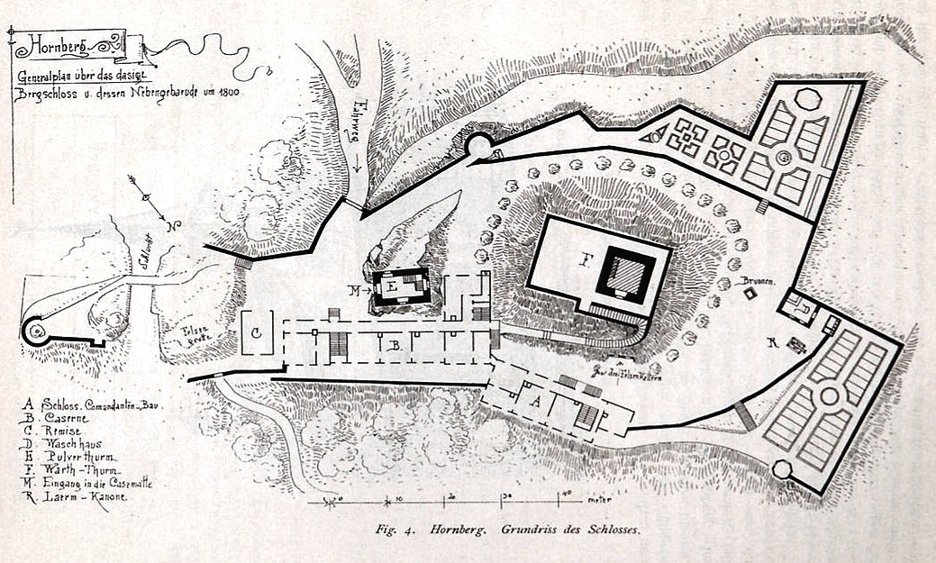
Ground plan of Schloss Hornberg, 1800.
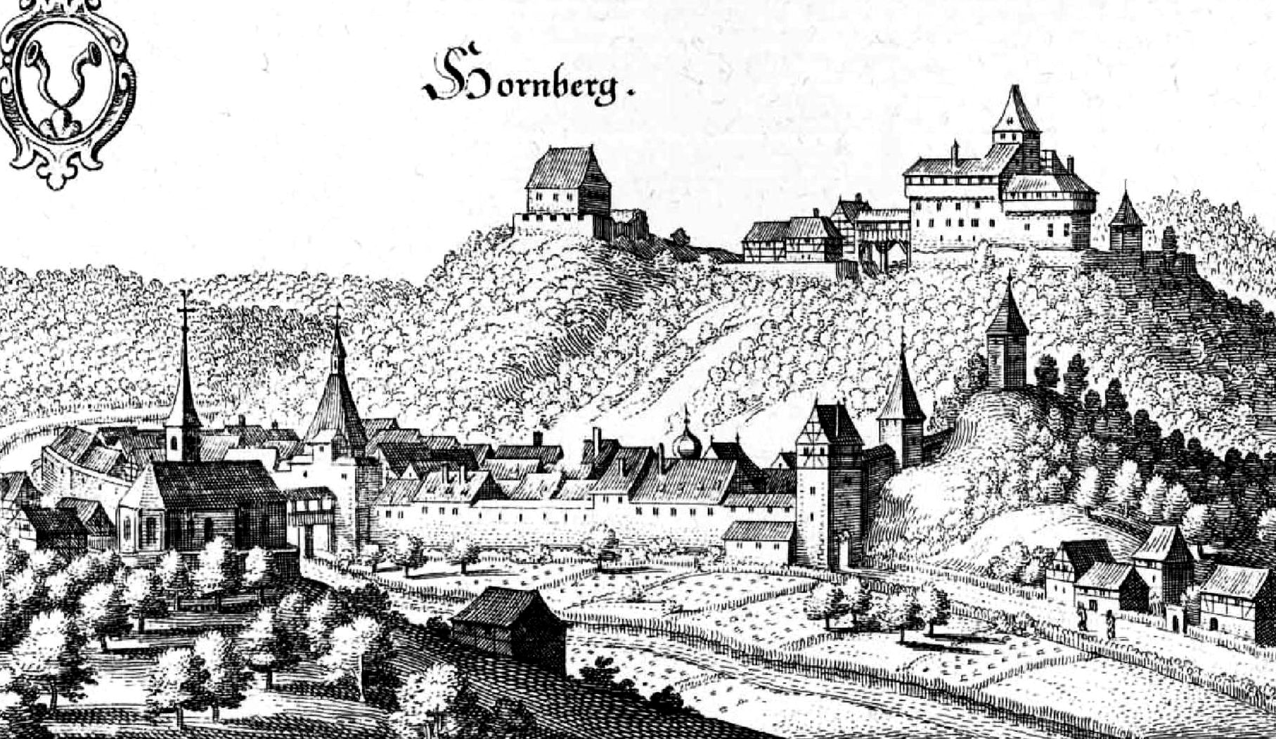
Schloss Hornberg, c1700s.
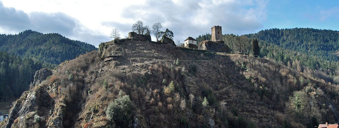
(Gargolla Photo)
Schloss Hornberg, |Ortenaukreis.
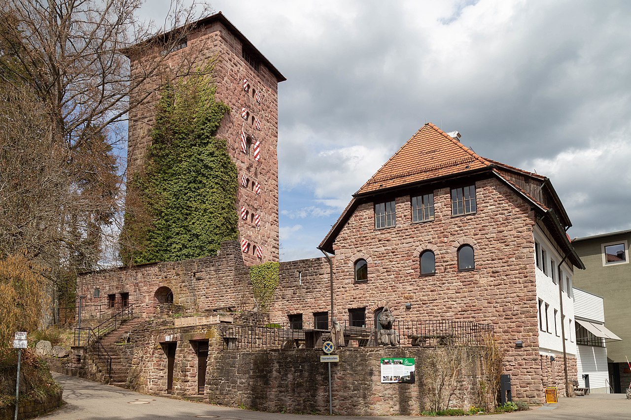
(Stefan Karl Photo)
Burg Hornberg, Altensteig. This is a second castle with the same name. Hornberg Castle is the ruin of a hilltop castle on the road to Berneck Hornberg (Johannes-Brenz-Weg 1), a current district of Altensteig in the Calw district in Baden-Württemberg. The castle was built in the 12th century for the Counts of Calw and mentioned in 1252. The castle was inhabited by their ministerials, the bailiffs of Wöllhausen and relatives of the Lords of Fautsberg. The castle was destroyed in the course of the Thirty Years’ War (1618–48) and rebuilt between 1958 and 1971 with a square keep. It now serves as a forest school home run by the State Forestry Administration.
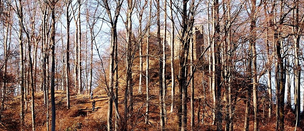
(Taxiarchors228 Photo)
Schneeburg is a castle ruin between Ebringen and Freiburg. The ruins are at an altitude of 516 metres (1693 feet) on the western summit of Schönberg. The castle was first mentioned in 1312 and was built by the Lords of Hornberg. In 1349, Werner von Hornberg handed ownership of the castle over to the Abbey of Saint Gall, and became ruler of Ebringen. The Schneeburg was most likely abandoned before 1500. It has been claimed that the castle was destroyed in 1525 during the German Peasant’ War, but this can not be confirmed. All that remains today are part of a tower and living quarters. The Ruin is about 37 metres (121 ft) long and 17 metres (56 ft) wide. On the north side are the remains of a four-story tower with two windows. The well also remains in good condition in the courtyard. (A. Hauptmann: Burgen einst und jetzt, Band 2, Konstanz, Südkurier, 1987)
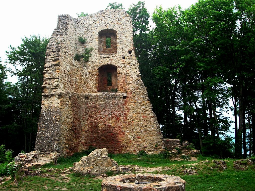
(W-j-s Photo)
Schneeburg.
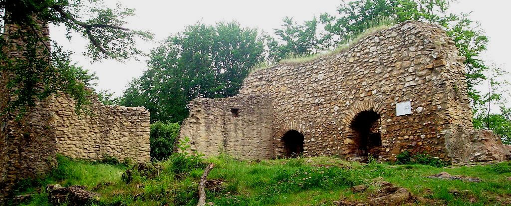
(W-j-s Photo)
Schneeburg.
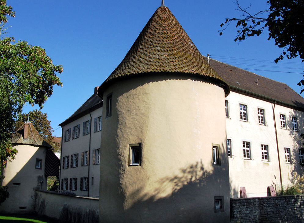
(Andreas Schwarzkopf Photo)
Schloss Kirchhofen, located south of Freiburg in the town of Ehrenkirchen-Kirchhofen. The schloss is an almost square, two-story castle-like complex of the Renaissance with three preserved corner round towers, black and white round tower broken off. It has a dry moat, still recognizable on the western and northern side. The castle is first mentioned in 1422. Around 1500 it was expanded and converted to a castle. It was enlarged after 1572 by Lazarus von Schwendi. During the Thirty Years’ War, On 18 June 1633, it was heavily damaged by Swedish troops. From 1740 to 1741 a new roof and a vaulted cellar were added. In 1847/48 the castle was
converted to a school, and in 1910 it was expanded. A flat extension to the castle was added in 1963/64. (Willig, Wolfgang: Landadel-Schlösser in Baden-Württemberg, Balingen, 2010)
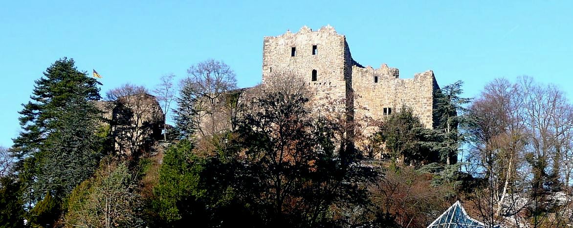
(Dr. Bernd Gross Photo)Baden Castle, also called Badin Castle or Badenweiler Castle, is the ruin of a hilltop castle at 454.6 m above sea level in the middle of the municipality of Badenweiler in the Breisgau-Hochschwarzwald district in Baden-Württemberg. It is considered the landmark of Badenweiler and is not identical to the Neuenfels castle ruins, which are located near Badenweiler. The excavations in the castle and on the castle hill show that the hill was settled before 1122. Finds show that the Romans built a fort to protect Aqua Villa. Later the Alemanni built a hilltop castle to secure their area. This was taken over by the Franks.
From 1122 the castle was owned by the Zähringers to protect their silver mining. The knight Adalbert von Baden, who named himself after the castle, was proclaimed to be the servant of Duke Konrad I von Zähringen in 1148. In 1152 Heinrich and Rudolf von Baden were mentioned. [1] In 1147 the castle came into the possession of the Guelphs as a dowry. The castle came to the Staufers by exchange in 1157, to the Counts of Freiburg as heir in 1268, and to the Counts of Strassberg by marriage in 1303. In the 14th century, external fortifications were built due to constant quarrels with the neighbors. By inheritance, the castle came into the possession of the Fürstenberg dynasty in 1363, then back to the Counts of Freiburg and temporarily also to the Habsburgs. The castle was damaged in 1409 by soldiers from Humbert von Neuenburg, Prince-Bishop of Basel, and then rebuilt. After the Council of Constance it came back to the Counts of Freiburg. Through the donation of the last Count of Freiburg it came to the Margraves of Hachberg-Sausenberg in 1444 and to the Margraviate of Baden in 1503.
Until it was destroyed, the castle was the center of Badenweiler’s rule. After the city of Freiburg surrendered on 16 November 1677 during the Dutch War (Siege of Freiburg (1677)), French units under General Joseph de Montclar moved to Badenweiler on 20 November 1677 and demanded that a French garrison be accommodated in the castle, what Then on November 21st, the Baden-Durlach officials granted it under certain conditions, since the French had threatened the destruction of the whole area. However, the French occupation did not comply with the agreed conditions. On 6 April 1678, the castle was set on fire by the retreating French occupiers under the command of Marshal Crequi and partially blown up. The population returning from their places of refuge after the French withdrew, took building materials from the ruins. [2] After that it was not rebuilt. Until it was blown up, the castle was constantly inhabited by bailiffs of the respective sovereigns.
The Grand Ducal Palace at the foot of the Burgberg was built in 1587 as the office of the Margraves of Baden. Until 1689 it was used as the seat of the upper office with interruptions. In 1727 the official seat was moved to Müllheim. From 1887 to 1888 the palace was rebuilt under Grand Duke Friedrich I of Baden into the Grand Ducal Baden summer residence. Today it is used for art exhibitions. In order to protect the ruin from decay and to open it up for tourism, it was restored; it can be reached via a steep path. This is lined with walls and leads past the round tower. To the northeast, in the hall with the three subdivisions, it can be seen that the castle was multi-story and had several rooms, the shapes of the windows have been preserved. The keep is to be climbed as a viewing platform; it offers an overview of Badenweiler, eastwards of the Black Forest and westwards a wide view of the “heavenly landscape” of René Schickele: the lower lying Müllheim, the Rhine plain and the Vosges. Baden Castle is state owned and is looked after by the State Palaces and Gardens of Baden-Württemberg. (Friedrich-Wilhelm Krahe: Burgen des deutschen Mittelalters – Grundriss-Lexikon. Sonderausgabe, Flechsig Verlag, Würzburg 2000)
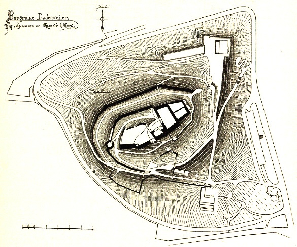
Ground Plan of Burg Badenweiler.
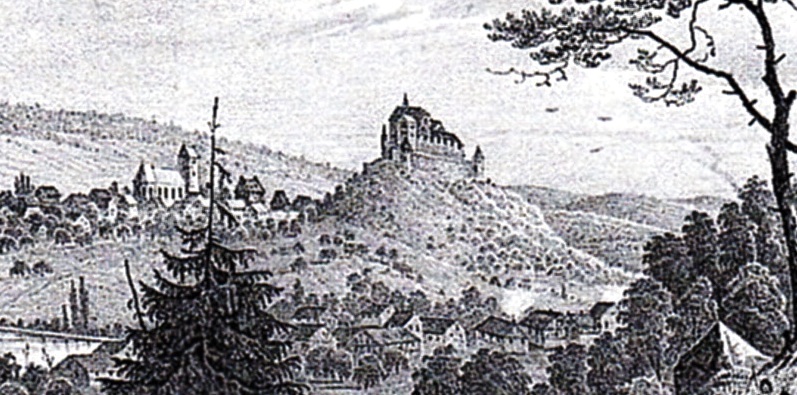
Burg Badenweiler, engraving from 1601.
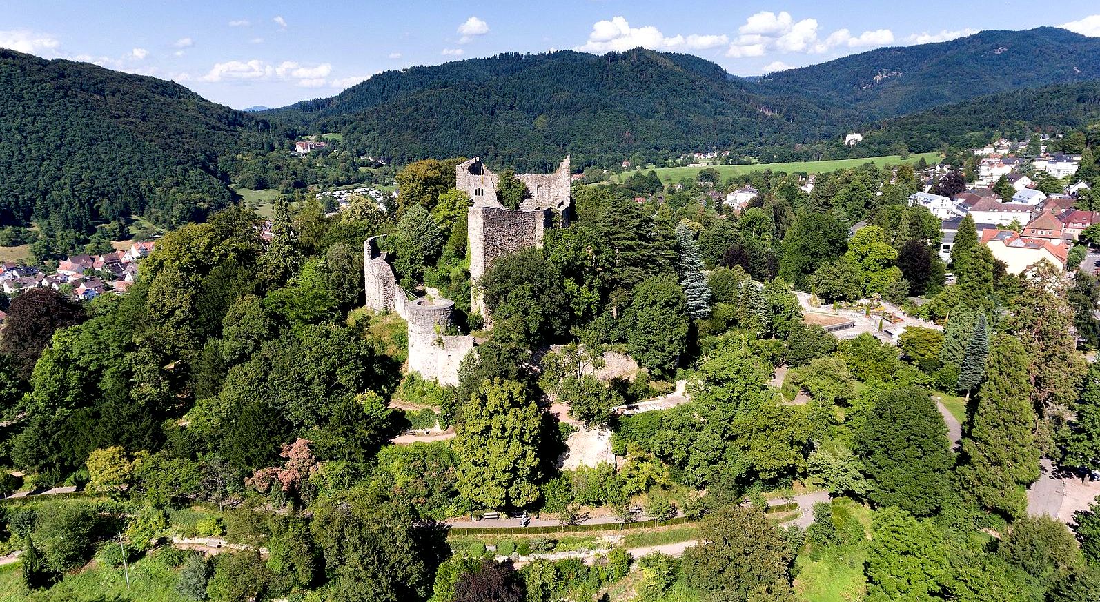
(Volatus Photo)
Aerial view of Burg Badenweiler.
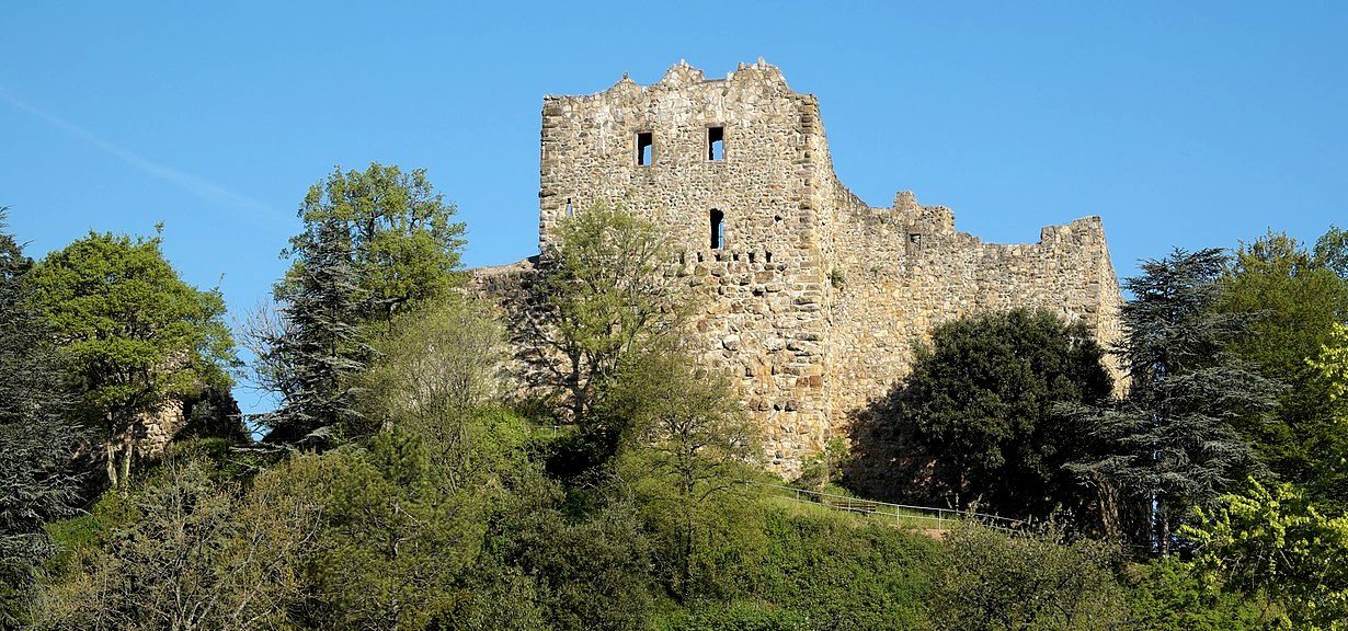
(GFreihalter Photo)
Burg Badenweiler.
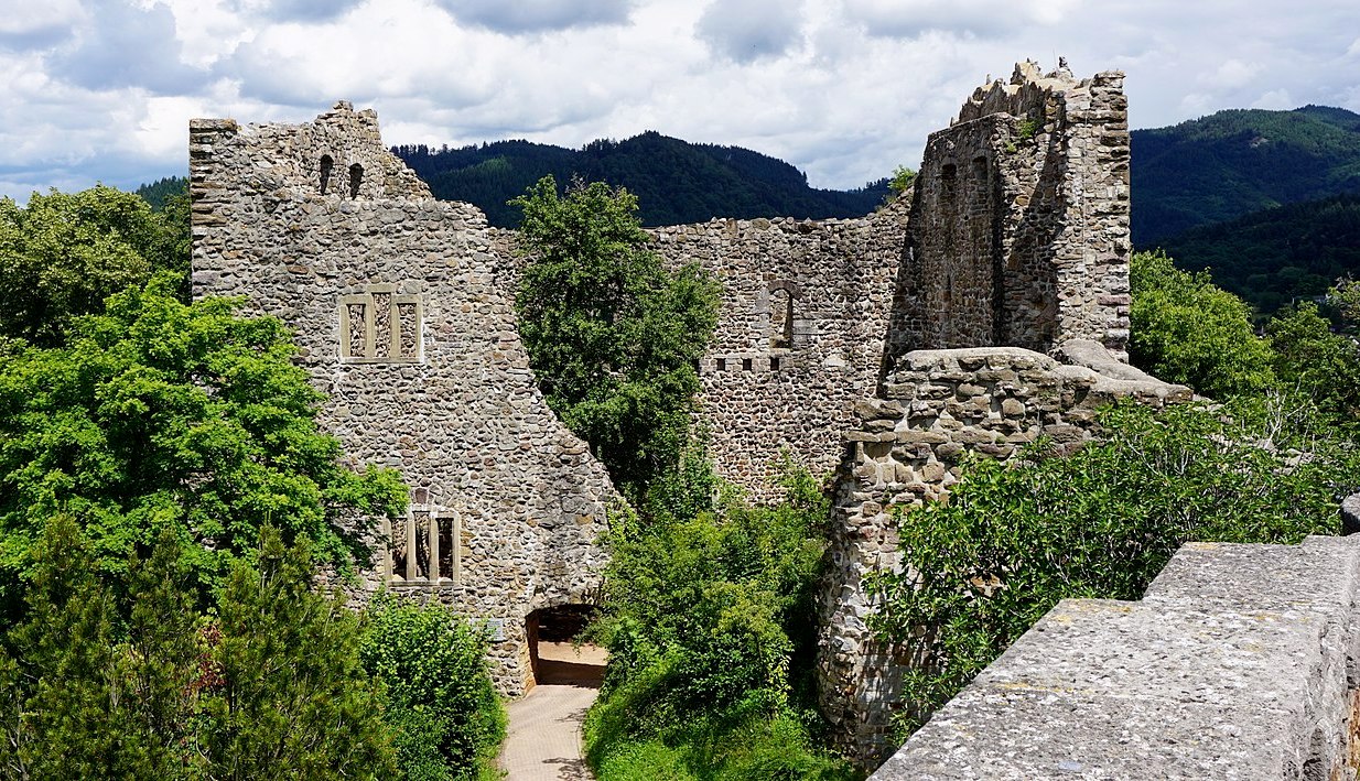
(Ziegelhar Photo)
Burg Badenweiler.
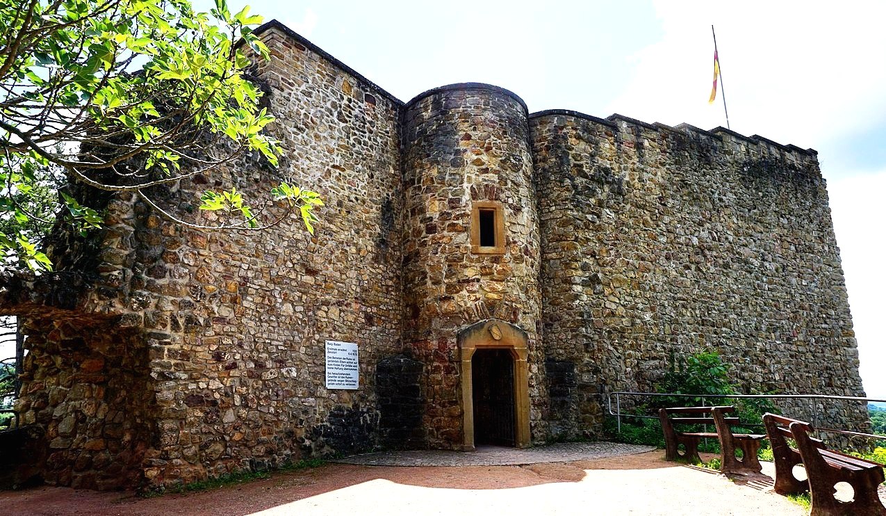
(Ziegelhar Photo)
Burg Badenweiler.
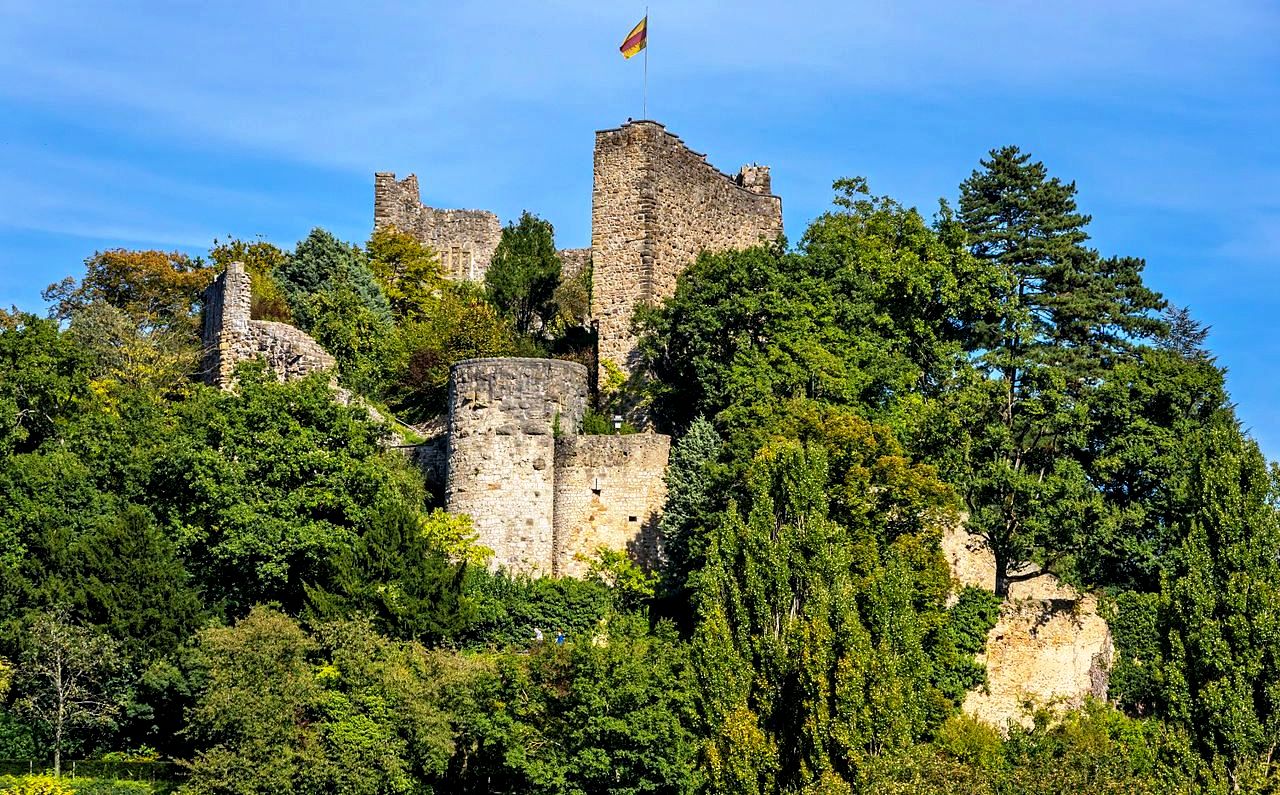
(Jorgens Photo)
Burg Badenweiler.

(Pierre Likissas Photo)
Burg Rötteln, aka Röttler Schloss, is a castle ruin located above the Lörrach suburb of Haagen. It lies in the extreme southwest corner of the German state of Baden-Württemberg, 10 km (6 miles) north-east of the Swiss City of Basel. The fortification was one of the most powerful in the southwest, and today, it is the third largest castle ruin in Baden. The ruins of the castle are situated on a widely visible forested hill 422 metres (1,385 ft) above sea level. The keep lies on a spur projecting from the steep-sided east side of the lower Wiese valley.
The castle has probably existed since the beginning of the 11th century. The first documented mention of a lord of Rötteln, was recorded by Dietrich von Rötteln, the bailiff of St. Albans near Basel, in 1102. This year is also considered the date of the founding of the city of Lörrach. In 1204 Dietrich III von Rötteln died, having amassed a large holding in the Wiese valley. The first documented mention of the castle itself is from the year 1259. Luithold II von Rötteln, the last male of his line gave the lordship of Rötteln to the Margrave Rudolf I of Hachberg-Sausenberg and his heiress Agnes von Rötteln, in the year 1311. As a result, the Margrave of Hachberg-Sausenberg also became lord of the former domain of Rötteln. The Margrave then moved from Sausenburg Castle to Rötteln Castle to more easily administer his new domain and appointed a bailiff to oversee Sausenburg.
Luithold II von Rötteln died on 19 May 1316, and the passing of Rötteln to Hachberg-Sausenburg was an important step in the eventual formation of the Markgräflerland. In 1332, the castle was besieged by the people of Basel because the Margrave Rudolf II stabbed the Mayor of Basel during an argument. The conflict was resolved at the last moment through an agreement to settle the argument. Arrowheads, crossbow bolts, and other finds near the castle attest to this siege.
The Basel earthquake of 1356 destroyed large portions of the city and the castle suffered severe damage. In 1444, the domain of Badenweiler passed from John, the last Count of Freiburg, to the son of Margrave Wilhelm, Rudolf IV von Hachberg-Sausenberg. The combination of the three dominions, Rötteln, Sausenburg, and Badenweiler formed the foundation of the Markgräflerland. In 1503, the castle came into the possession of the Margrave of Baden. During the German Peasant’s War in 1525, revolting peasants briefly took possession of the castle. From 1618 to 1648, during the Thirty Years’ War, the castle was occupied by both Swedish and Imperial forces.
On 29 June 1678, during the Franco-Dutch War, the castles of Rötteln, Sausenburg and Badenweilaer were destroyed by the army of the French Marshall François de Créquy. The castle ruins were thereafter used as a source of building stone (quarry). The Black Forest Society of Baden (Schwarzwaldverein) began to survey the ruins in 1884 in order to preserve them. Since 1926, this has been the concern of the Röttelnbund e.V. club based in Lörrach-Haagen. Today the ruins have been restored to their approximate condition in 1678.
The site of the castle extends from northwest to southwest over a distance of almost 300 metres (980 ft). The widely spread castle can be roughly divided into the fore-castle and upper castle. To the west, a bastion-like point extends for the placement of light artillery. Passage from the fore-castle to the upper castle is by means of a drawbridge. The upper castle, with its powerful keep, is the oldest part of the castle. Archaeological finds from the castle and grounds are on display in the museum located in the courtyard of the castle. (Helmut Bender u. a.: Burgen im südlichen Baden. Verlag Karl Schillinger, Freiburg i. Br. 1979)
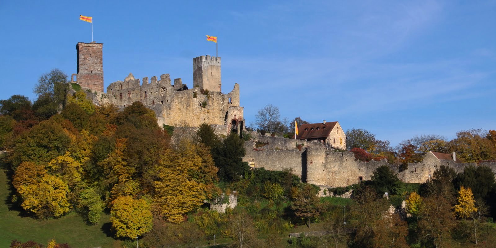
(Pierre Likissas Photo)
Burg Rötteln, Lörrach.
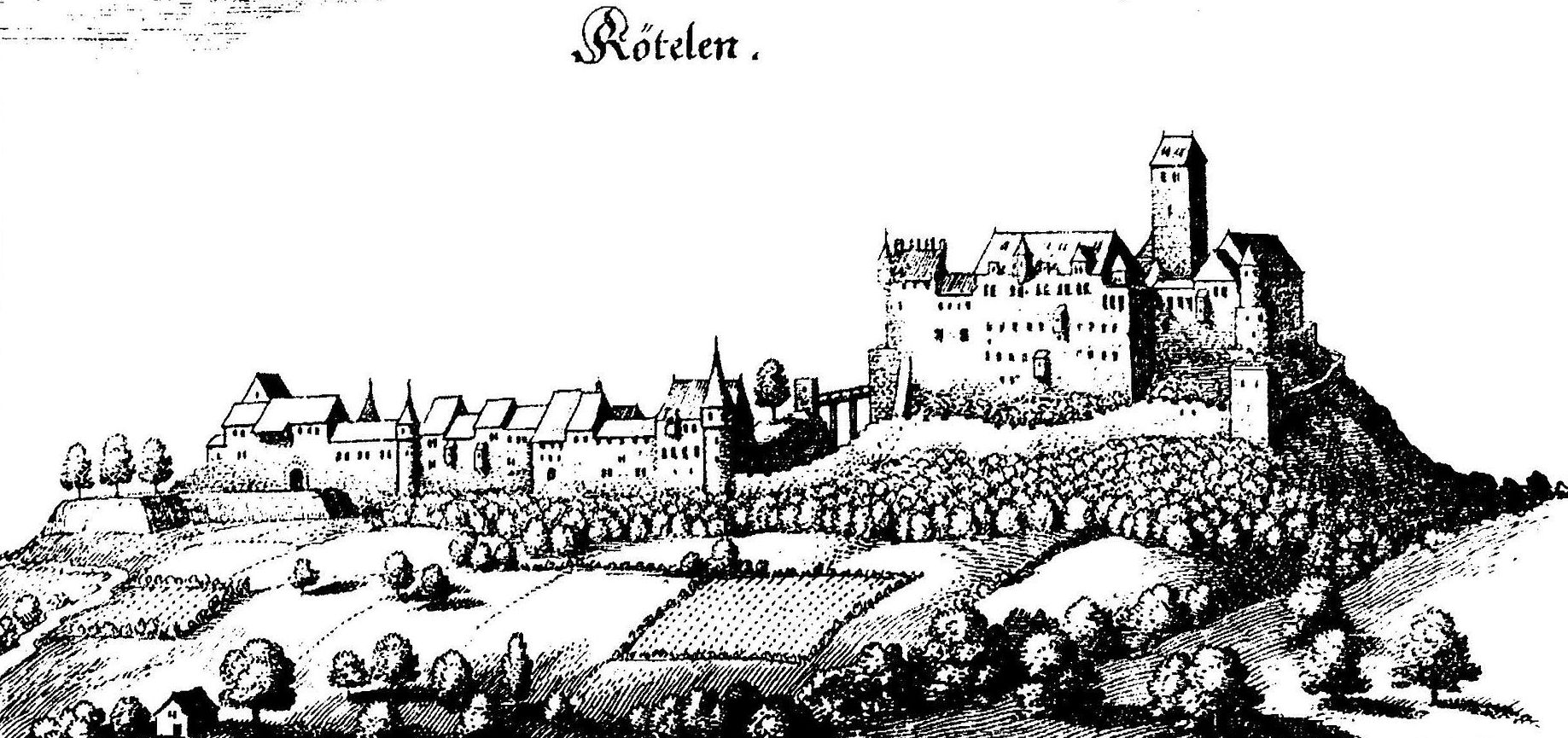
Burg Rötteln in 1643, Matthäus Merian illustration.
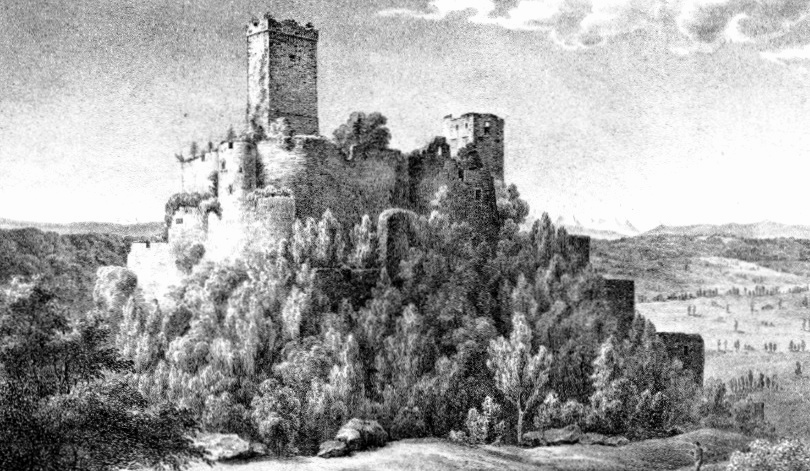
Burg Rötteln c1828, Johann Baptist Brecht illustration.
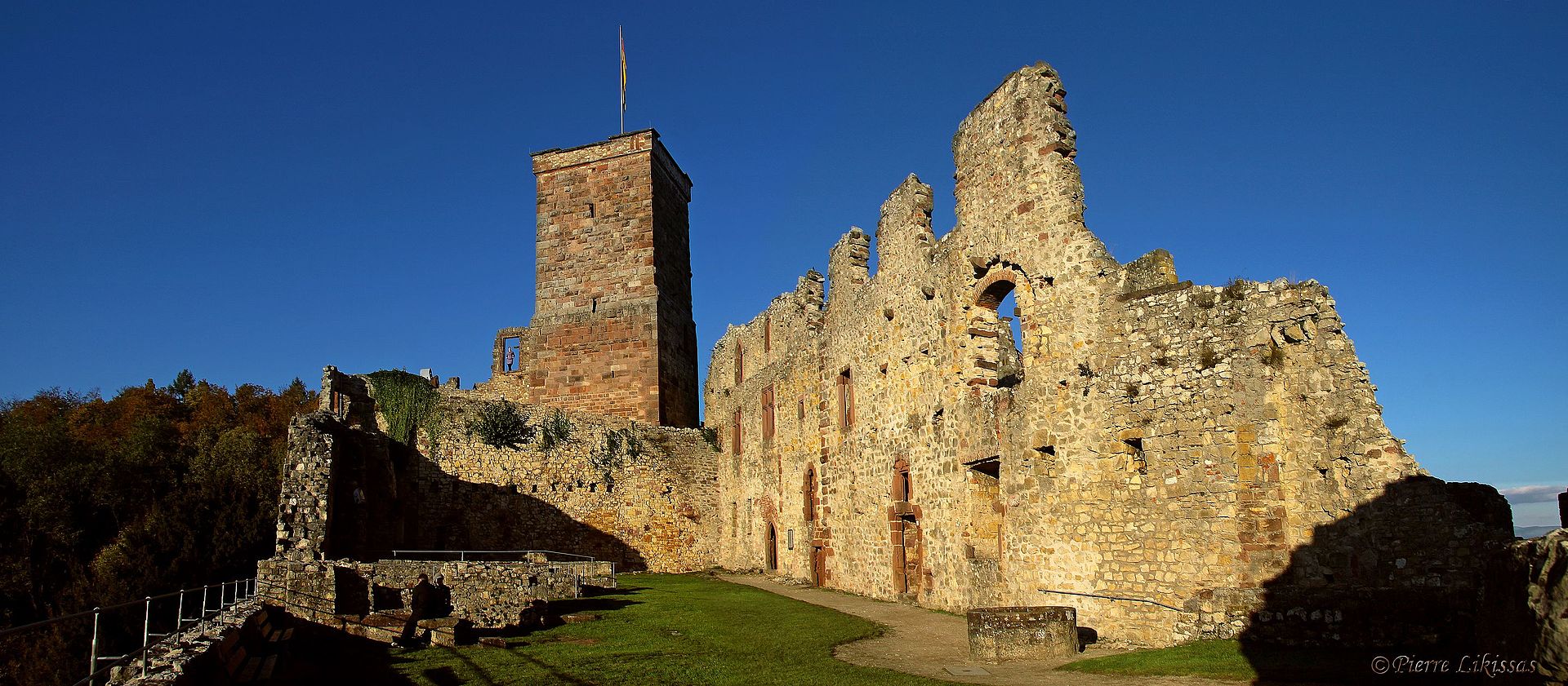
(Pierre Likissas Photo)
Burg Rötteln, Lörrach.
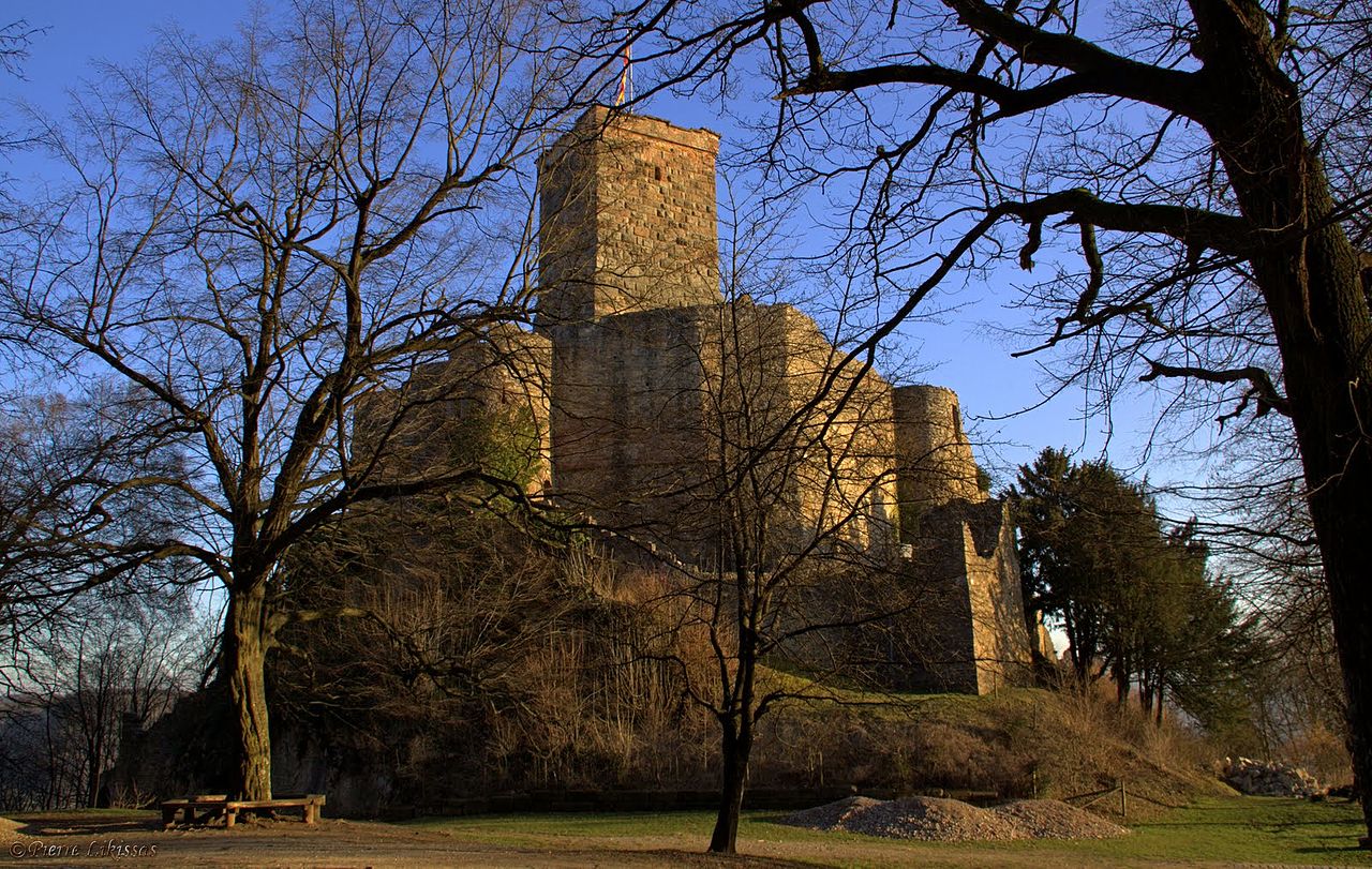
(Pierre Likissas Photo)
Burg Rötteln, Lörrach.
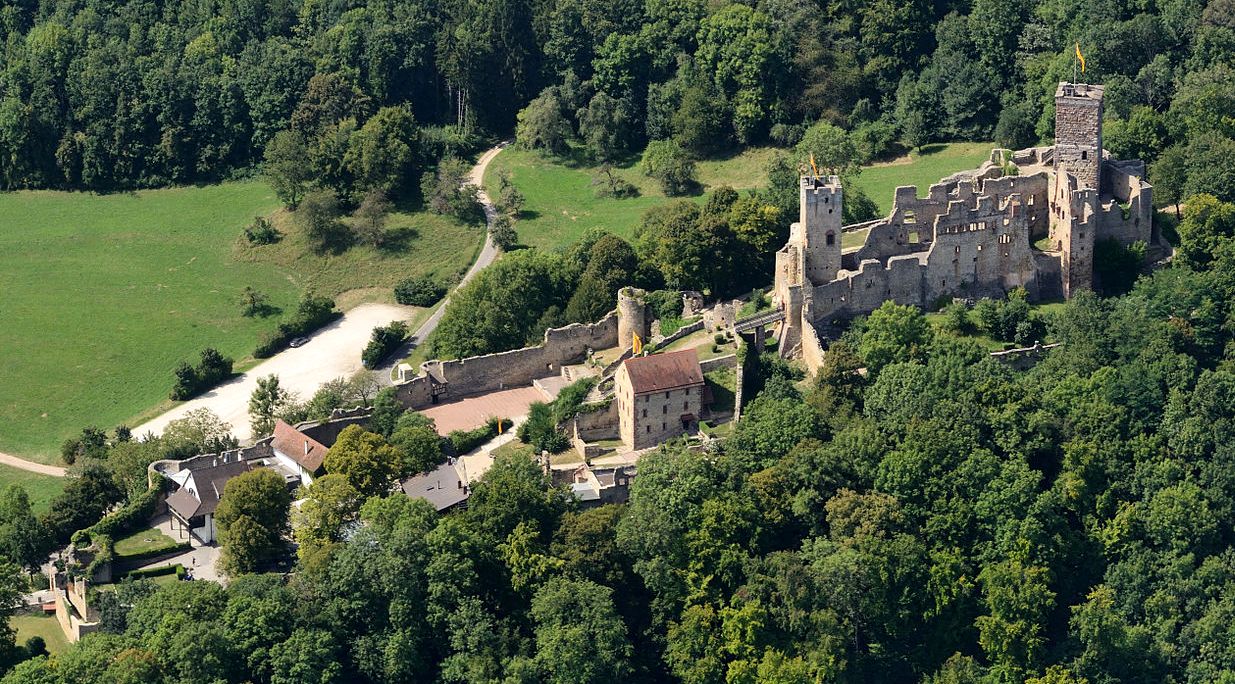
(Taxiarchos228 Photo)
Burg Rötteln, aerial view. There are two parts to the castle, each surrounded by a wall and each at different elevations.
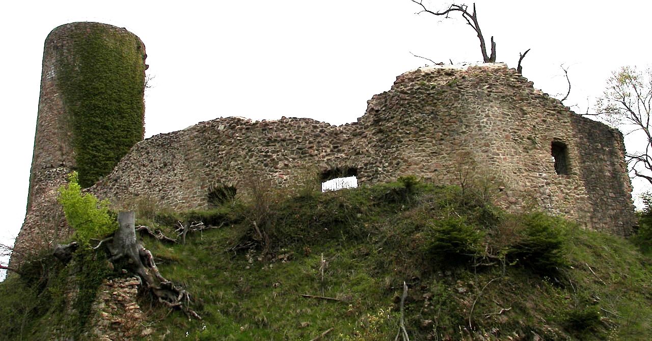
(Public Domain Photo)
Sausenburg Castle is a ruined German castle on the edge of the Black Forest, just north of the town of Kandern in Baden-Württemberg, between the villages of Sitzenkirch and Malsburg-Marzell. The castle was originally the stronghold of the lords of Sausenburg, and is built on a hill, 665 metres high, known as the Sausenberg. At the beginning of the 12th century, the area was given to the Benedictine monks of the Monastery of St. Blaise. The counts of Hachberg acquired the property in 1232 from the monastery. They built the castle in order to protect the area and lived there from 1246. In 1306, the counts founded the Sausenberg dynasty. From that point on, they called themselves the Margraves of Hachberg-Sausenberg.
In 1315, Liuthold II of Roetteln, the last male member of his dynasty, bestowed Roetteln to the counts of Hachberg-Sausenberg. He died in 1316. The counts of Hachberg-Sausenberg moved to Rötteln Castle and established their advocates (vogts) on the Sausenberg. John, the last of the Counts of Freiburg, bestowed his property Badenweiler to the margraves of Hachberg-Sausenberg in 1444; the merger of Badenweiler, Rötteln, and Sausenberg marked the beginning of the Markgräflerland. In 1503, through inheritance, the Sausenburg and the Markgräflerland became part of the Margraviate of Baden. The castle was destroyed in 1678 during the Franco-Dutch War by the army of French Marshal de Créquy. At this point, medieval fortifications could not survive long against the advances in artillery and siege warfare. Today an old circular rampart, a tower and several wall segments remain of the former castle.
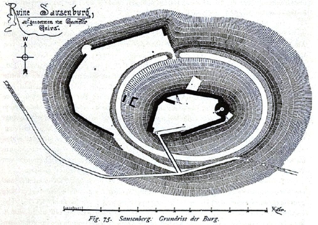
Sausenburg Castle, ground plan.
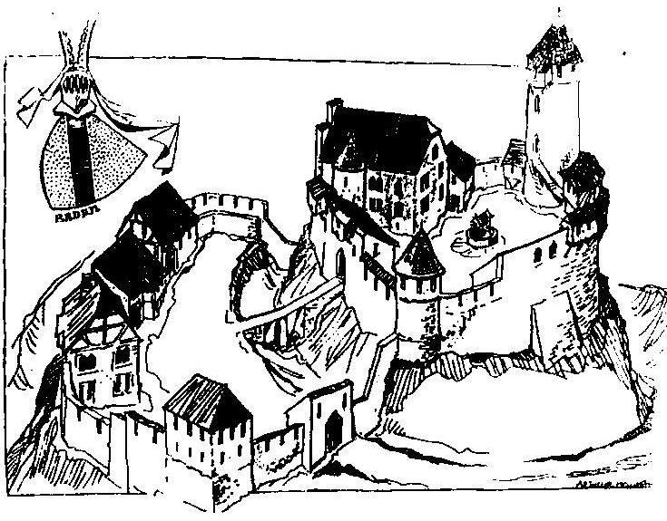
Drawing of Sausenburg Castle before its destruction.
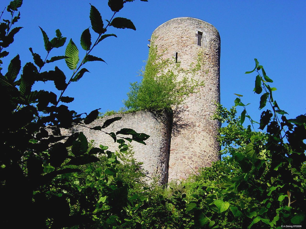
(E.A. Goering Photo)
Sausenburg Castle.
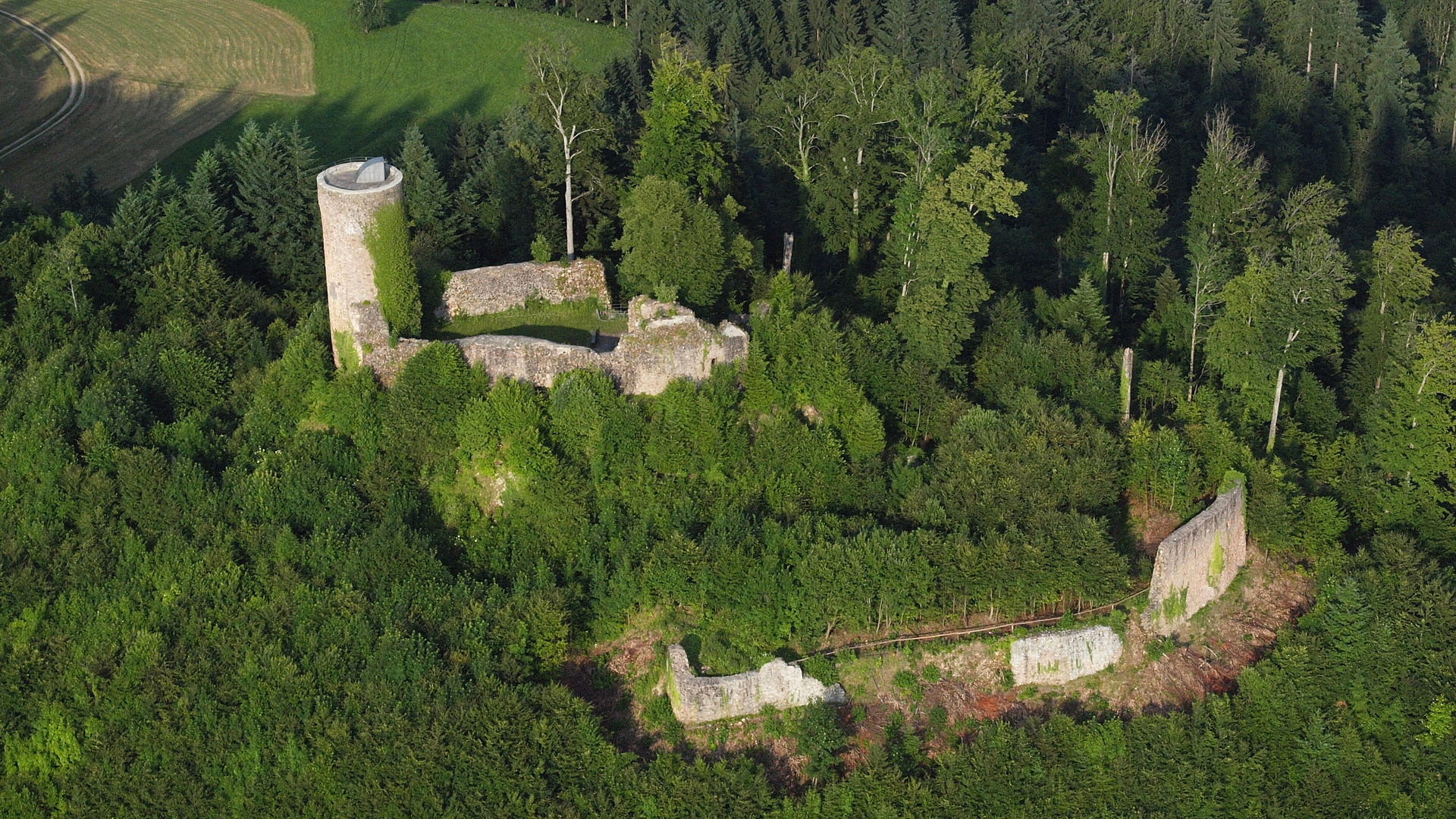
(Wolkenkratzer Photo)
Sausenburg Castle, aerial view.
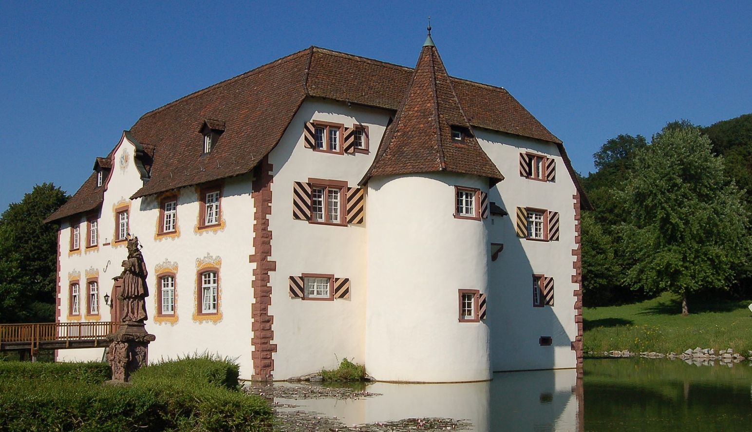
(Taxiarchos228 Photo)
Inzlingen Castle (Wasserchloss Inzlingen), also Reichenstein Castle (Schloss Reichenstein) is a medieval castle surrounded by a moat situated in the village of Inzlingen in the district of Lörrach, Baden-Würtembeerg, in the south-west of Germany close to the Swiss border line near Basel. The origins of the castle cannot be clearly dated. The first written evidence dates from 1511, when the castle was a possession of a relative of the barons Reich von Reichenstein. This noble family hold fiefdoms from the Prince-Bishopric of Basel, the Margraviate of Baden, and the House of Habsburg. A Prince-bishop of Basel, six mayors of Basel and a principal of Basel University came from this noble family. In 1394 Margrave Rudolf III enfeoffed Heinrich Reich von Reichenstein with the right for high justice regarding the village of Inzlingen. This placed the family in a position to acquire a substantial landholding within this village, and subsequently, they named themselves Lords of Inzlingen. A first major conversion of the castle took place from 1563 to 1566.
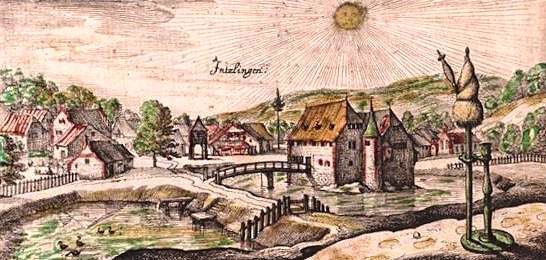
This copper engraving illustrates Inzlingen Castle in 1625. Between 1674 and 1745, the buildings were converted to a Baroque style, and c1750 a Baroque interior was added. Since 1820 the castle has been the residence of a weaving mill, producing silk ribbons. Later, it was used for a century as a farm house. In 1969 Inzlingen Castle was purchased by the municipality of Inzlingen and renovated thereafter. Since 1978 it has served as the city hall for the municipality of Inzlingen. There is currently a luxury restaurant within the castle. In 1980 the Deutsche Post issued a stamp showing an engraving of Inzlingen castle.
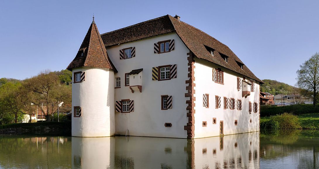
(Taxiarchos228 Photo)
Inzlingen Castle.
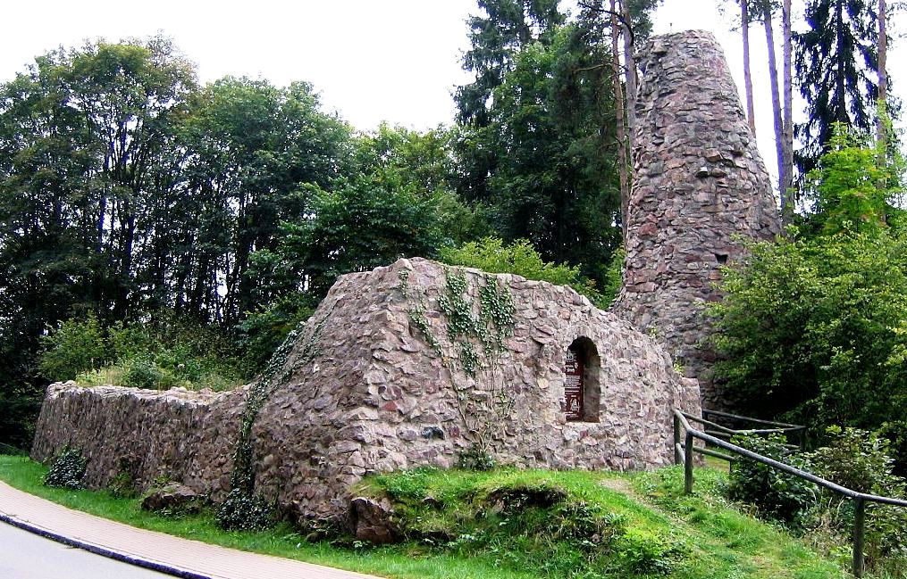
(Flominator Photo)
Alt-Urach Castle ruin is in Lenzkirch, in the district of Breisgau-Hochschwarzwald (Baden-Württemberg) in the Black Forest. The ruin can be found right at the entrance to Titisee-Neustadt on the right hand side of the federal highway 315 on a ledge above the Haslach valley. The castle complex was built in the 13th century by the lords of Urach. It is mentioned in a document dated 1316 as burg ze Úra. It was owned by the Lords of Blumegg in the 14th and 15th centuries and was the center of the Lenzkirch rule. In 1491 it was sold to the Counts of Fürstenberg, at that time, however, it was already known as the Burgstall, which means that it was uninhabitable. It
has been owned by the community of Lenzkirch since 1972 and is looked after by the Black Forest Association Lenzkirch.Around 1404 a house was added to the original castle with its square residential tower and wall ring. The brickwork was renovated in 1995/96 by the Black Forest Association Lenzkirch.
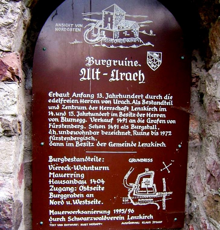
(Flominator Photo)
Alt-Urach Castle.
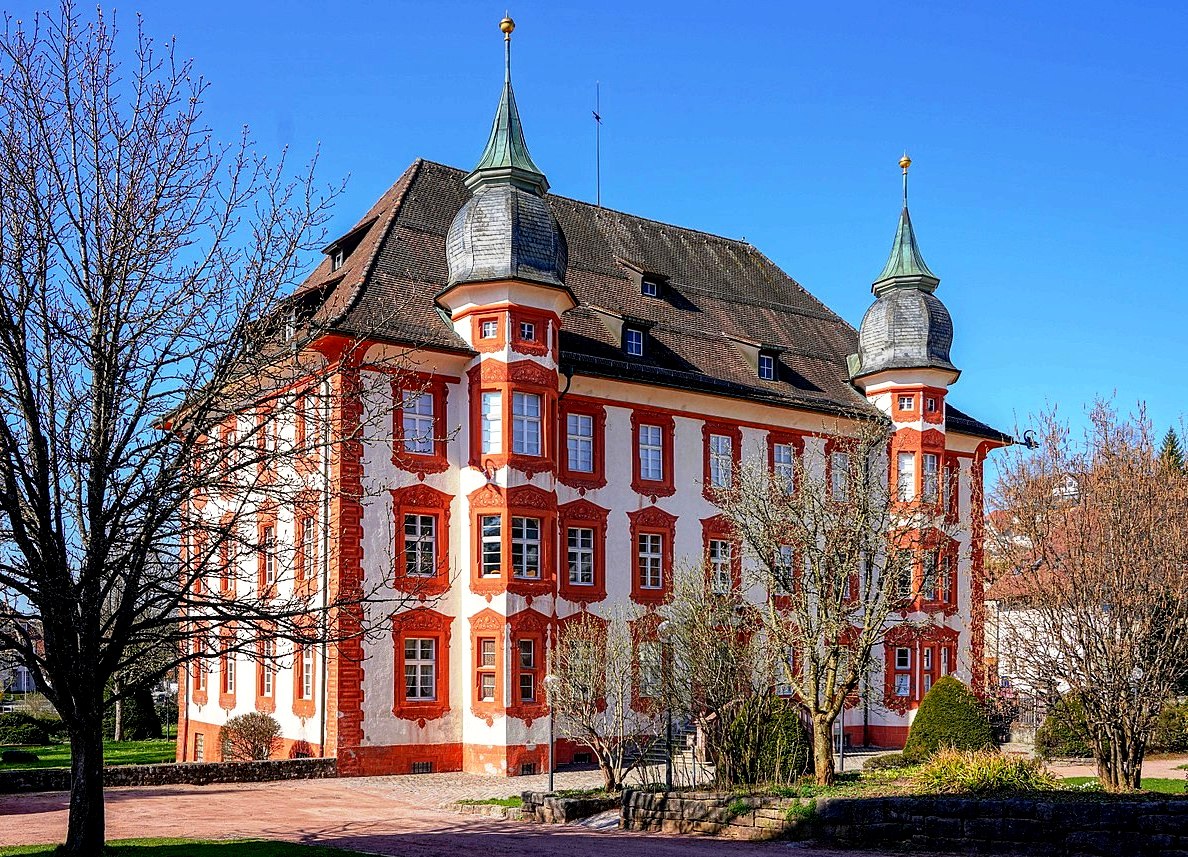
(Panta Rhei Photo)
Bonndorf Castle is a castle in the town of Bonndorf in the Black Forest in the Waldshut district. Peter von Mörsberg († around 1594) and his son Joachim Christoph von Mörsberg probably built this moated castle in the Renaissance style. The construction costs of the building erected between 1592 and 1595 were so high that Joachim von Mörsberg was forced to sell in 1613. The von Mörsberg family descends from the Morimont line. In 1686 Ulrich von Mörsberg was the last of his tribe. The Bonndorf rulership was acquired by Abbot Martin I for the St. Blasien monastery for 150,000 guilders.
Abbot Blasius III. From 1723 to 1727 the property was converted into a baroque country palace and two towers, a portal with an outside staircase and a staircase extension were added on the south side. The construction was completed under Abbot Franz II Schächtelin, with the ballroom on the upper floor only being completed with a mirror vault under Abbot Martin Gerbert. The stucco mirror vault is decorated with a fresco by Franz Josef Spiegler. The main fresco shows Christ and the disciples. In the four corner spandrels there are allegories of the four continents and in four cartouches in the middle of the sides putti with symbols that refer to the builder of the castle, Abbot Blasius III. In the numerous rooms there is stucco by the Freiburg plasterer Franz Joseph Vogel with tendrils and bands.
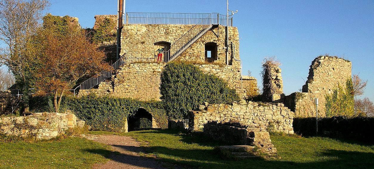
(R Kirchner Photo)
The Küssaburg, Küssenberg or Küssaberg Castle (Burg Küssaberg) is a ruined hilltop castle located at an elevation of 634 m above sea level in Bechtersbohl, a village in the municipality of Küssaberg, in the county of Waldshut in the German state of Baden-Württemberg. The name may be derived from the Roman personal name, Cossinius, or from the German Kissen (Alemannic Chüssi) which means “cushion”, after the shape of the mountain on which it stands.
The Küssenberg is one of the most important historic buildings on the High Rhine, and a landmark of the county of Waldshut. It was probably constructed between 1125 and 1141. The present ruins were owned inter alia by the Counts of Küssenberg, the Bishopric of Constance and the Counts of Sulz. The castle, which was later developed into a fortress, was destroyed by a fire started by its garrison on 8 March 1634 when the Swedish Army approached it during the Thirty Years’ War and by a landslide on 25 December 1664. In the 19th century work began on uncovering the ruins which have since become a popular destination in the region.
The ruins lie above the village at an elevation of about 634 metres above sea level. They are a landmark in this region and overlook the Klettgau, which runs east of the mountain, and the Rhine valley (High Rhine). In addition, there are views of the Southern Black Forest and the Aargau in Switzerland. (Andreas Weiß, Christian Ruch: Die Küssaburg. Herausgegeben vom Küssaburg-Bund e.V., o. O. 2009)
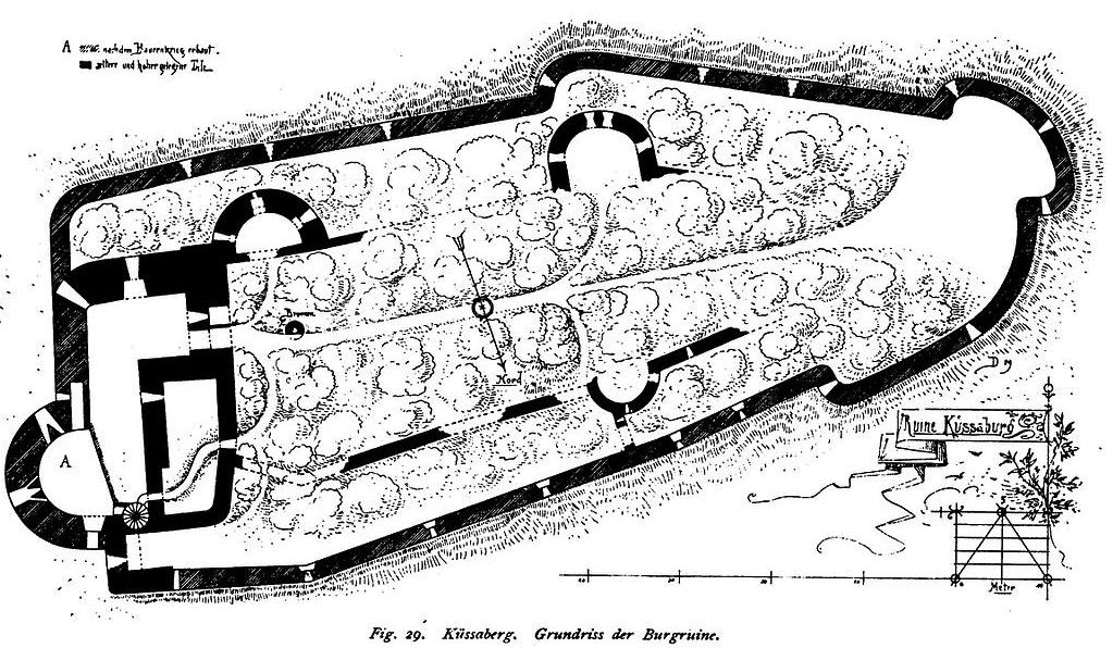
Küssaberg Castle, ground plan.
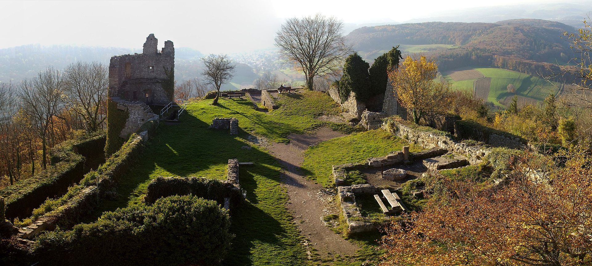
(R. Kirchner Photo)
Küssaberg Castle.
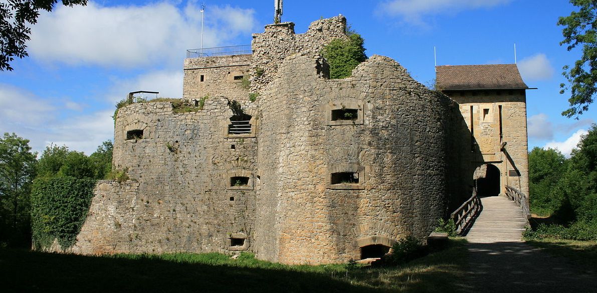
(Lutz Fischer Photo)
Küssaberg Castle, East side view.
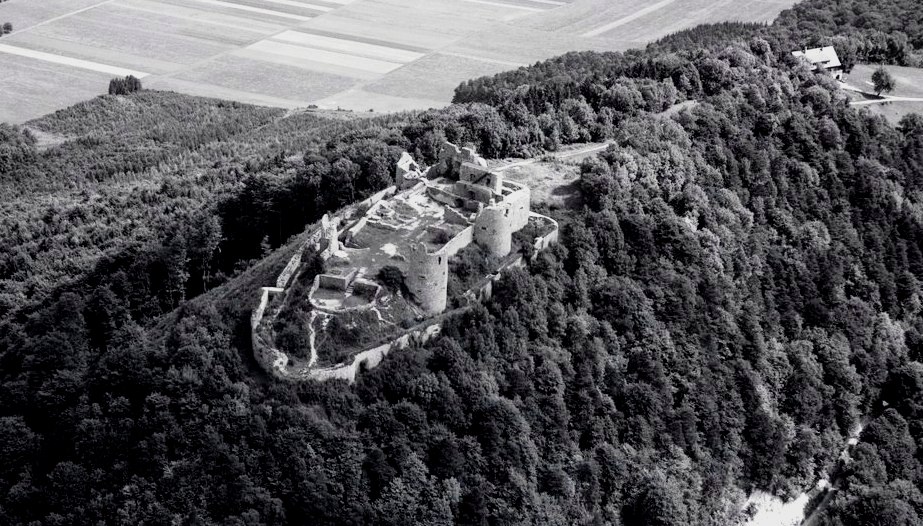
(Werner Friedli Photo)
Küssaberg Castle, aerial view.
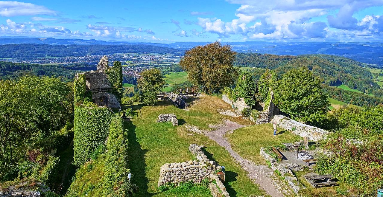
(PantaRhei Photo)
Küssaberg Castle, view from the Bergfried.
Hohenzollern is a bit further afield, but it was well worth the drive, so I am including it here for reference.
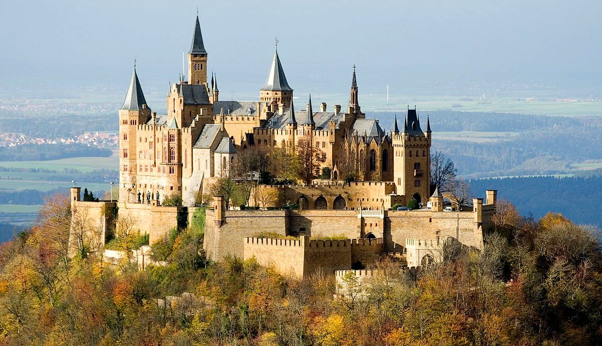
(A Kniesel Photo)
Hohenzollern Castle aka Burg Hohenzollern, is the ancestral seat of the imperial House of Hohenzollern. The third of three hilltop castles built on the site, it is located on top of Mount Hohenzollern, above and south of the town of Hechingen on the edge of the Swabian Jura of central Baden-Württemberg. The House of Hohenzollern emerged in the Middle Ages and produced the three German emperors of the German Empire in late 19th and the early 20th centuries.
The first castle on the mountain was built in the early 11th century. Over the years the House of Hohenzollern split several times, but the castle remained in the Swabian branch of the family. They were the dynastic seniors of the Franconian-Brandenburgian cadet branch that later acquired its own imperial throne. This castle was completely destroyed in 1423 after a ten-month siege by the free imperial cities of Swabia.
The second castle, a larger and sturdier structure, was built from 1454 to 1461. It served as a refuge for the Catholic Swabian Hohenzollerns, including during the Thirty Years’ War. By the end of the 18th century it was thought to have lost its strategic importance and gradually fell into disrepair, leading to the demolition of several dilapidated buildings.
The third, and current, castle was built between 1846 and 1867 as a family memorial by Hohenzollern King Frederick William IV pf Prussia. Architect Friedrich August Stüler based his design on English Gothic Revival architecture and the Châteaux of the Loire Valley in France. No member of the Hohenzollern family was in permanent or regular residence when it was completed, and none of the three German Emperors of the late 19th and early 20th century German Empire ever occupied the castle; in 1945 it briefly became the home of the former Crown Prince Wilhelm of Germany, son of the last Hohenzollern monarch, Kaiser Wilhelm II.
Among the historical artifacts of Prussian history contained in the castle are the Crown of Wilhelm II, some of the personal effects of King Frederick the Great, and a letter from US President George Washington thanking Hohenzollern descendant Baron von Steuben for his service in the American Revolutionary War.
Hohenzollern Castle is located on the top of Berg Hohenzollern, an isolated promontory of the Swabian Jura, 855 meters (2,805 ft) above sea level, south of Hechingen and approximately 50 kilometers (31 mi) south of Stuttgart, capital of Baden-Württemberg. This mountain lends its name to the local geographic region, der Zollernalbkreis, and is known among locals as Zollerberg (Zoller Mountain), or simply Zoller.
Only written records exist of the original castle built in the High Middle Ages, built by the Counts of Zollern. Although the House of Hohenzollern itself finds its first mention in 1061, the castle is first mentioned as “Castro Zolre” in 1267, without any mention of the castle beyond its name, though contemporary sources praised it as the “crown of all castles in Swabia.” In 1423 the castle was totally destroyed after a year-long siege by the Swabian League of Cities.
Construction on a second, stronger castle began in 1454. It was captured by Württemberger troops in 1634 midway in the Thirty Years’ War (1618–1648), then fell under Habsburg control for about a century. During the War of the Austrian Succession (1740–1748) it was occupied in the winter of 1744/45 by French soldiers. Returned to Habsburg control after the war, it was rarely occupied and began to fall to ruin after the last Austrian owner left the castle in 1798. By the beginning of the 19th century only the Chapel of St. Michael remained usable. The current castle was built by Hohenzollern Crown-Prince Frederick William IV of Prussia.
Hohenzollern Castle, covering almost all of Mount Hohenzollern’s summit, is a structure composed of four primary parts: military architecture, the palatial buildings, chapels, and the gardens. The Eagle Gate (Adlertor) and its attached drawbridge form the entrance to the castle. The castle’s winding zwinger turns four times and terminates in the bastions. From here, the palatial buildings can be accessed through the square upper gate and so are the rest of the bastions.
The palace itself, sitting upon the outline of the second castle, is an open-air museum arranged in a u-shape that ends with Protestant and Catholic chapels. Sitting on top of the old casemates are the three story Gothic Revival buildings of Friedrich August Stüler’s design, decorated with towers and pinnacles. The four towers of the palace are aligned to the bastions, with the Emperor’s Tower to the Fuchsloch bastion, Bishop’s Tower to the Spitz bastion, Markgraf Tower to the Scharfeck bastion, and Michael’s Tower to the garden bastion. Attached to the main residential building, the Count’s Hall, is the final tower, the Watch Tower (Wartturm), which functions both as a staircase to the library, and as the flag pole whenever the Hohenzollern family is residing in the castle.
The interior of the castle has a perron leading up to the ancestry hall, where one enters the Count’s Hall (Grafensaal), which covers the entirety of the southern wing. The rib vaulting of the Count’s Hall, adorned with grisailles by Stüler depicting the history of the House of Hohenzollern and pointed-arch windows, is supported by eight free standing red marble columns. Below the Count’s Hall is the old castle kitchen, today a treasure chamber. Next to the Count’s Hall is the Emperor’s Tower and the Bishop’s Niche, following the library decorated with murals of the Hohenzollern history by Wilhelm Peters. The Margrave’s Tower contains the King’s parlor, also referred to as the Margrave’s room, contrary to Stüler’s terminology. (Herbert Gers. Hohenzollern Castle. 5th ed. Hechingen: Administration of Hohenzollern Castle, 1984)
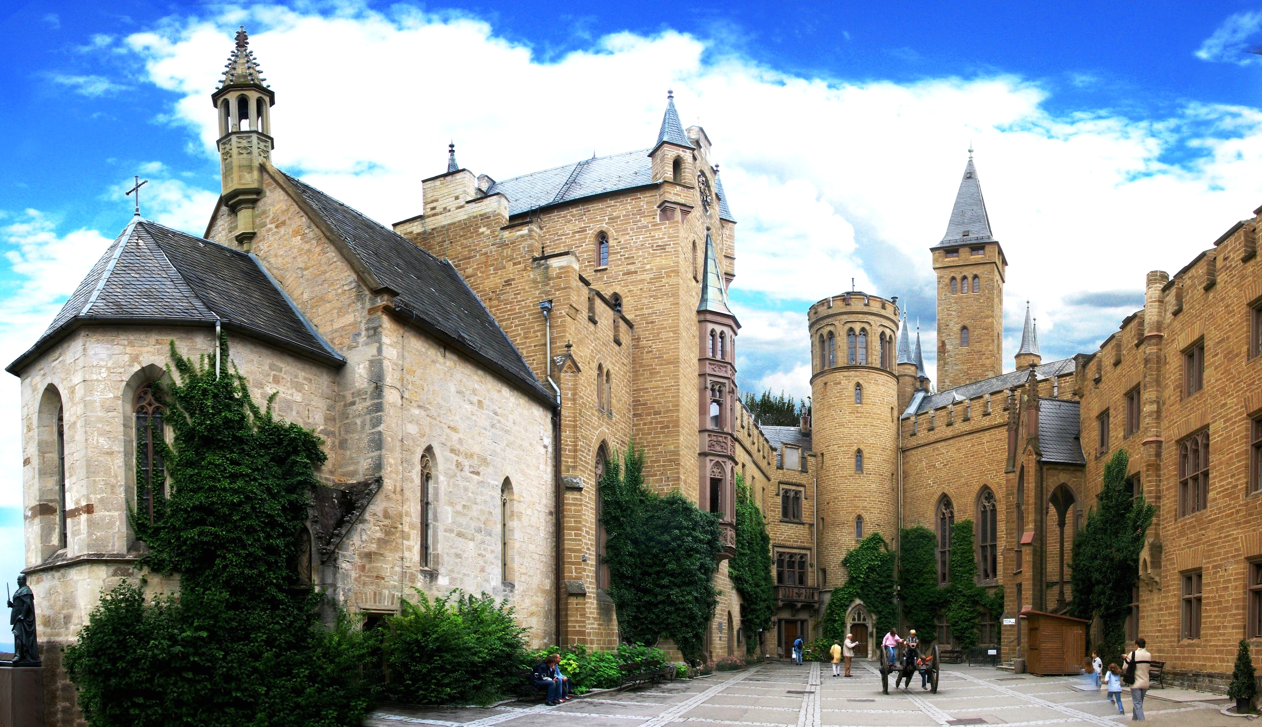
(Joachim Fenkes Photo)
Hohenzollern Castle, inner court.
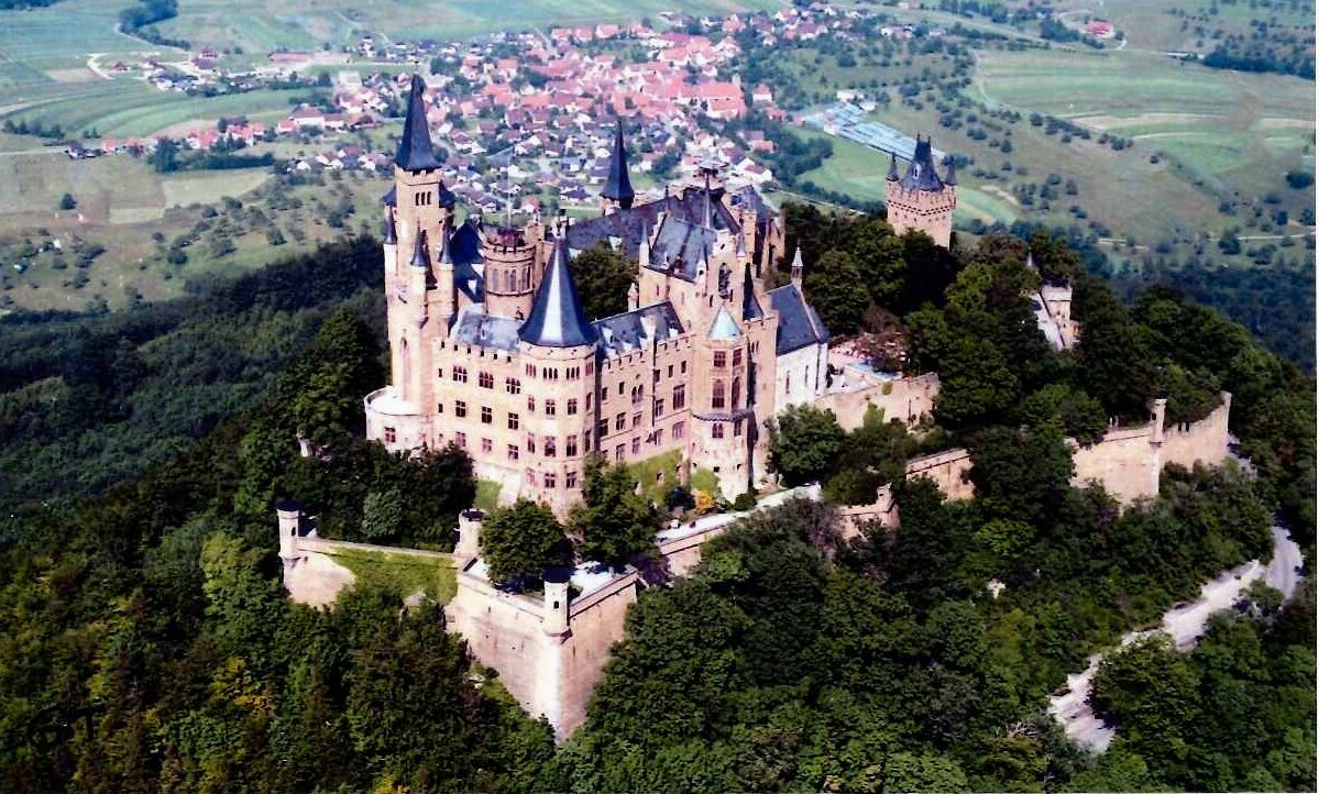
(Duprat40 Photo)
Hohenzollern Castle, aerial view.
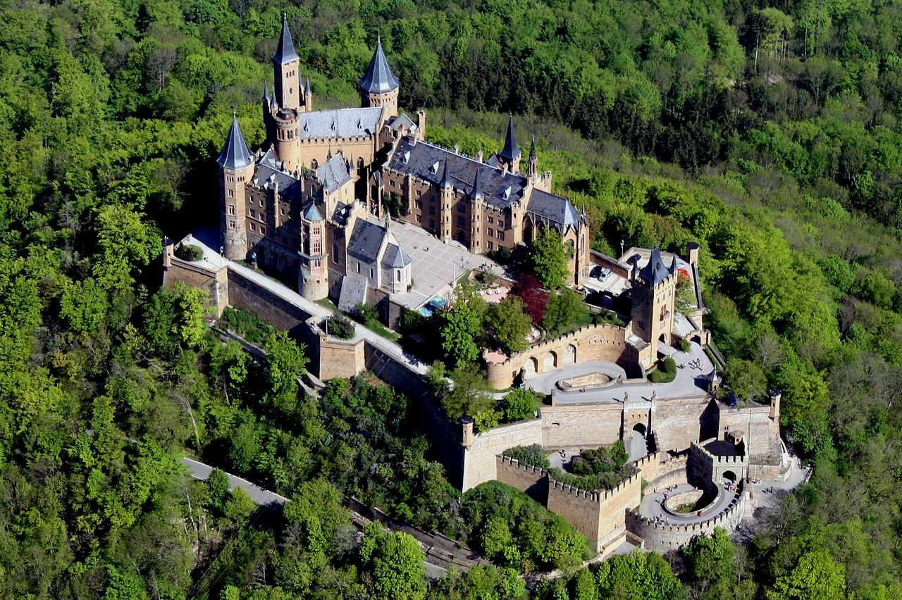
(Sven Scharr Photo)
Hohenzollern Castle, aerial view.
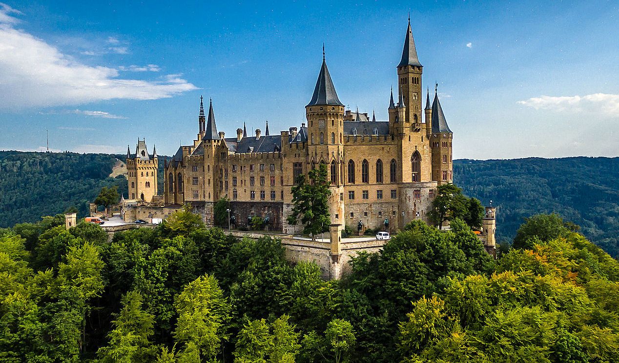
(Marco Beckl Photo)
Hohenzollern Castle, aerial photo.
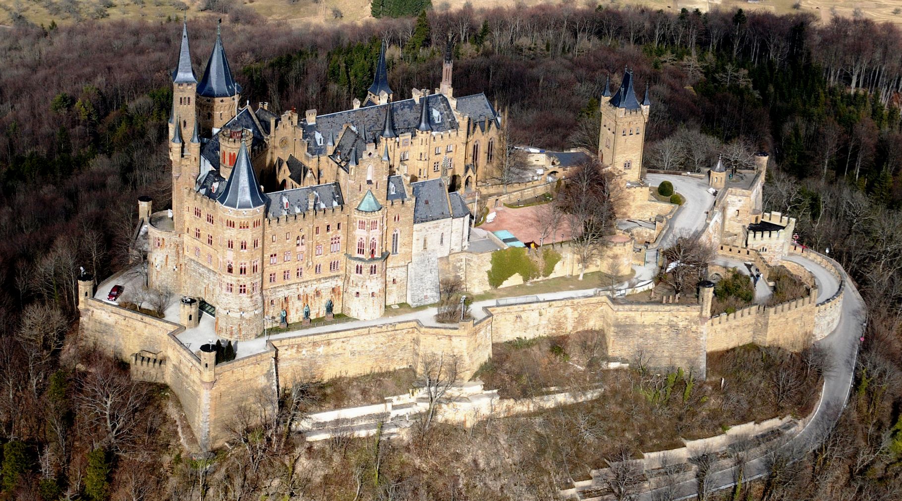
(MFSG Photo)
Hohenzollern Castle, aerial photo.
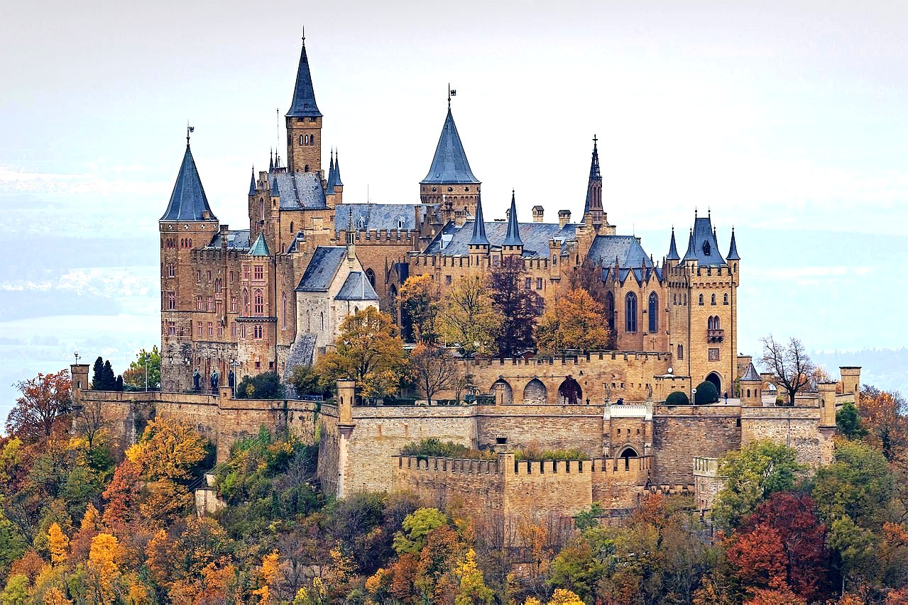
(A. Savin Photo)
Hohenzollern Castle, aerial photo.
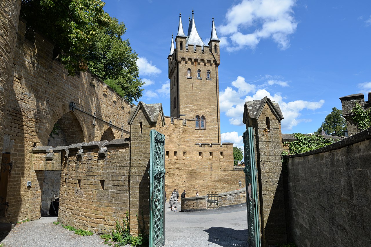
(Calips Photo)
Hohenzollern Castle, inner court.
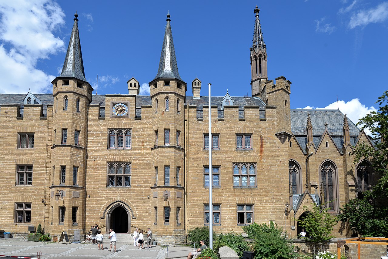
(Calips Photo)
Hohenzollern Castle, inner court.
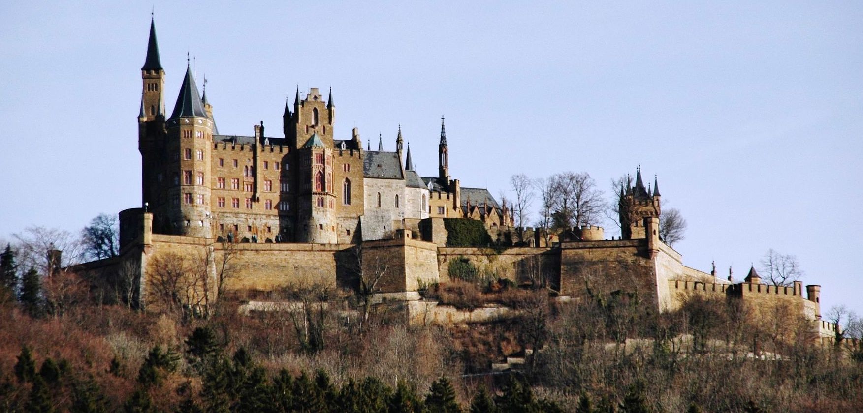
(Quesy Photo)
Hohenzollern Castle.
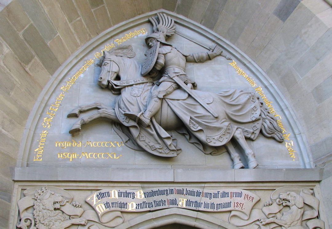
(Mercy Photo)
Hohenzollern Castle, knight sculpture over one of the four entrances to the castle.
Sigmaringen Castle is another significant castle worth the extra time to drive to.
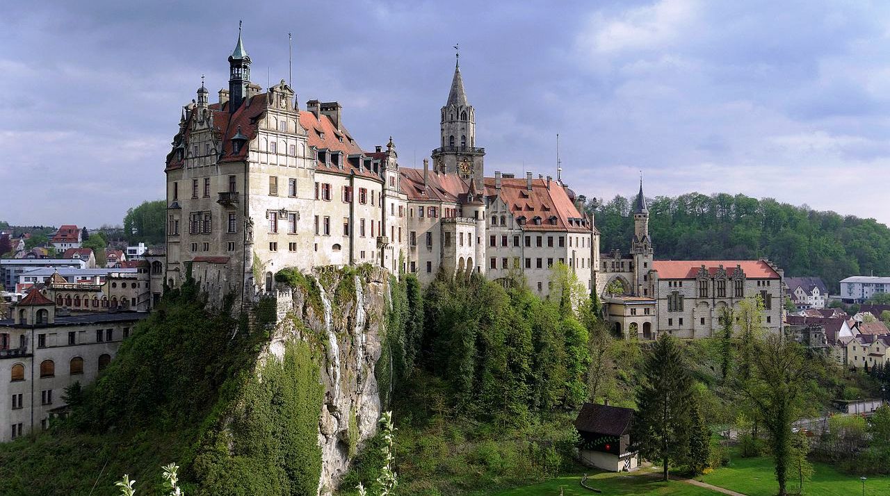
(Berthold Werner Photo)
Sigmaringen Castle (Schloss Sigmaringen), was the princely castle and seat of government for the Princes of Hohenzollern-Sigmaringen. Situated in the Swabian Alb region of Baden-Württemberg, this castle dominates the skyline of the town of Sigmaringen. The castle was rebuilt following a fire in 1893, and only the towers of the earlier medieval fortress remain. Schloss Sigmaringen was a family estate of the Swabian Hohenzollern family, a cadet branch of the Hohenzollern family, from which the German Emperors and kings of Prussia came. During the closing months of the Second World War, Schloss Sigmaringen was briefly the seat of the Vichy French Government after France was liberated by the Allies. The castle and museums may be visited throughout the year, but only on guided tours. It is still owned by the Hohenzollern-Sigmaringen family, although they no longer reside there.
Sigmaringen is located on the southern edge of the Swabian Jura, a plateau region in southern Baden-Württemberg. The Hohenzollern castle was built below the narrow Danube river valley in the modern Upper Danube Nature Park (Naturpark Obere Donau). The castle rises above the Danube on a towering chalk projection that is a spur of the white Jura Mountains formation. The hill is known simply as the Schlossberg or Castle Rock. The Schlossberg is about 200 meters (660 ft) long and up to 35 meters (115 ft) above the river. On this free-standing towering rock, the princely Hohenzollern castle is the largest of the Danube valley castles. The sheer cliffs and steep sides of the tower made it a natural site for a well-protected medieval castle.
The first castle at Sigmaringen appeared during the end of the early Middle Ages, in the early 11th century. The castle was first mentioned in 1077 following the unsuccessful siege of Burg Sigmaringen by Rudolf of Rheinfelden in his fight against the King of Germany, Henry IV. In 1083 a pair of brothers, Ludwig and Manegold von Sigmaringen, are listed as witnesses on a document for the Königseggwald abbey.
Ludwig von Sigmaringen was married to Richinza von Spitzenberg, daughter of Berthold I, von Zähringen. At the end of the 11th century he built a castle on the Spitzenberg at Kuchen. The castle and the surrounding land and villages were part of the inheritance of Richinza. From their marriage Richinza and Ludwig had four children; Mathilde von Spitzenberg, the wife of Aribo von Wertingen, the clergyman Ulrich von Sigmaringen, Ludwig II von Sigmaringen-Spitzenberg and Manegold von Sigmaringen-Spitzenberg. The three brothers, Ulrich, Ludwig and Mangold von Sigmaringen are named as the founders of the 11th-century St. George’s Abbey in the Black Forest. From 1133 until 1170 Rudolf von Sigmaringen-Spitzenberg, the son of Ludwig II, ruled at Sigmaringen. In 1183 Graf Ludwig von Sigmaringen-Spitzenberg-Helfenstein, the son of Rudolf, is mentioned at the castle. In 1147 Ludwig as well as his father Rudolf and brother Ulrich II von Sigmaringen-Spitzenberg are mentioned in a document of Walter von Dillingen, Prince-Bishop of Augsburg as lords of Spitzenberg-Sigmaringen.
Under the Helfenstein family, the castle was renovated around 1200. The castle was totally rebuilt with buckel stones (squared-off stones with a rounded outer surface). Between 1209 and 1258 the castle was occupied by Graf Gottried von Sigmaringen-Helfenstein and his son Graf Gebhard von Sigmaringen-Pietengau. In 1258 the cousin of Graf Gebhard, Graf Ulrich II von Helfenstein, became the owner of Burg Sigmaringen. Later, Ulrich’s daughter Agnes married Graf Ulrich I von Montfort. Following the marriage in 1272, Sigmaringen was owned by the Counts of Montfort. Then, in 1290 Graf Hugo V von Montfort, son of Ulrich I, sold the castle and the city of Sigmaringen to Albrecht and Rudolf von Habsburg. Before 1325 Duke Luipold von Habsburg sold the castle and the county of Sigmaringen to the Count of Württemberg.
In 1399 Count Eberhard von Württemberg granted the castle and county of Sigmaringensein as well as the county of Veringen in Margraviate of Austria, to his uncle and liegeman Count Eberhard III von Werdenberg (1387–1416) as a fief. His son Count Johann IV. von Werdenberg (1416–1465) and his wife Countess von Württemberg (disinherited by the House of Württemberg), in 1459 inherited the castle and county of Sigmaringen. To protect his land, in the following year he declared Sigmaringen an Austrian fief. From 1460 until 1500 the Counts von Werdenberg renovated the Burg (a military fortress) into Schloss Sigmaringen (a fortified residence), and expanded it to the dimensions which remain today. Toward the end of the 15th century they built two long, angular buildings in the north east. Then, in the early 16th century another wing was added to the west. The two round towers that flank the entrance to the castle also date from this time. Hugo IX. zu Sigmaringen (1459–1508), son of Johann IV., died without any male offspring. His sister Anna von Werdenberg married Count Friedrich von Fürstenberg in 1516.
In 1521 Christoph (1494–1534), together with his brothers Johann VI. and Felix I. von Werdenberg, was granted the fief of Sigmaringen from Emperor Charles V. Count Christoph married, after his first marriage to Eleonore Gonzaga remained childless, Johanna von Bröseln, widow of the Count Eitel Friedrich III von Hohenzollern in 1526. All of his children died, except for his daughter Anna, who married Friedrichs II von Fürstenberg. According to the Zimmern Chronicle in 1530, as Count Felix I was in the bath house with Leonora Werdenberg (the illegitimate daughter of Hugo IX and the mistress of Felix and Christoph von Werdenberg) the bath house fire was allowed to spread, leading to a fire that expanded throughout the outbuildings around the castle.
In 1534, following the death of the last male member of the Werdenberger family, Count Friedrich von Fürstenberg demanded the Werdenberger lands. However, King Ferdinand I granted the fief of Sigmaringen and Veringen, in 1535, to Charles I of Hohenzollern (1516–1576), the son from Johanna von Bröseln’s first marriage with Friedrich III. von Hohenzollern. Charles I was the first Hohenzollern to rule in Sigmaringen. In 1539 there was another fire that damaged the castle. A year later, in 1540, Sigmaringen and Veringen were transferred to the House of Hohenzollern as part of the Pfullendorf agreement (Pfullendorfer Vertrag). Count Charles I von Hohenzollern occupied the castle. Charles II von Hohenzollern-Sigmaringen (1547–1606), son of Charles I was the count of Sigmaringen from 1576 until 1606. He was also the founder of the Hohenzollern-Sigmaringen line of the Hohenzollern family. Under Charles II the castle was renovated. Between 1576 and 1606 the gatehouse was expanded to cover the entrance to the castle and a new church was built near the castle.
In 1576 the House of Hohenzollern split into four lines, Hohenzollern (died out in 1602), Hohenzollern-Haigerloch (absorbed by Hohenzollern-Sigmaringen after 1630), Hohenzollern-Hechingen (died out in 1869) and Hohenzollern-Sigmaringen. Sigmaringen was the main residence of the family of Hohenzollern-Sigmaringen from 1576 until 1850. Johann von Hohenzollern-Sigmaringen (1578–1638), the son of Charles II was the count of Hohenzollern-Sigmaringen from 1606 until 1623. Then in 1623 the family was promoted from Count (Graf) to the rank of Princes of the Holy Roman Empire (Reichsfürst). Johann then became the first prince (Fürst) of Hohenzollern-Sigmaringen. During the Thirty Years’ War, the castle was besieged by Swedish troops in 1632, and retaken by the Imperial troops in the following year. During the attack by Imperial troops under General Horn, the eastern section of the castle was destroyed by fire. Before the siege, Johann fled to Bavaria. He would remain in Bavaria until his death, at age 60, in 1638. Johann’s son, Meinrad I (1605–1681), was the prince from 1638 until 1681. Meinrad had the burned eastern wing rebuilt during 1658 and 1659 by the master builder Michael Beer. Both eastern buildings, built when the Werdenberg family owned Sigmaringen, were combined under a single roof.
Maximilian (1636–1689), son of Meinrad I, was prince of Hohenzollern-Sigmaringen from 1681 until 1689. His son Meinrad II (1673–1715) ruled from 1689 until 1715. From 1698 on he ruled in Haigerloch. His son, Josef (1702–1769) ruled from 1715 until 1769. In 1724 Josef ordered the construction of the Marstalles or royal stables. In addition to this construction, in 1736 he had the castle modernized and the Knights’ Hall (Rittersaal) was built. In 1867 it was refurnished and renamed the Ancestors’ Hall (Ahnensaal). His son, karl Friedrich reigned from 1769 until 1785. Karl Friedrich’s son, Anton Aloys (1762–1831), reigned from 1785 until 1831. Between 1815 and 1817 he had the granary rebuilt as a five-story knights’ building, which became known as Wilhelm’s building (Wilhelmsbau).
Prince Karl (1785–1853), the son of Anton Aloys, ruled from 1831 until 1848. In 1833 Karl called a constitutional assembly (Landtag) together and created a constitutional charter that would be the law in his lands. He founded a hospital for his subjects, and had the Ständehaus built on the modern Leopoldsplatz in Sigmaringen (today owned by the Hohenzollerischen Landesbank). Karl also removed the burden of serfdom and various other medieval. During the German Revolution of 1848 Karl abdicated in favor of his son, Karl Anton, on 27 August 1848. In recognition of Karl’s efforts to improve the lives of his subjects, in 1857 the hospital that he built was renamed the Fürst-Carl-Landesspital (Prince Carl Regional Hospital). In 1869 Karl Anton, following the death of Konstantin the last prince of Hohenzollern-Hechingen, annexed the lands of Hohenzollern-Hechingen and became the prince of Hohenzollern.
Karl Anton built the castle into a meeting point for the nobility of Europe. Portions of the castle were rebuilt and decorated to make Schloss Sigmaringen into a destination of the rich and powerful. In 1855 the walls of the upper story were removed to create the Old German Hall (Altdeutschen Saal). In 1864 he modified the arches above the southern curtain wall to form the Weapons Room (Waffenhalle). From 1862 until 1867 he built the new Art Gallery (Kunsthalle), which is today a museum. As a member of the German high nobility, Karl Anton needed a centerpiece of his elegant castle. To create this, in 1872 he had the Parisian architect Lambert rebuild the dining hall into the French Hall (Französische Saal). In 1877 he expanded the central keep, removed the old roof and topped the keep with a new pointed roof. In the following year, the Ancestors’ Hall (Ahnensaal) was rebuilt. Since 1871 the castle has been open for guided tours. These tours provide a history of the castle as well as the House of Hohenzollern.
Leopold (1835–1905), the son of Karl Anton, was offered the Spanish crown after the Spanish Revolution of 1868 overthrew Queen Isabella II. He was supported by the Prussian Prime Minister Otto von Bismarck, but opposed by the French emperor Napoleon III. Leopold was forced to decline the offer, but the extra demands made by the French government and the sending of the Ems Telegram resulted in the Franco-Prussian War of 1870–71, which led to the fall of emperor Napoleon III and the setting up of the French Third Republic. Following the war and the death of Karl Anton, he ruled as prince of the Houses of Hohenzollern-Sigmaringen and Hohenzollern from 1885 until his death in 1905.
In 1893 the eastern wing burned and was nearly totally destroyed. Starting in 1895, the construction manager Johannes de Pay and the Nunich architect Emanuel von Seidl rebuilt the destroyed section. In 1899 and 1906, other sections of the castle were redone in the eclectic style (a combination of Romanesque, Gothic and mostly Renaissance styles) that was common at the time. The Portuguese Gallery (Portugiesische Galerie) was built during this reconstruction. The construction continued under Leopold’s son, Wilhelm (1864–1927) who was prince of the Houses of Hohenzollern-Sigmaringen and Hohenzollern from 1905 until 1927.
In 1901, the pointed spire on the keep was destroyed. It was replaced with an octagonal pointed neo-gothic tower made from tuff stone. Leopold’s son Friedrich (1891–1965) was the prince of the house from 1927 until 1965. He opened the carriage house in the lower story of the museum as an early history museum.
Following the Allied invasion of France, the French Vichy Regime was moved from France into Schloss Sigmaringen. The princely family was forced out of the castle by the Gestapo, and moved to Schloss Wilflinger. The French authors Louis-Ferdinand Céline and Lucien Rebatet, who had written political and anti-semitic works, feared for their safety and fled to Sigmaringen with the Vichy government. Céline’s 1957 novel D’un châ l’autre (From one castle to another) describes the end of the war and the fall of Sigmaringen on 22 April 1945.
During the 1970s, following a crisis in the steel industry, Frederick William had to sell some of the family property to support the Hüttenwerke Laucherthal (Laucherthal Steel Works). Since the death of his wife Margarita in 1996, Prince Frederick William lived on a country estate in Jagdschloss Josefslust between Krauchenwies and Sigmaringen. His son and heir, Karl Friedrich, lives in the Sommerschloss (Summer Palace) in Krauchenwies. The castle is occupied by the management for the business interests of the prince as well as the museum.
The first castle at Sigmaringen dated from around 1200 and was built from Buckel Stones (squared off stones with a rounded outer surface). The original castle was fully absorbed into the later constructions. Built on the eastern side of the rock hill, it was one of the best protected castles in Germany during the Middle Ages. The original castle was 80 by 30 meters (262 by 98 ft) with the central keep being 45 by 20 meters (148 by 66 ft) in size. The flat and therefore threatened west side was protected by a moat and a 25 or 26 meters (82 or 85 ft) high keep. The square western keep was 8.23 by 8.34 meters (27.0 by 27.4 ft) in size.
The foundations of the castle were between 3 and 2.5 meters (9.8 and 8.2 ft) thick. The, originally, four story keep walls taper slightly to between 2 or 2.5 meters (6.6 or 8.2 ft) thick. The walls are built in the buckel stone style out of a mixture of limestone and Nagelfluh, a conglomerate rock found in the area. The keep could be entered through a nearly 8 metres (26 ft) high entrance on the courtyard side. To the north of the keep, next to the wall tower, is the castle gate with a gatehouse. The 2.28 meters (7.5 ft) wide and 3.96 meters (13.0 ft) high castle gate was built as a semi-circular entrance with rounded stones and soldiers carved as capitals on the columns. Currently, the castle gate is located at the upper end of the steeply inclined entry hall. The flat top of the hill was surrounded by a curtain wall. From the original fortified house with its blind arches and enclosed kitchen, located on the highest point of the cliff, the arches and portions of the wall are still visible in the outer wall. On the southside, about 6 meters (20 ft) below the keep, a 10–12 meters (33–39 ft) wide inner courtyard was located. Today this area is occupied by the Hall of Weapons. On the east side near the mill is a small 2 meters (6.6 ft) wide opening in the wall, which was most likely a lower castle gate. The 6 to 8 meters (20 to 26 ft) high outer curtain wall is the foundation of the modern castle building. In the north inner wall of the keep is a small opening, which likely was a hidden passage leading to the Danube.
The weapon collection in Schloss Sigmaringen contains over 3000 different examples of weapons and armor. Prince Karl Anton’s passion for collecting weapons resulted in the creation of this collection. The collection shows the evolution of weapons from the 14th century to the 20th century. In addition to weapons, the collection also includes protective items such as shields, armor and handguns. Particularly noteworthy are such rare objects dating from the 15th century as a German multi-barrel gun, a body shield and a richly engraved helmet once belonging to a royal bodyguard from ca.1622. The collection includes not just European weapons but also weapons that were considered exotic, such as Persian weapons and the full equipment of a Japanese Samurai.
In the Galeriebau (Gallery Building), built from 1862 to 1867 under Prince Karl Anton, west of the castle is a collection of medieval torture instruments. The torture chamber with its instruments illustrates an earlier sense of justice.
In addition to the torture museum, the Galeriebau also houses a Pre and Ancient history museum. The collections give a picture of life from the Stone Age until the end of the Merovingian dynasty (10.000 B.C. until 700 A.D). It also includes artifacts from the Roman settlements around Sigmaringen. Karl Anton wasn’t just fascinated by weapons and hunting, he also loved history and archeology. In 1881 during construction of a canal in the Sigmaringen Market Square, Roman pottery shards and iron work were found. This discovery excited Karl Anton, and he ordered a member of the court F. A. von Lehner to search for and archeologically explore the Villa Rustica in the area. Finds from this Roman estate as well as other nearby estates are included in the collection.
Located south west of the castle is the royal stables (Marstall). The building now houses the Marstallmuseum, a collection of princely carriages. Carriages, coaches, sleds and sedan chairs are presented in an open building. Additionally, equipment for the horses including saddles, horse shoes and spurs, are on display in the museum. One of the exhibits, a manual firefighting pump dates back to the fire in the castle in 1893. The fire raged for three days because the connections on the modern firefighting equipment didn’t match the castle’s connections. Water had to be brought up by a human chain in buckets from the Danube to the castle. (Sigmaringen. In: Ders.: Burgenführer Schwäbische Alb. Band 3: Donautal. Wandern und entdecken zwischen Sigmaringen und Tuttlingen. S. 41–62. Biberacher Verlagsdruckerei. Biberach 1990)
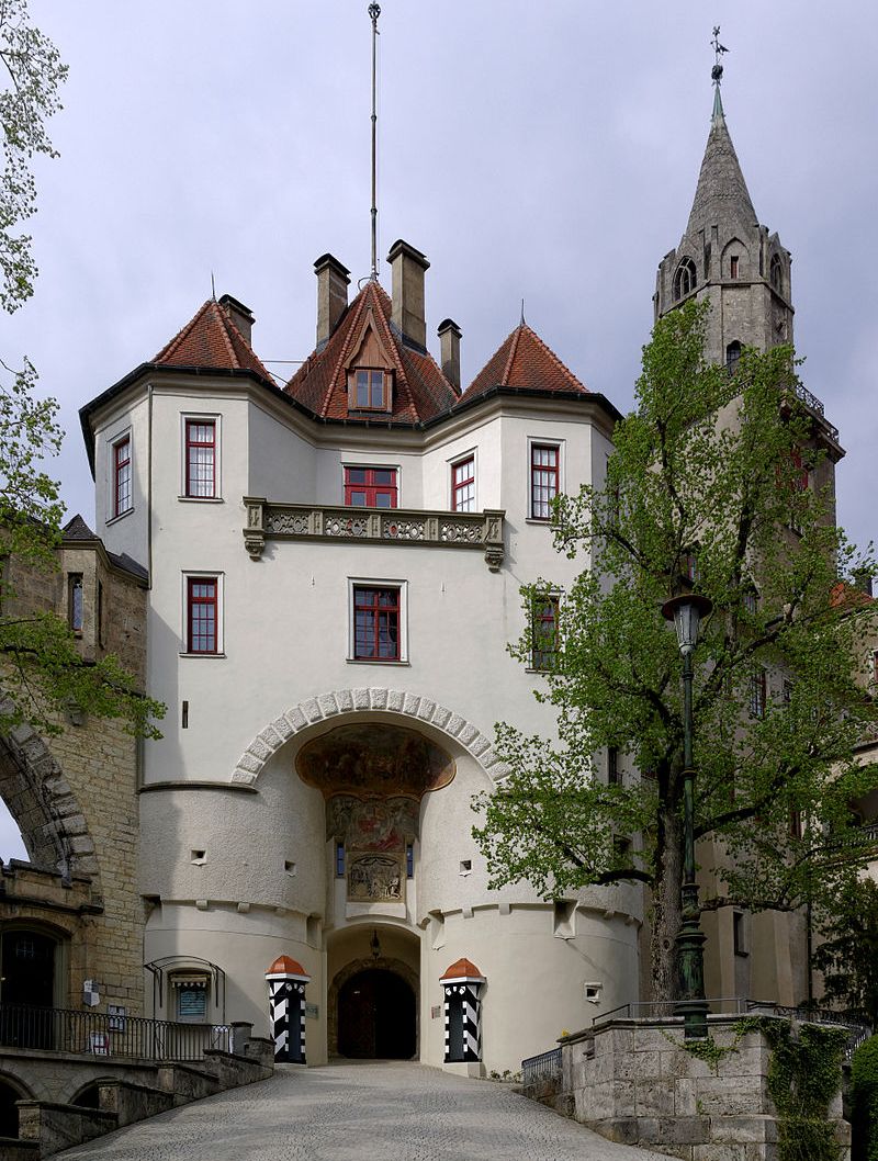
(Berthold Werner Photo)
Sigmaringen Schloss, main gate.
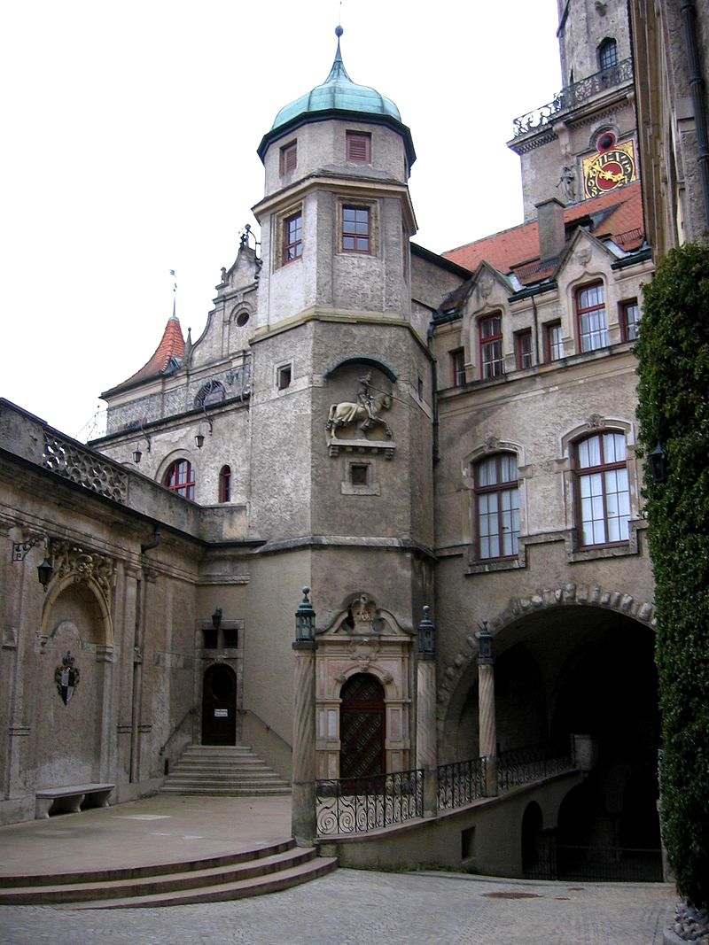
(Manuel Heinemann Photo)
Sigmaringen Schloss, inner courtyard.
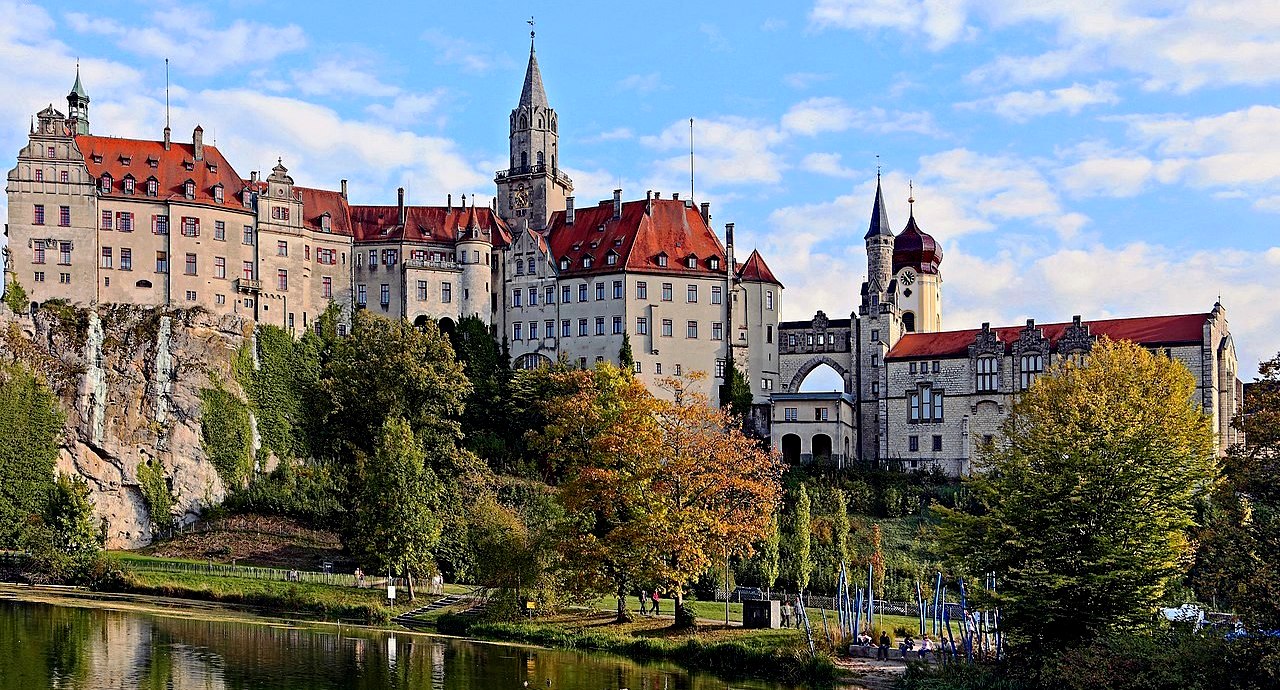
(W. Bulach Photo)
Sigmaringen Schloss.
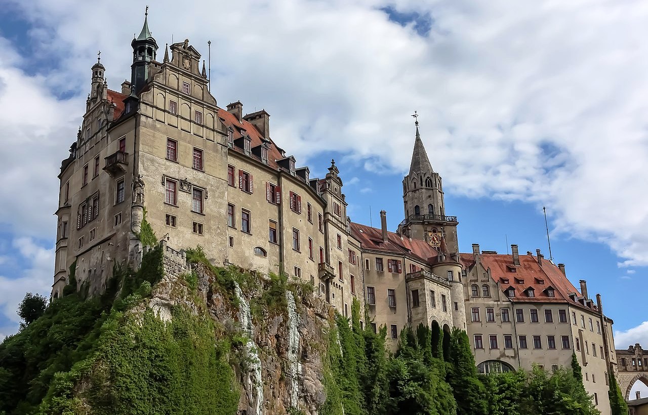
(GrangerJHermione Photo)
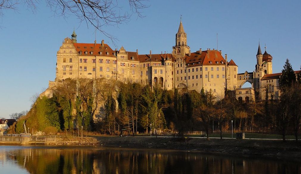
(Salsaloco Photo)
Sigmaringen Schloss.
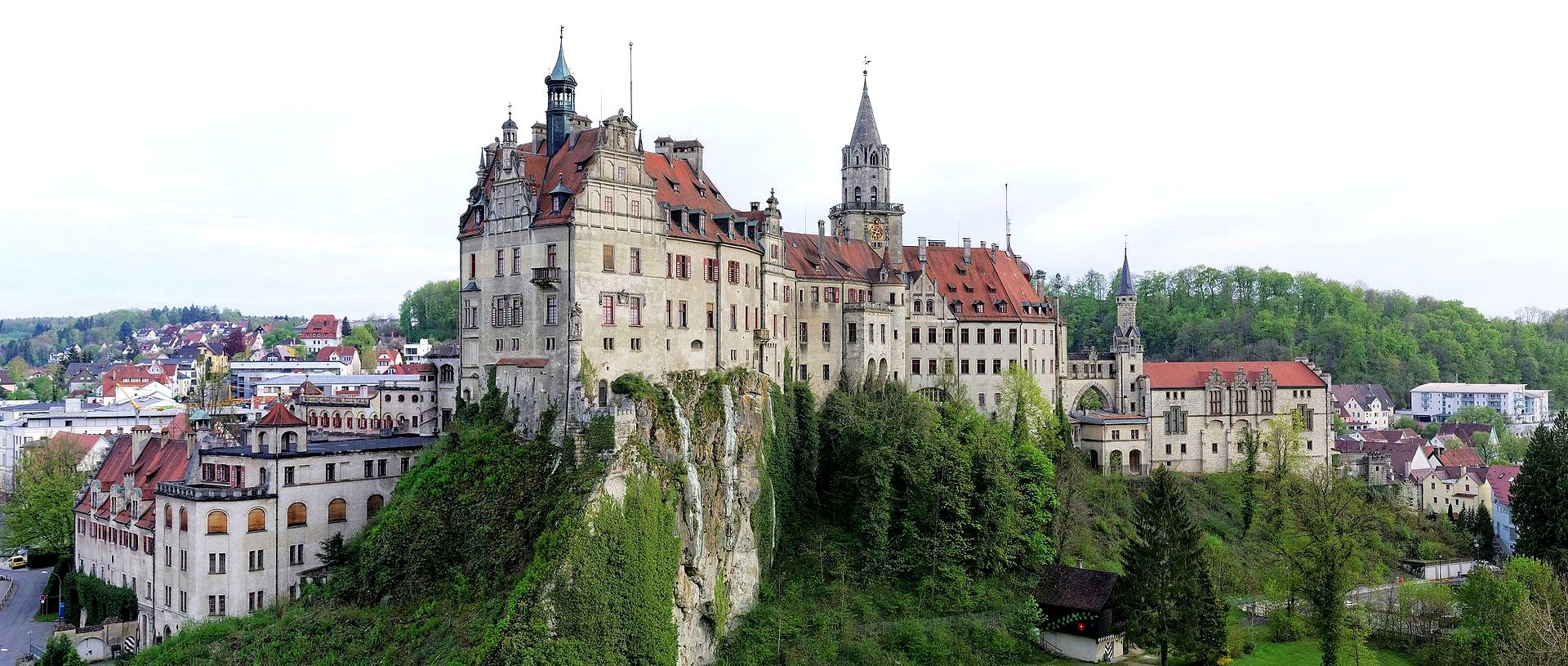
(Berthold Werner Photo)
Sigmaringen Schloss.
Castles and Châteaus in Haut-Rhin, France within an hour or two West of Lahr and the Rhine River (North to South) are listed on a separate page on this website.
